![[Translate to English:]](/fileadmin/Der_SAC/Unserer_Partner/CSS_cyan_rgb.svg)
From Jungu (Weisshornweg) Topalihütte SAC 2674 m
-
- Difficulty
- T4
-
- Ascent
- 5 h, 1180 m
-
- Descent
- 490 m
One of the most attractive access trails to Topalihütte
This is the first leg of Weisshornweg. It proceeds from Jungu via Topalihütte to Randa (see access trail to Topalihütte from Randa).
Route description
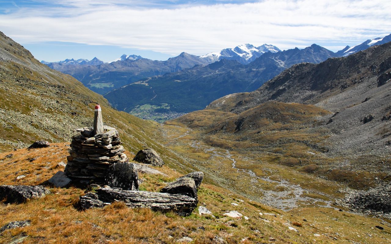
Jungu, summit station – Jungtal – lake (ca. 2800 m)
Jungu/Jungen (1954 m) is a beautifully situated hamlet above St. Niklaus. It is reached by an aerial cable way. From the summit station ascend left (north-westward) to P. 1988. What follows is a marvellous, gently ascending ridgeway leading to Jungtal. Go as far as Alp Jungtal (2388 m), 1 1⁄2 h.
Now ascend right on an old overgrown moraine and follow its crest to P. 2546, traverse above Galkigi Flüe to the slopes full of scree named Rothoruwäng. Now turn south on a mountain path to reach the wide glacier forefield and a small lake (ca. 2800 m) just below P. 2898, 1 1⁄2 h.
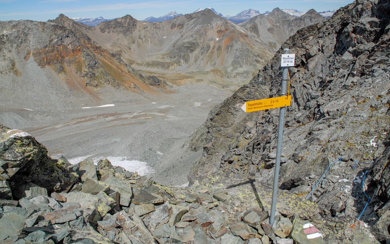
Lake (ca. 2800 m) – Wasulicke
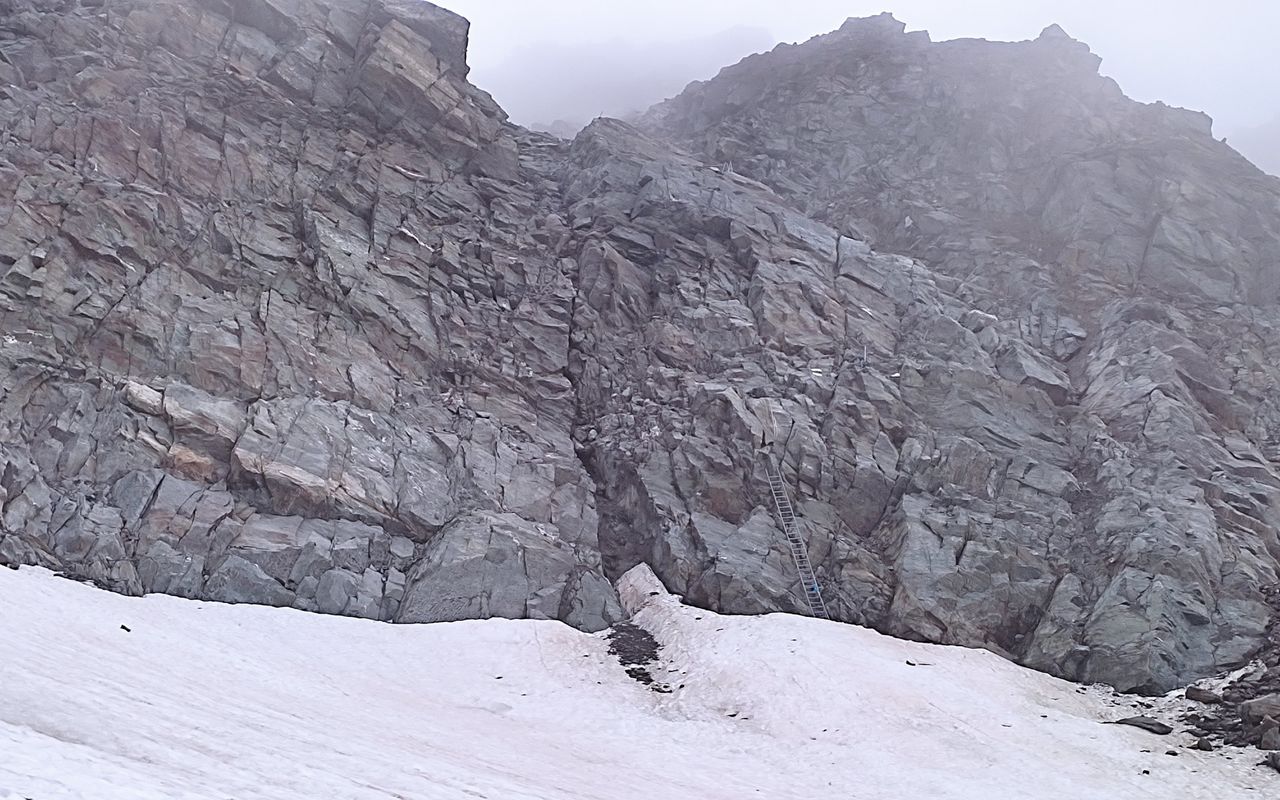
From the lake (ca. 2800 m) the trail continues across Wasulicke (T4): ascend left on the trail to P. 2898. From there the trail follows another small moraine crest and traverses the eastern part of Junggletscher on the left (south). Now on rocks hike up to Wasulicke (3113 m), where the trail crosses the ridge somewhat east-north-east of the survey point, 1 1⁄4 h.
Wasulicke – Stelline – Topalihütte
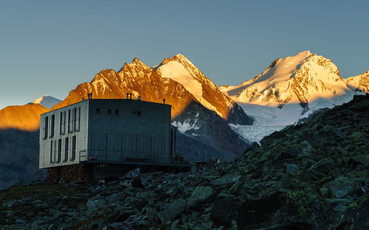
From Wasulicke descend on a ledge right (south-westward) to the scree world of Wasmutälli. Now traverse southward to the south-east ridge of Wasuhorn. Cross this ridge at P. 2948. Hike down to the grassy fields of Stelline (2764 m), from where you traverse the scree fields of Undere Stelligletscher on a ridgeway making an arc to the right. This trail leads directly to the cabin visible from afar (2675 m), 1 3⁄4 h.
Additional information
- Departure point
-
Jungen / Jungu, Bergstation (1955 m)
Informationen zur Seilbahn St. Niklaus - Jungen: www.jungenbahn.ch/fahrplan.html
-
- Difficulty / Material
-
The trail is marked white-red-white and signposted. Across Wasulicke there are a few exposed passages equipped with fixed ropes and ladders.
- Waypoints
-
Col on the way to Topalihütte
-