SouthWest Spur | Alpinism | Swiss Alpine Club SAC
Unterstütze den SAC Jetzt spenden

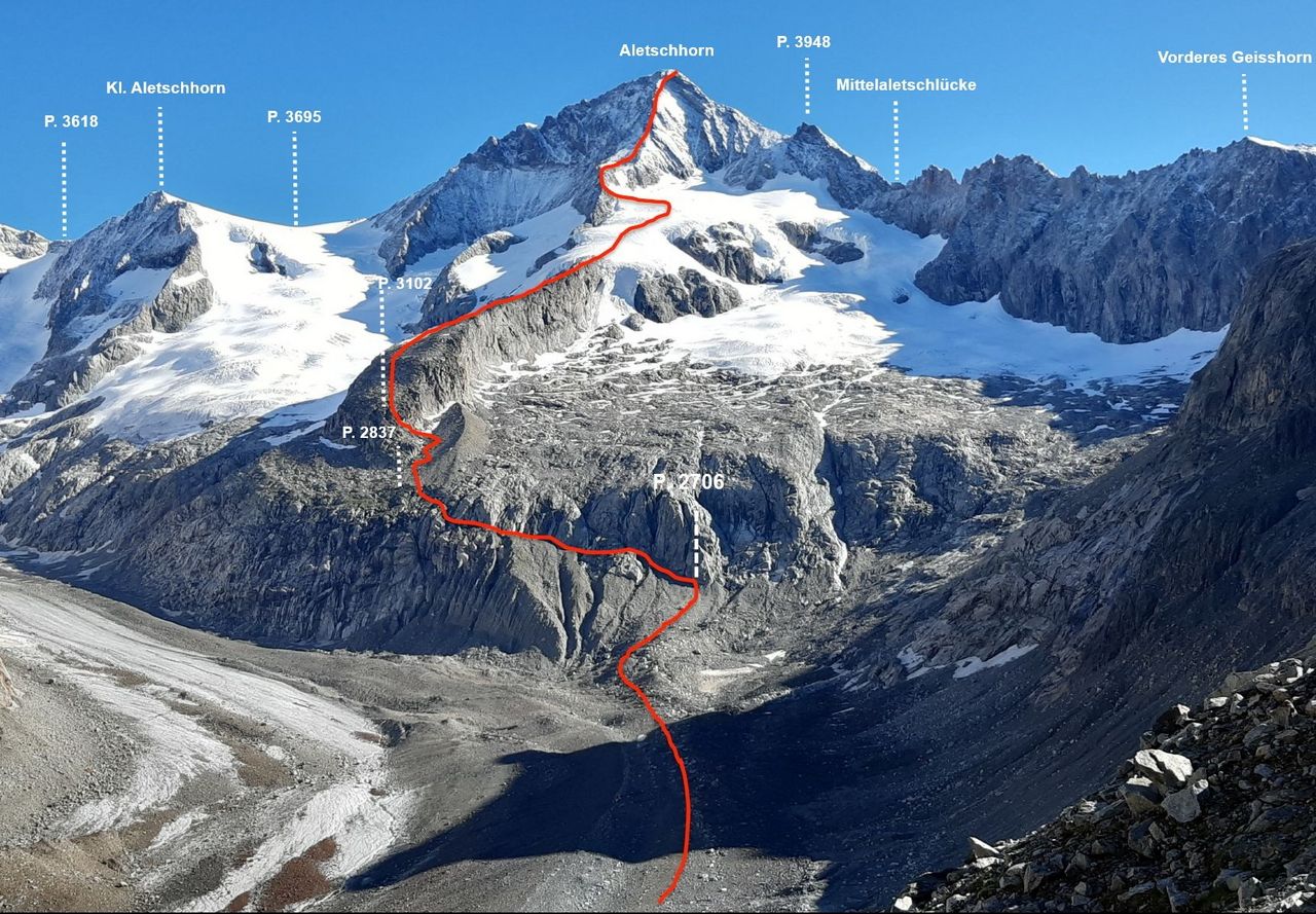
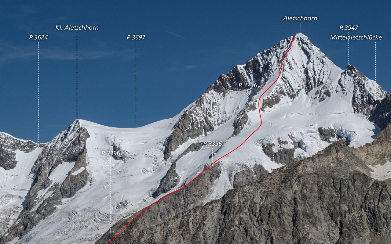
SouthWest Spur (Normal route) Aletschhorn 4193 m

  • Difficulty
    AD-, 2a
  • Ascent
    6–7 h, 1700 m

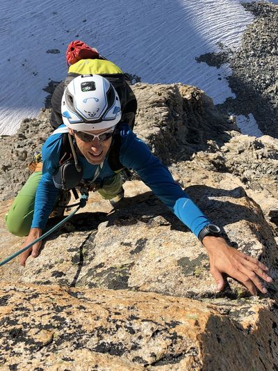
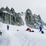
The normal route from the Oberaletsch hut. A long, but very rewarding, high-altitude tour that is often done. A traverse of the Aletschhorn, ascending the SW-Spur and descending the NE-Ridge into the Mittelaletsch basin is extra long but thouroughly recommended. In winter, the SW-Spur is often done as a ski tour, with the skis being deposited beneath the spur itself. In bad visibility, the upper part of the spur is poorly pronounced and difficult to find. Since 2001, metal posts have been in place along the upper part of the spur, in order to facilitate orientation and increase the safety margin. Transition onto the firn ridge at p. 3396 can be difficult in the case of heavy snow melt.

Route description

Oberaletschhütte - Glacier
From the Oberatletschhütte (2640 m) descend the winter hut approach northwards onto the Oberaletschgletscher.
Galcier - P. 3396
Follow the Oberaletsch Glacier on its eastern lateral moraine northeastwards to below P. 2706 (marker poles). Here you leave the glacier and climb leftwards up the moraine on tracks to the rocks above. (In July 2019, stakes and chains were mounted in the lower part of the moraine) Cross a deep brook from right to left, then continue on tracks to gain a broad trough east of P. 2838. Markings and reflectors show the way. Follow tracks up the trough/gully to join the SW-Spur. Climb mostly along on the E side of this coarse blocky ridge from P. 3101 to reach the glacier at P. 3396, 3½ hrs.
P. 3396 - Summit
The transition from the rock ridge at P. 3396 can be tricky. Once on the glacier head East at first, then slowly arc north through northeast to reach the crest of the upper SW rib, just south of P. 3736 over an easily identified scree/ snow slope. From here, continue up a broad slope towards the middle of three rocky ridges. The ridge is climbed via quite solid rock to a blocky tower at its upper end. Cross to the right of this and onto the following rib which in turn leads into another scree snow field. Finally the summit is reached over indistinct and rubble-covered rock (between 3900 m and the summit, in order to aid navigation there are metal posts placed at a distance of 30-35 m apart)

Additional information

Departure point
Difficulty

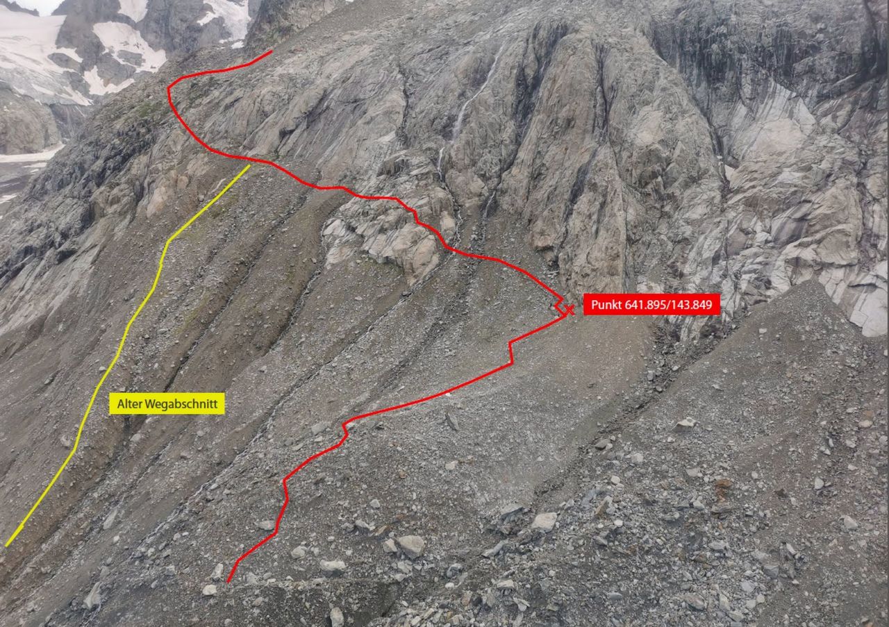
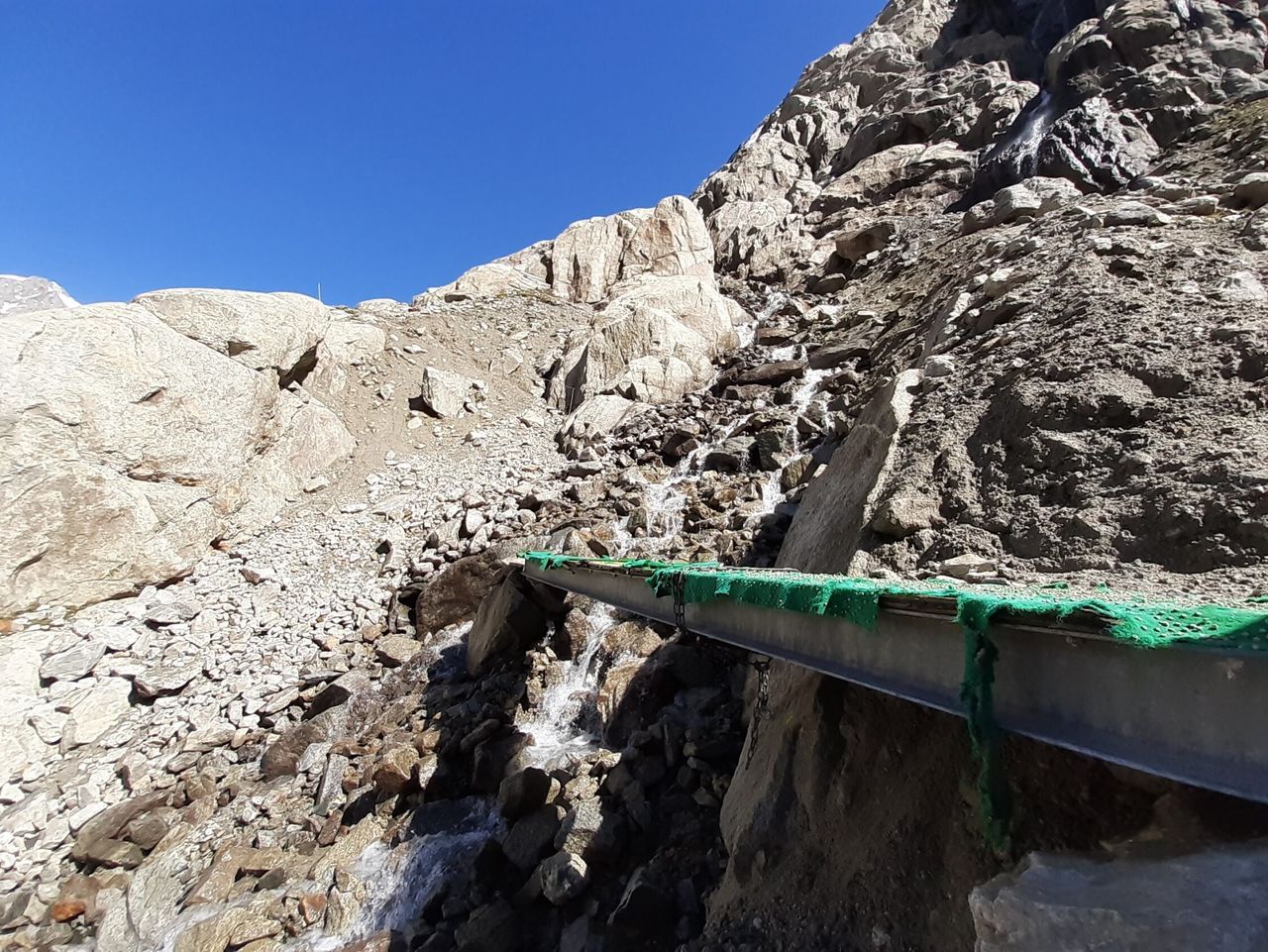
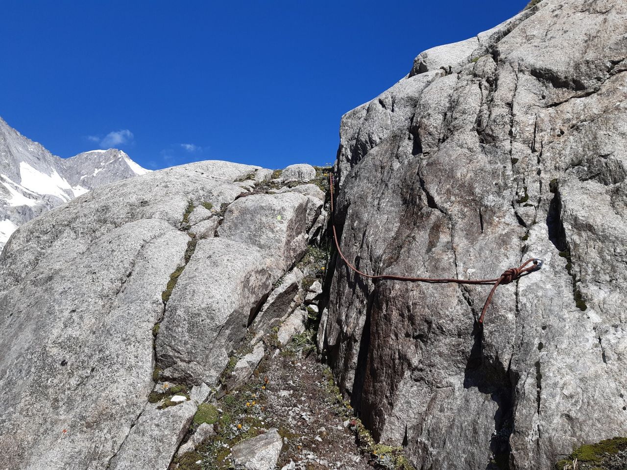
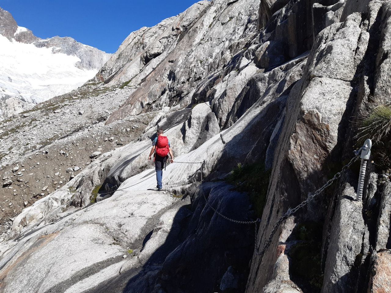
In July 2019, stakes and chains were mounted in the lower part of the moraine near P. 2706

The stakes in the uppermost part of the route facilitate orientation in poor visibility.

History

L. Liechtig with A. Kummer and Träger, 6. August 1879

Author

Bernhard Senn

Bernhard Senn is a physiotherapist specializing in workplace ergonomics and workplace health promotion. Bernhard has been an SAC author since 2013 and will often be found 'out and about' in the mountains; whether with rock gear, skis, mountain bike or paraglider.

Our recommendations

Walliser Alpen

Alpine Touren

Selection guide

Walliser Alpen

Price CHF 49.00
Member price CHF 39.00
Skitouren Berner Alpen Ost

Skitouren

Skitouren Berner Alpen Ost

Price CHF 44.00
Member price CHF 34.00
Klettern Kombipaket Berner Oberland

Klettern

Klettern Kombipaket Berner Oberland

Price CHF 98.00
Member price CHF 79.00
Tourenportal/App-Abo Jahreszahlung

Subscription to the SAC Route Portal

Tourenportal/App-Abo Jahreszahlung

Price CHF 49.00
Gipfelziele Berner Oberland Grossformat

Berg- und Alpinwandern

Gipfelziele Berner Oberland Grossformat

Price CHF 54.00
Member price CHF 45.00
SAC-Hydro Flask

Equipment

SAC-Hydro Flask

Price CHF 39.00
Member price CHF 35.00
SAC-Taschenmesser

Equipment

SAC-Taschenmesser

Price CHF 54.00
Member price CHF 49.00
SAC-Brändi Dog XS

Equipment

SAC-Brändi Dog XS

Price CHF 66.00
Member price CHF 60.00
Bergsport Sommer

Ausbildung

Bergsport Sommer

Price CHF 59.00
Member price CHF 49.00
Ausbildung Bergwandern / Alpinwandern

Ausbildung

Ausbildung Bergwandern / Alpinwandern

Price CHF 59.00
Member price CHF 49.00
feedback