

![[Translate to English:]](/fileadmin/Der_SAC/Unserer_Partner/CSS_cyan_rgb.svg)
via the lower couloir (Normal route) Bächistock (Glärnisch) 2914 m
-
- Difficulty
- PD, I
-
- Ascent
- 3–4 h, 920 m
-
- Descent
- 2–3 h, 920 m
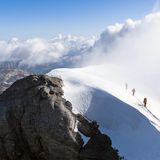
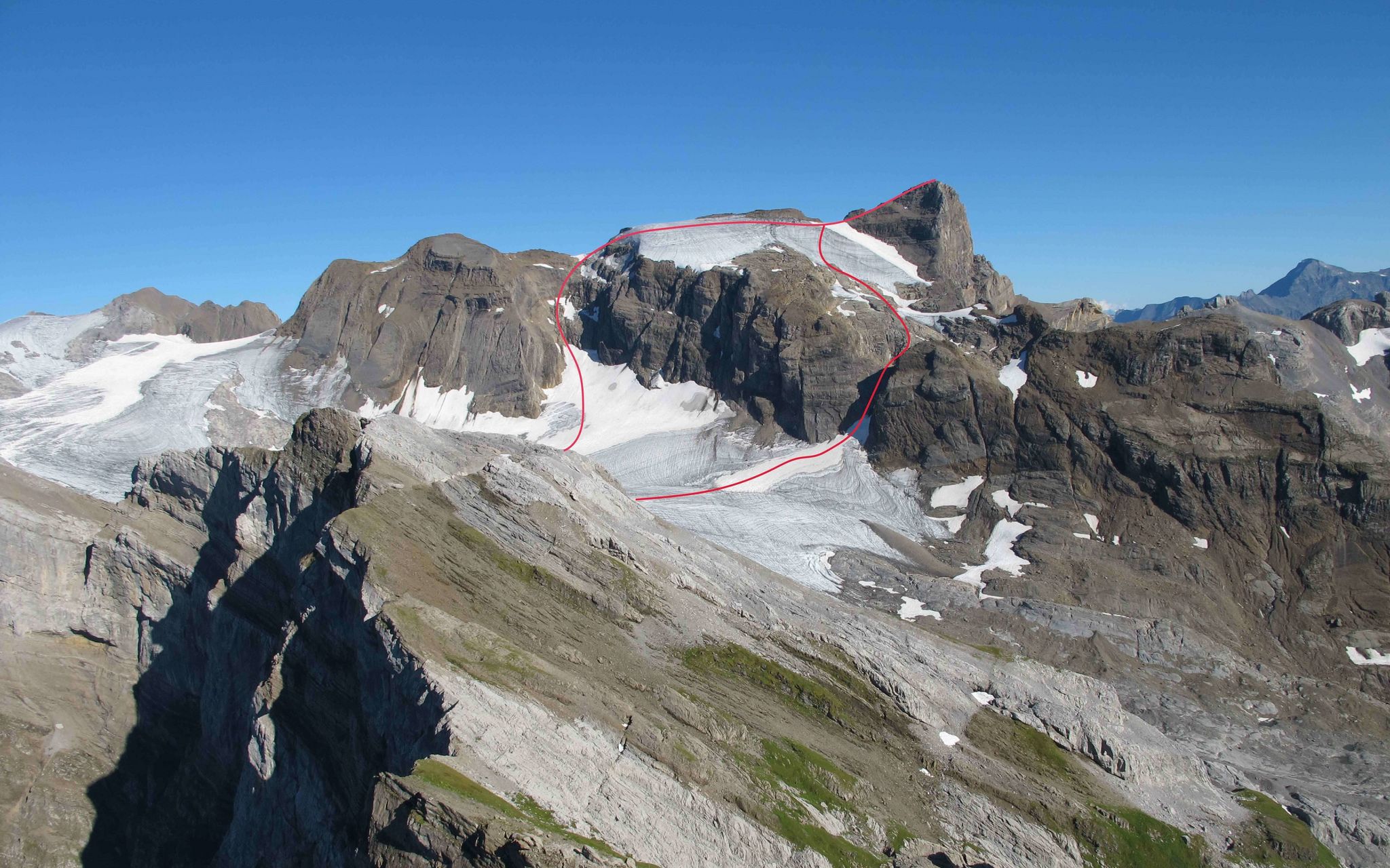
A rewarding tour to the highest peak of the Glärnisch massif. Keep an eye out for the summit book! The Bächistock has a great offering of proper alpine routes. Already the normal route, which crosses some steep sections of glacier and finishes with an exposed blocky summit ridge, requires a good set of alpine skills. Depending on the prevailing snow conditions, an ascent of the Bächistock through the upper couloir could in fact be more pleasant than that through the lower couloir, so its good to be aware of both options and stay flexible.
Route description
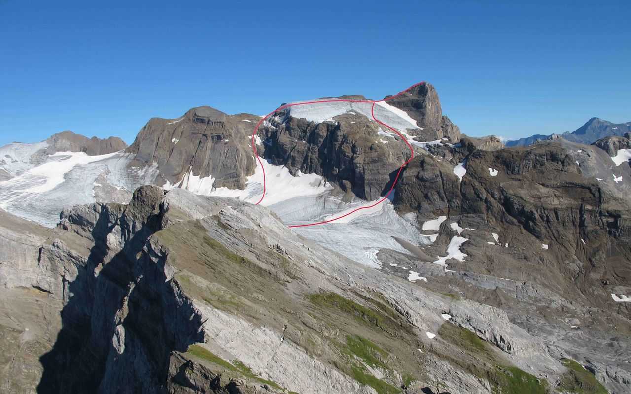
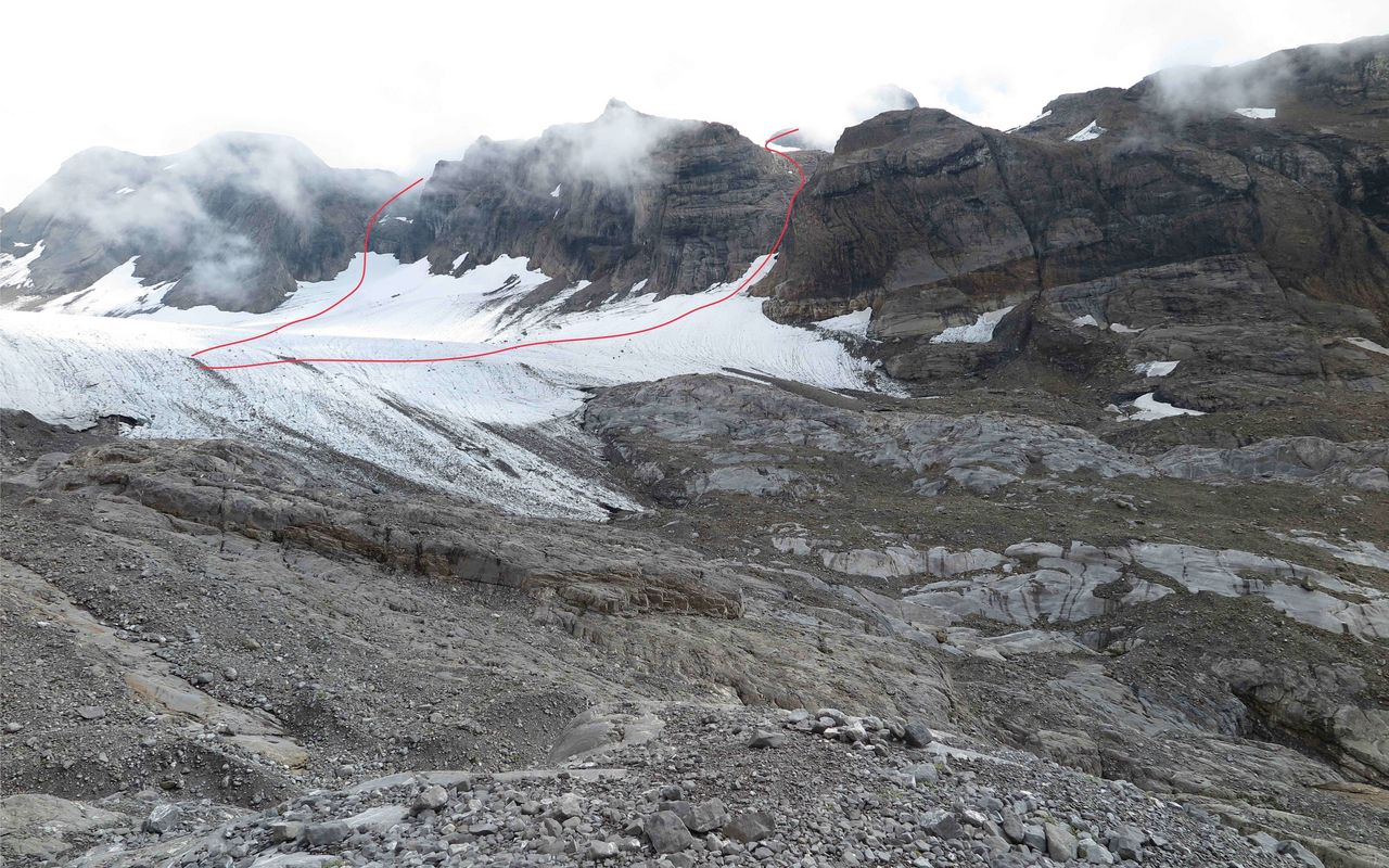
Glärnischhütte - Glärnischfirn (glacier)
From the Glärnischhütte, follow the marked footpath east to the foot of the Glärnischfirn (glacier)
Glärnischfirn - Lower Couloir - Bächistock
At about 2470m traverse across the glacier to the base of the couloir (east of P. 2628). The couloir is now mostly snow-free, especially in late summer, sadly due to glacier retreat. Climb the couloir direct, or take to the rocks beside it, move up onto the northwest flank's Bächistockfirn, climb diagonally left (east) on this to reach a shoulder on the rocky summit ridge, then follow this to the top.
A few bolts were placed in the couloir circa 2015.
Variant: through the upper Couloir
From the same start point (ca. 2470 m on the glacier) traverse across, this time diagonally upwards (southeasterly direction) to reach the larger upper couloir. Follow this more or less directly up to the join east ridge at a lower point. Climb along the initially glaciated ridge (danger steep cliffs on your left!) to join the normal route and continue on to the top!
Descent
Follow the route of ascent. Depending on conditions you could make it interesting: ascend via the Upper- and descend via the Lower Couloir.
Additional information
- Departure and arrival point
-
-


