

![[Translate to English:]](/fileadmin/Der_SAC/Unserer_Partner/CSS_cyan_rgb.svg)
From Arolla via Pas de Chèvres Cabane des Dix CAS 2928 m
-
- Difficulty
- T4
-
- Ascent
- 3:30–5 h, 1100 m
-
- Descent
- 180 m
The first part to the Pas de Chèvres is a tranquil mountain hike. Metal stairs lead down the other side to Clacier de Cheilon. The necessary alpine skills and equipment are required. As an alternative to the Pas de Chèvre, the Col de Riedmatten can also be crossed.


Route description
Arolla - La Remointse Pas de Chèvres
From Arolla (2008 m, bus stop) follow the wide forest path in four hairpin bends up to the Kurhaus (2068 m). Directly before this, a hiking path leads into the very pretty, old Swiss stone pine forest and up to Alp Tsijiore Nouve (2165 m). Climb steeply NW to P. 2301, then turn left to La Remointse, marked here in yellow. Continue westwards past the ski area infrastructure to P. 2538. Pass the Petit Mont Rouge (2927 m) and climb into the depression behind it to P. 2741 m. The righthand fork here leads to the Col de Riedmatten (a little longer, because its higher. The lefthand fork leads to the Pas de Chèvres (2854 m), 2 1⁄2 hours (T2).
Pas de Chèvres - Glacier de Cheilon - Cabane des Dix
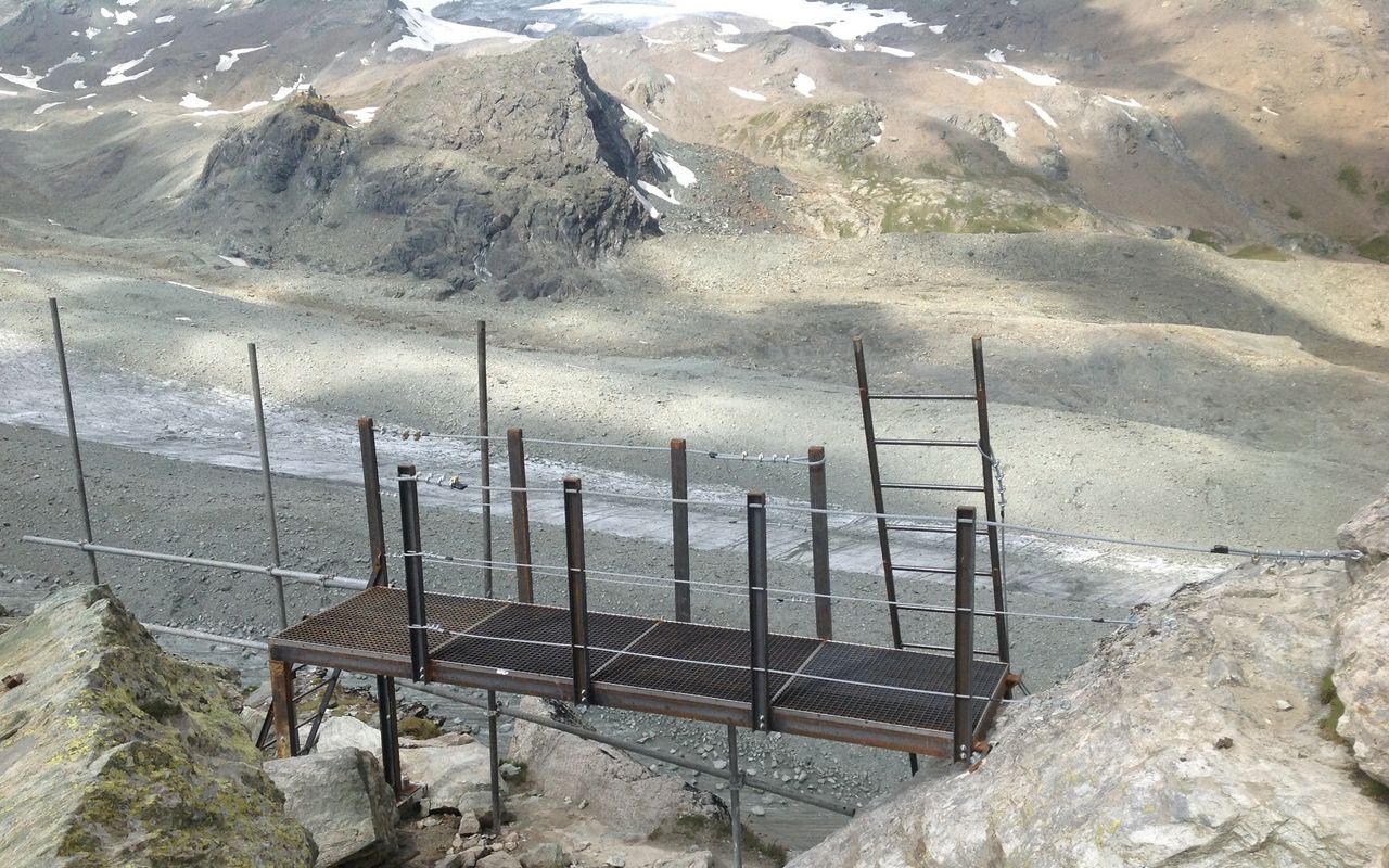
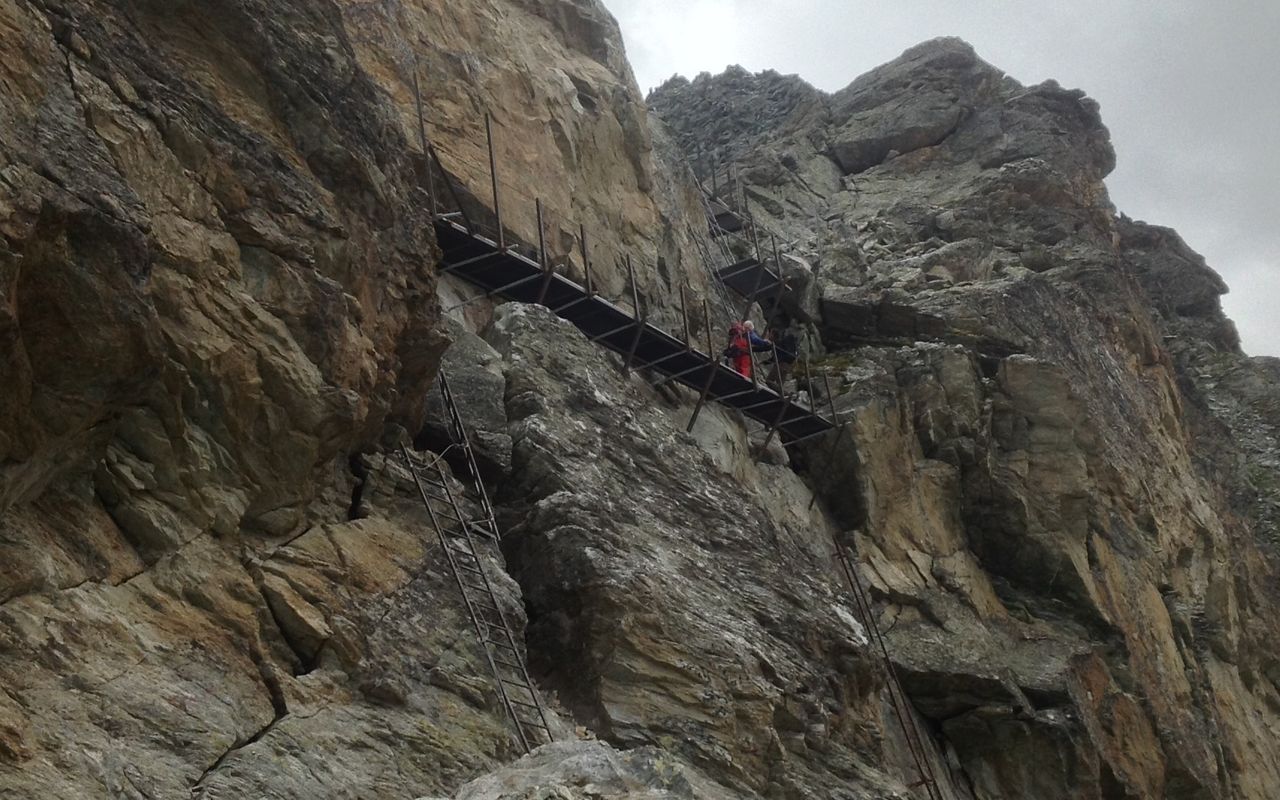
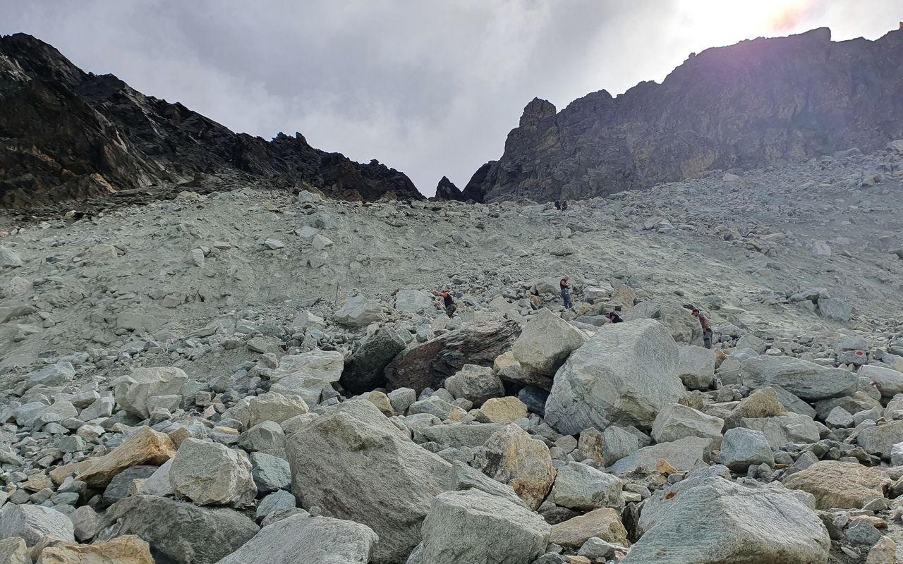
On the W side of the Pas de Chèvres is a 30 m high rock wall. This is well furnished with near-vertical metal ladders (T4) At the bottom, turn briefly to the right to reach the path that comes from the Col de Riedmatten. When the paths merge, turn left (SW) and reach the ice of the glacier at approx. 2790 m. Cross the Glacier de Cheilon in a SW direction (the specific route varies practically every season), cross the central moraines and reach a path on the western bank that leads up over through moraine debris to a plateau then back right (NE) to the hut (2928 m), 1 hour.
Pas de Chèvre – Cabane de Dix
If conditions do not allow you to reach the hut directly via the Glacier de Cheilon, follow the red markings in a northerly direction. Bypass the small glacial lake and continue following the red markings, a wooden footbridge leads across the glacial stream. Now climb the mighty left (W) moraine of the Glacier de Cheilon, where you meet the normal trail that leads from Lac de Dix to the hut. Follow the moraine ridge to P. 2782, from where the trail turns right (SW) and climbs to a small pass to the W of the Tête Noire. Then you descend to an almost flat bottom and climb steeply for a short while to the hut. +200 hm ascent and 200 hm descent and 1 - 1½ hrs longer than the route over the glacier.
Additional information
- Difficulty / Material
-
The route across the glacier changes. Crampons may be needed!
- Waypoints
-
-
-
Rock fall danger!
-


