Traverse Crap Grisch – Tällihorn | Mountain hiking | Swiss Alpine Club SAC
Unterstütze den SAC Jetzt spenden

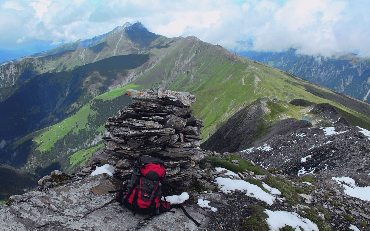
Traverse Crap Grisch – Tällihorn (Normal route) Crap Grisch / Planggenhorn 2861 m

  • Difficulty
    T4
  • Ascent
    4 h, 1300 m
  • Descent
    3–4 h, 1300 m

On the trail of the "Wildmannlis"

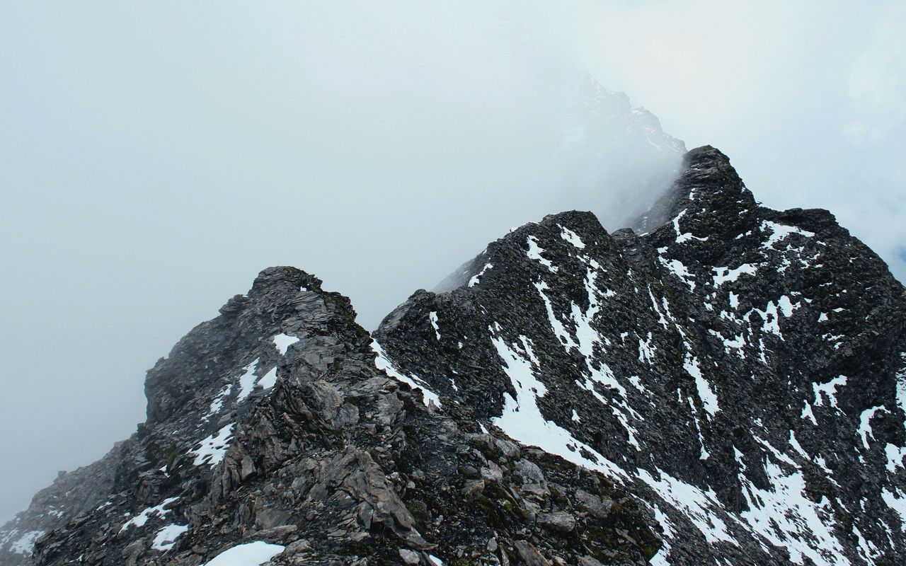
Crap Grisch–Tällihorn is a superb alpine hiking tour with many exciting ingredients: an ascent to warm-up, a long, exposed ridge with fun scrambling passages and two spots with great views. And to round out the tour a pleasurable descent through the area of a prehistoric landslide with many boulders.

Route description

Safien Bäch - Bächer Tobel
From Bäch follow the alp access road to Bächer Hütta, then the hiking trail in Bächer Tobel.
Bächer Tobel - Crap Grisch
After Bächer Tobel ascend pathless in pastures and past small lakes to reach Camaner Grat. Via P. 2725 and P. 2777 follow the slightly exposed, but easily walkable ridge to Crap Grisch.
Crap Grisch - Tällihorn - Bächer Hütte - Bäch
From Tällihorn go down about 100 metres vertical height on the south ridge, then turn northward to reach the eastern ridge. Follow this ridge back to Bächer Hütta and Bäch.

Additional information

Departure and arrival point

Safien, Bäch (1662 m)

Time

Bäch - Crap Grisch: 4 h

Crap Grisch - Tällihorn: 1 h

Tällihorn - Bäch: 2–3 h

Difficulty / Material

The grade of difficulty is for the last stretch up to the summit (slightly exposed schrofen) and the traverse to Tällihorn. The ascent and descent are often on pathless terrain, which requires intuition to find the best way.

Waypoints
Neighbor summit

Piz Tomül / Wissensteinhorn (2946 m)

This is the highest point of the chain. It can be reached directly from Tällihorn via Rinderpirglickli. From Rinderpirglickli bypass the following rocky step on a talus to the east and ascend to the ridge. Bypass P. 2704 on the left. On grass, scree and rock ascend to the summit. T4. The ascent is 400 metres vertical height and takes 1½ h from Rinderpirglickli (2 h from Tällihorn). From Piz Tomül follow the south-east ridge down to P. 2589. Then turn eastward to descend in pastures to Turrahus (bus). 1200 m metres vertical height down, T3, 2–3 h.

Authors

Fabian Lippuner

David Coulin

David Coulin works as a communications manager, photojournalist and author. In addition, he provides mountain experiences throughout Switzerland and has published several alpine hiking and snowshoeing guides through the SAC.

Our recommendations

SAC-Crocs

Equipment

SAC-Crocs

Price CHF 59.00
Member price CHF 49.00
Tourenportal/App-Abo Jahreszahlung

Subscription to the SAC Route Portal

Tourenportal/App-Abo Jahreszahlung

Price CHF 49.00
SAC-Hütten-Monopoly

At home

SAC-Hütten-Monopoly

Price CHF 69.90
Member price CHF 60.00
Graubünden Süd

Skitouren

Graubünden Süd

Price CHF 44.00
Member price CHF 34.00
SAC-Taschenmesser

Equipment

SAC-Taschenmesser

Price CHF 54.00
Member price CHF 49.00
Familienausflüge zu SAC-Hütten

Hütten

Familienausflüge zu SAC-Hütten

Price CHF 54.00
Sales price CHF 20.00
Ausbildung Bergwandern / Alpinwandern

Ausbildung

Ausbildung Bergwandern / Alpinwandern

Price CHF 59.00
Member price CHF 49.00
Hütten der Schweizer Alpen / Cabanes des Alpes suisses

Bildbände

Hütten der Schweizer Alpen / Cabanes des Alpes suisses

Price CHF 69.00
Member price CHF 59.00
feedback