From Berghaus Malbun (Buchserberg) | Mountain hiking | Swiss Alpine Club SAC
Unterstütze den SAC Jetzt spenden

From Berghaus Malbun (Buchserberg) (Normal route) Gross Fulfirst 2383 m

  • Difficulty
    T4+
  • Ascent
    3:30 h, 1020 m
  • Descent
    2:30 h, 1020 m

The "eleventh" Churfirst

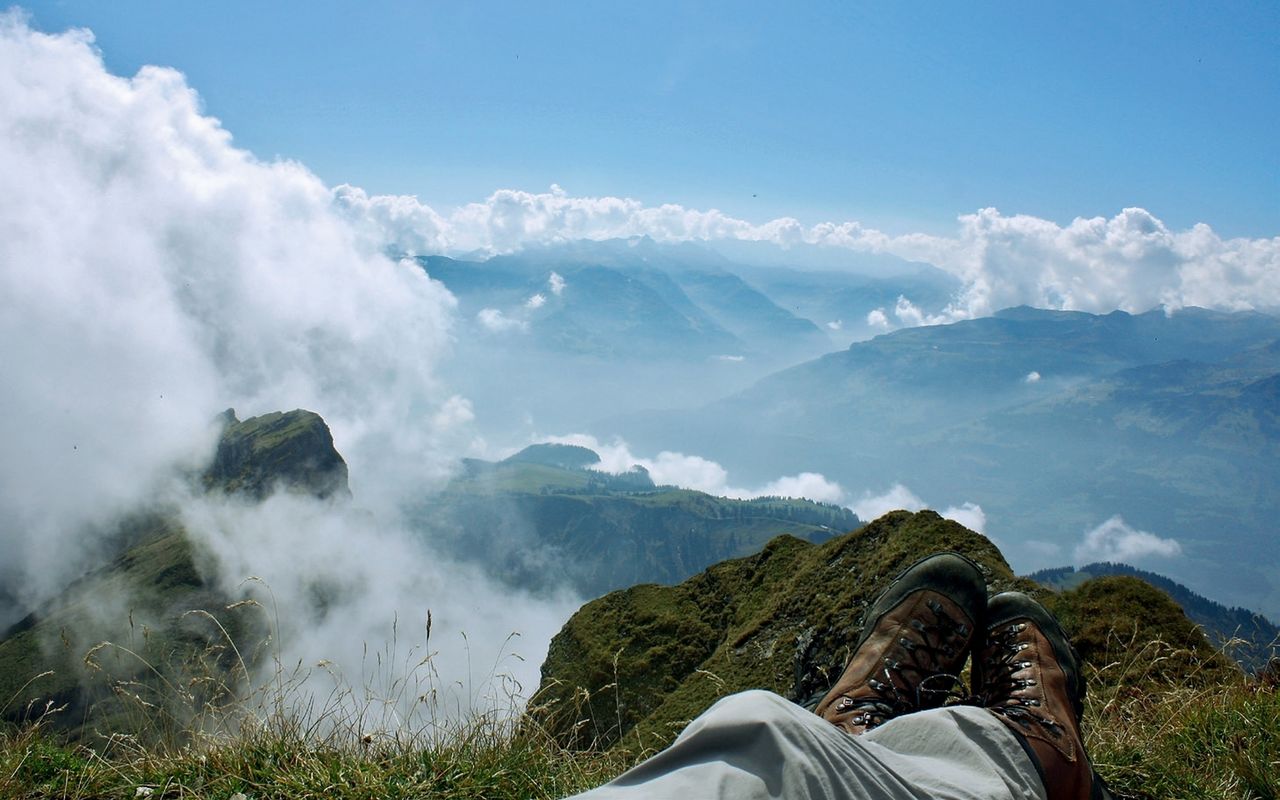
The Werdenberg mountain range (with, among others, Gross and Chli Fulfirst) is a continuation of the Churfirsten chain. It offers a view down to the Seez valley and the possibility to observe game. The area around Margelchopf and Fulfirst especially is a multifaceted landscape, which was once a huge sanctuary for animals reaching from Speer to Gonzen. Moreover, at the foot of Fulfirst it is possible to find Edelweiss.

Route description

Malbun - Glanna P. 2008
From Berghaus Malbun ascend on marked trails via Untersäss to P. 1743 (Alp Obersäss). Past Hahnenspil go to the bifurcation at P. 1959 (Bi den Seen). Continue to P. 2008, where the marked mountain hiking trail descends.
Glanna (P. 2008) - Fulfirst - Glanna
From P. 2008 continue south-westward on a faint path to reach the north-east ridge of Fulfirst. Follow this moderately steep ridge to Ober Platte (ca. 2200 m). On faint trails south-westward and later steep on scree to the saddle between Gross Fulfirst und Chli Fulfirst. From here an exposed and faint trail leads to the summit.
Variant: NE-ridge
From Ober Platte (ca. 2200 m) the NE-ridge directly to the summit becomes more and more steep and at the end exposed (T5+).
Descent
The descent is on the ascent. One can also follow the basin of Glanna in all its length.

Additional information

Departure and arrival point

Buchserberg, Berghaus (1371 m)

Bus fährt nur am Wochenende, siehe Fahrplan: www.ortsgemeinde-buchs.ch/berghaus-malbun/busbetrieb/

Time

Berghaus Malbun - Hanenspil - Glanna - Fulfirst: 3½ h

Descent Fulfirst - Berghaus Malbun: 2½ h

Difficulty / Material

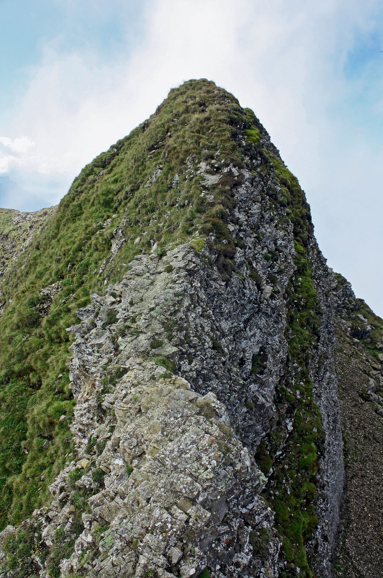
The difficulties are concentrated on the ascent of the summit structure (T4+). From the saddle between Chli Fulfirst and Gross Fulfirst a faint path leads through exposed dangerous schrofen. Therefore, the ascent of the summit requires dry and snow-free conditions around the summit.

Ascending on the northeast ridge presents some technically not very difficult, but very exposed passages (T5+).

Waypoints
Neighbor summit

Chli Fulfirst (2368 m)

This is a short detour from "Fulfirstlücke", exposed passages, T4+.

Margelchopf (2164 m)

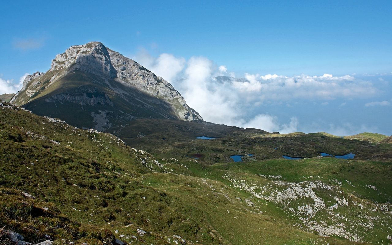
Margelchopf is easily accessible over a well-equipped escarpment. The summit is a large plain, almost as wide as a football field. From P. 1959 (Bi den Seen) take the hiking trail westward to reach Isisizgrat. From there, overcoming an escarpment on a steep trail equipped with chains, you reach the summit (T3).

Authors

David Coulin

David Coulin works as a communications manager, photojournalist and author. In addition, he provides mountain experiences throughout Switzerland and has published several alpine hiking and snowshoeing guides through the SAC.

Fabian Lippuner

Our recommendations

Skitouren Glarus - St. Gallen - Appenzell

Skitouren

Skitouren Glarus - St. Gallen - Appenzell

Price CHF 44.00
Member price CHF 34.00
SAC-Crocs

Equipment

SAC-Crocs

Price CHF 59.00
Member price CHF 49.00
Tourenportal/App-Abo Jahreszahlung

Subscription to the SAC Route Portal

Tourenportal/App-Abo Jahreszahlung

Price CHF 49.00
SAC-Hütten-Monopoly

At home

SAC-Hütten-Monopoly

Price CHF 69.90
Member price CHF 60.00
Klettern Alpstein

Klettern

Klettern Alpstein

Price CHF 64.00
Member price CHF 54.00
SAC-Taschenmesser

Equipment

SAC-Taschenmesser

Price CHF 54.00
Member price CHF 49.00
Bergsport Sommer

Ausbildung

Bergsport Sommer

Price CHF 59.00
Member price CHF 49.00
Klettern St. Galler Oberland

Klettern

Klettern St. Galler Oberland

Price CHF 69.00
Member price CHF 59.00
feedback