Traverse north-south (Schönhalden - Weisstannen) | Mountain hiking | Swiss Alpine Club SAC
Unterstütze den SAC Jetzt spenden

Traverse north-south (Schönhalden - Weisstannen) Hochfinsler 2421 m

  • Difficulty
    T4+
  • Ascent
    3–4 h, 1100 m
  • Descent
    3–4 h, 1550 m

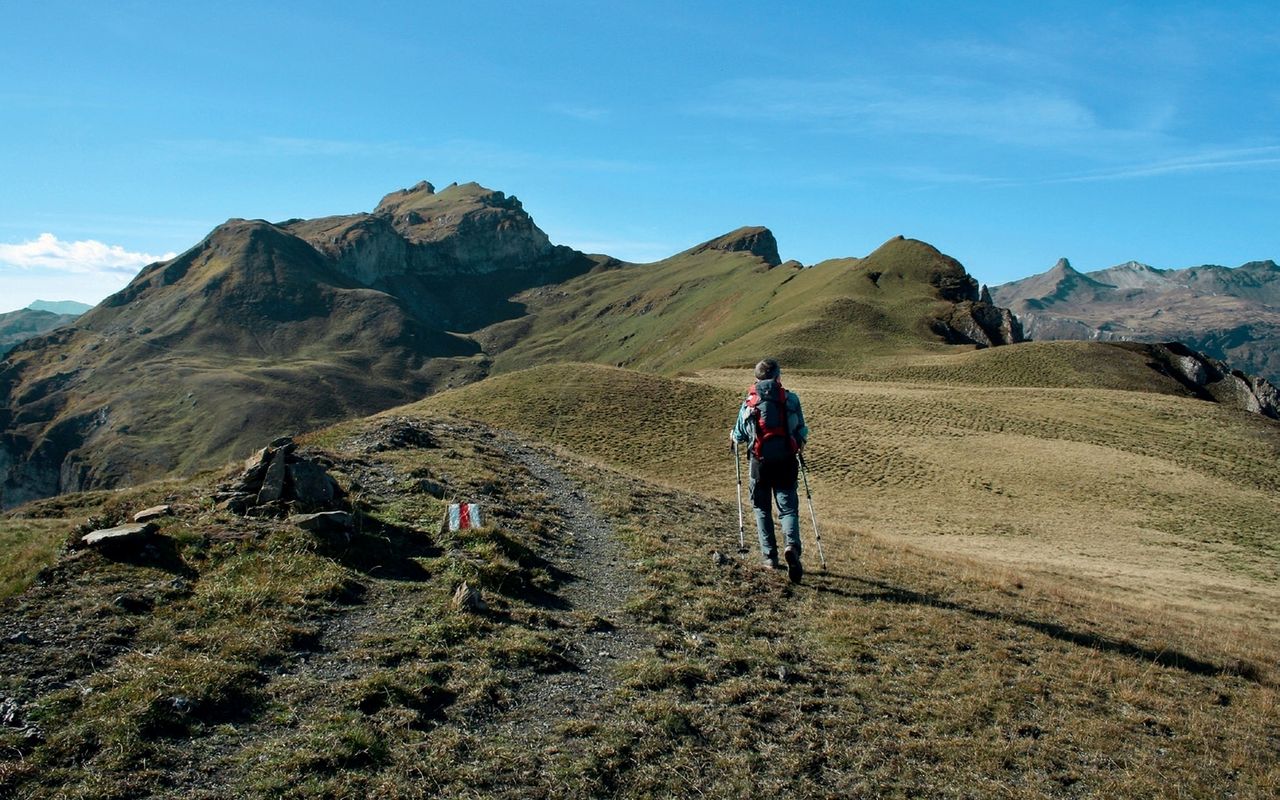
Little Tibet between the cantons

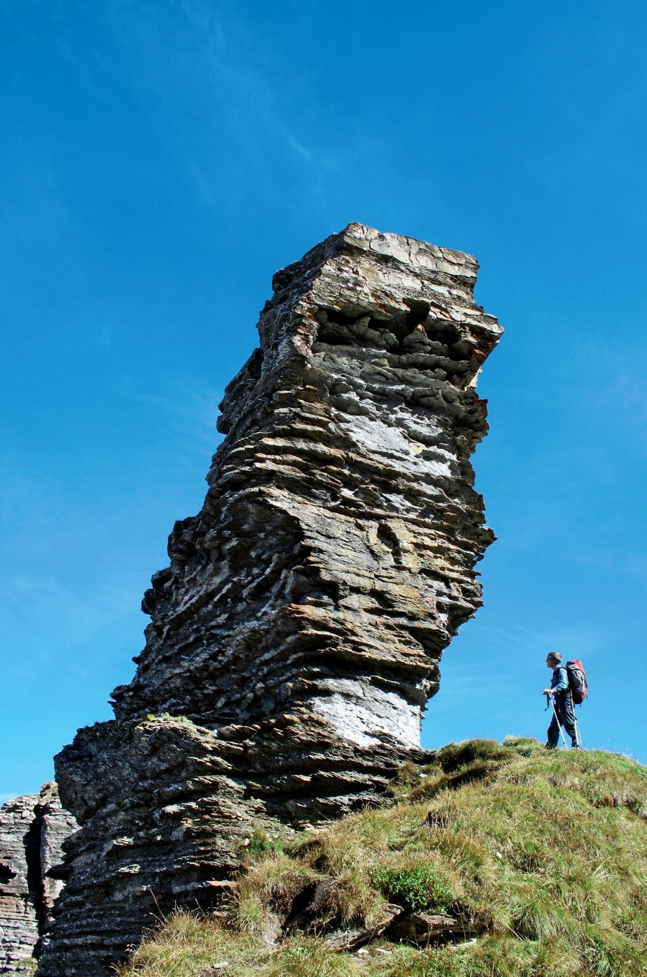
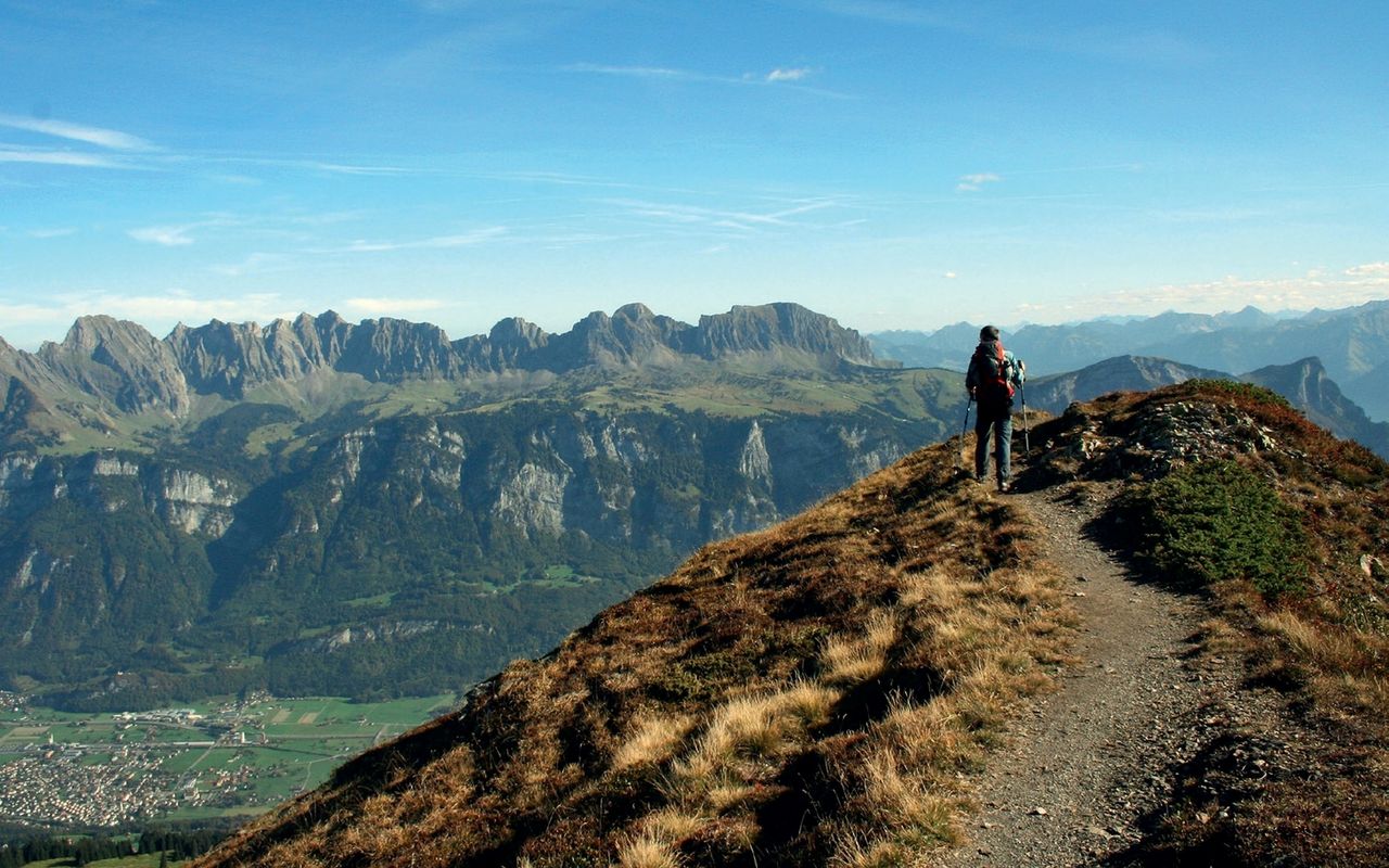
The high plain between the Weisstannen/Seez valleys and Sernftal may have a slight resemblance with Tibet, but there are no yaks, monasteries or prayer flags. Instead it offers grazing cattle and a colourful landscape. Every natural terrain unit is a world of its own, every ridge calls for being climbed. The main ridge with Hochfinsler as its highest point is the orientation through this secluded world. On this hike many small summits are traversed. Once you reach Chläuifurggla, you have already completed five. There are many more to climb, possibly a dozen or more. After the long panorama hike, the descent to the wild Weisstannental awaits hikers.

Route description

Schönhalden - Guscha - Steingässler
From the Schönhalden summit station the marked mountain hiking trail goes initially southward, at P. 1711 it turns westward to reach the ridge with a summit cross (viewpoint). Continue on a trail with initial white-red-markings, then without any to reach Steingässler.
Steingässler - Hochfinsler - Chläuifurggla
From here on there are only faint paths. Scramble up an escarpment following a faint path directly on the ridge line (short climbing passages, T4). Continue on a faint path, which follows ledges on the western face below the ridge line. The Hochgamatsch summit can be reached on a short detour through a couloir (T4+). A steep couloir on the east side leads to the foot of a bizarre rock tower (called by the locals «Zigerchnörri», no name on the map, P. 2358). It is grade III exposed climbing. Now follow an undemanding faint path on the grassy slopes of the east face of Hochfinsler to reach the summit. Continue southward on the ridge across four small summits called Apöstel. Some rocky escarpments are climbed easily (T4) or bypassed. Descend steeply but without difficulty to Chläuifurggla.
Chläuifurggla - Langrain - Weisstannen
At Chläuifurggla you meet a number of marked mountain hiking trails. To reach the descent to Weisstannental it is best to go southward to P. 2285, traverse the grassy ridge Langrain (P. 2270) and meet the white-red-white marked trail down to Weisstannen Dorf via Obergalans and Untergalans; Madchopf can be climbed or left out.
Variant: return to Schönhalden from Chläuifurggla
From Chläuifurggla follow a marked faint path to Chläui, then the poorly maintained mountain hiking trail traversing the east face of Hinderchamm to reach Pfufisegg, a popular ski touring target in winter. Via Mädems Hintersäss you meet the ascent route at P. 1711. Roughly 2 h from Chläuifurggla (1 h less than the descent to Weisstannental).

Additional information

Departure point

Wildenberg / Schönhalden, Bergstation (1487 m)

Berghotel Schönhalden https:/www.schoenhalden.ch at the mountain station.

Information about the cable car: http:/www.schoenhalden.chseilbahn

Buses Flums Bahnhof-Saxlirank only during the week, on foot approx. 45 min or https:/www.taxi-walensee.ch

End point

Weisstannen, Oberdorf (1003 m)

Time

Schönhalden summit station - Guscha - Steingässler - Hochfinsler: 3–4 h

Hochfinsler - Apöstel - Chläuifurggla - Langrain - Madchopf - Madfurggl - Weisstannen Dorf: 3–4 h

Difficulty / Material

Between Steingässler and Chläuifurggla there are exposed passages, but the terrain is always well tiered. While there is always a faint path, markings are missing on several stretches. Therefore, with bad visibility it is not easy to find the best itinerary.

Waypoints
Neighbor summit

Guli (2354 m)

Guli is reached within ½ h from Chläuifurggla (T3, pathless). It is not easy to choose a summit out of the many which are accessible from Chläuifurggla. On the Guli summit the ridge branches out in different directions opening up an array of new hiking targets.

Our recommendations

Skitouren Glarus - St. Gallen - Appenzell

Skitouren

Skitouren Glarus - St. Gallen - Appenzell

Price CHF 44.00
Member price CHF 34.00
SAC-Crocs

Equipment

SAC-Crocs

Price CHF 59.00
Member price CHF 49.00
Tourenportal/App-Abo Jahreszahlung

Subscription to the SAC Route Portal

Tourenportal/App-Abo Jahreszahlung

Price CHF 49.00
SAC-Hütten-Monopoly

At home

SAC-Hütten-Monopoly

Price CHF 69.90
Member price CHF 60.00
Klettern Alpstein

Klettern

Klettern Alpstein

Price CHF 64.00
Member price CHF 54.00
SAC-Taschenmesser

Equipment

SAC-Taschenmesser

Price CHF 54.00
Member price CHF 49.00
Bergsport Sommer

Ausbildung

Bergsport Sommer

Price CHF 59.00
Member price CHF 49.00
Klettern St. Galler Oberland

Klettern

Klettern St. Galler Oberland

Price CHF 69.00
Member price CHF 59.00
feedback