Arête du Verdy – Hochmatt – Cheval Blanc | Mountain hiking | Swiss Alpine Club SAC
Unterstütze den SAC Jetzt spenden

Arête du Verdy – Hochmatt – Cheval Blanc Hochmatt 2151 m

  • Difficulty
    T5-
  • Ascent
    3:30 h, 1350 m
  • Descent
    2:30 h, 1350 m

The "Röstigraben" (dig) is a "Röstiridge" (ridge)

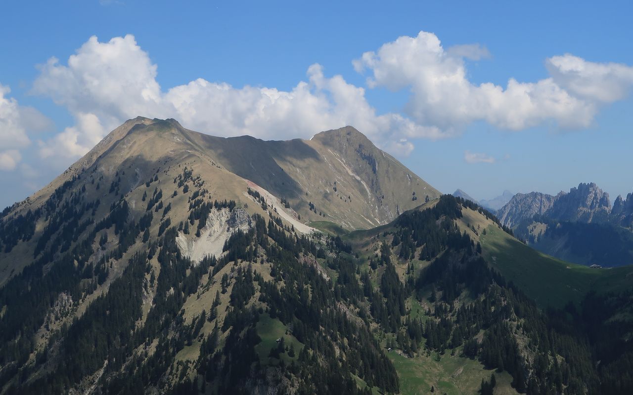
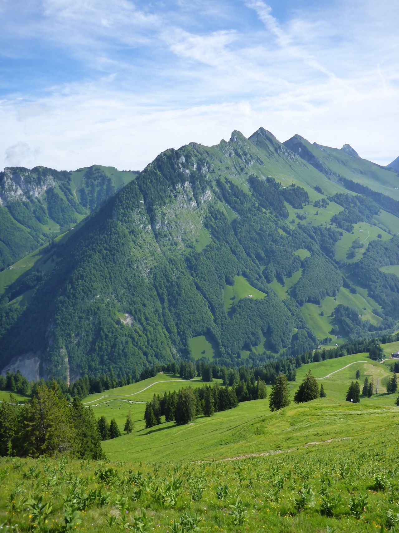
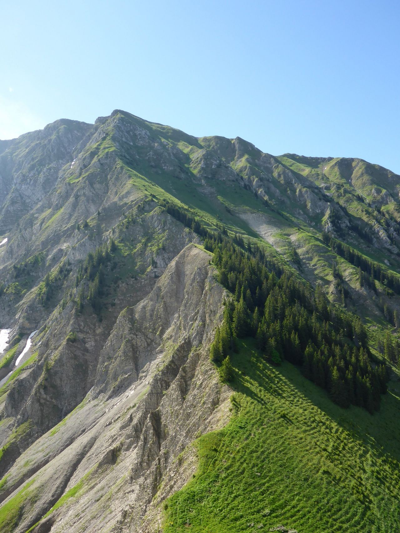
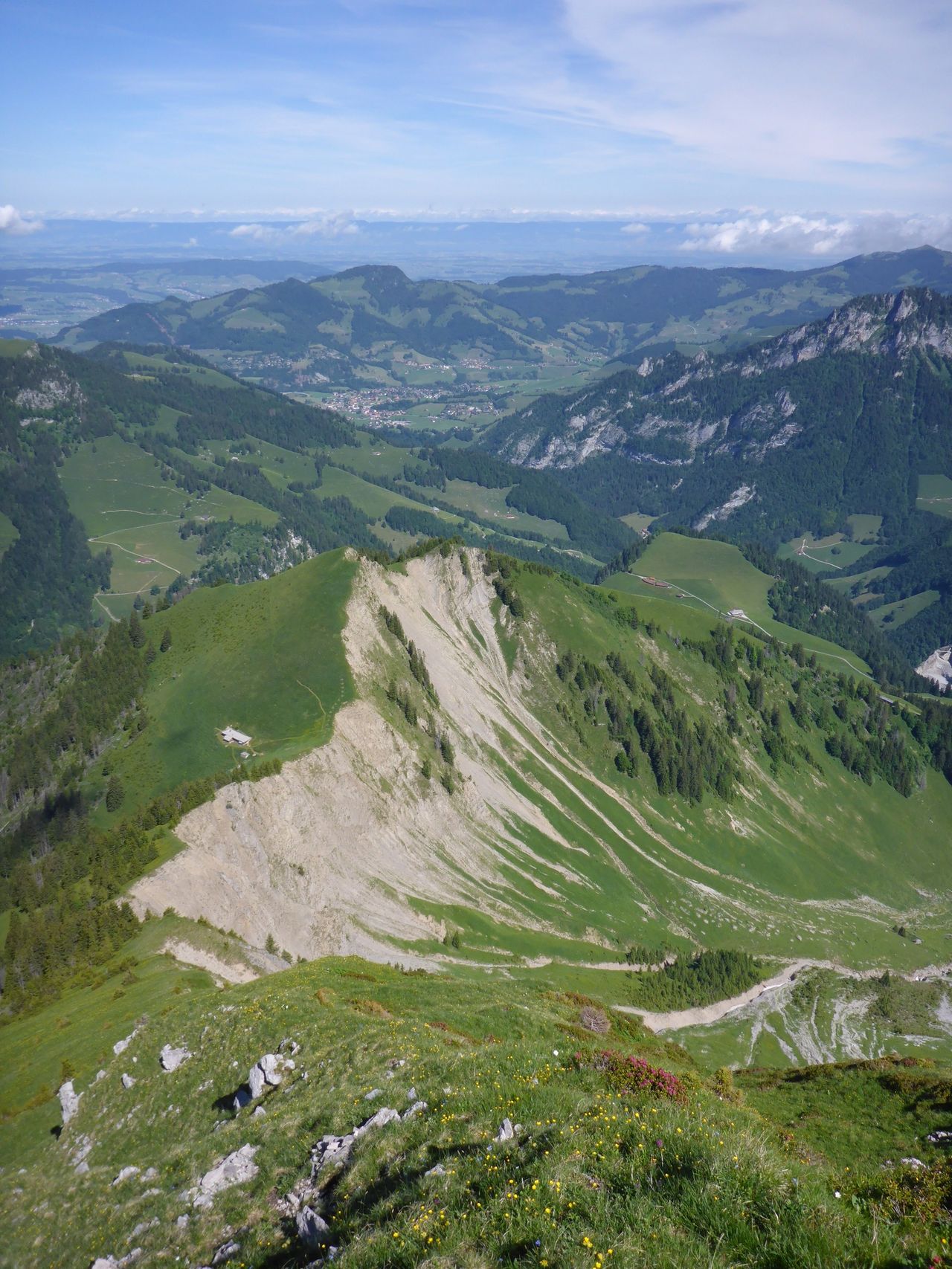
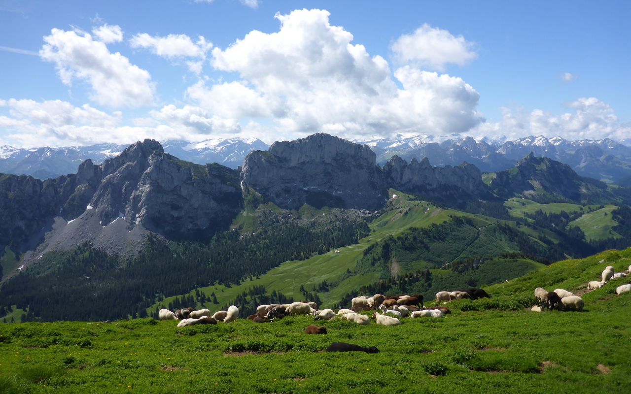
When climbing Arête du Verdy to Hochmatt, the names on the right-hand side are French, and on the left-hand side they are German. This is the invisible line separating the French and German speaking parts of Switzerland. The ridge brings us to a magnificent pasture with a splendid view. The highest chalet in the canton of Fribourg formerly stood in this pasture. Today, it is in ruins. The tour has a language theme because we visit two summits, one with a French name and the other a German one.

Route description

Im Fang – Pointe de Tosse – Le Verdy
From Im Fang follow the hiking trail to Bi Chalet. After leaving the village, the trail is on the forested N side. From Bi Chalet either follow the road or hike in pastures directly up to the hut at P. 1348. The trail continues via Rustoz, traversing the two elevations of Pointe de Tosse (P. 1750 and P. 1771, unnamed on the map) on the west side. Finally, you reach a saddle above the chalet at Le Verdy (1693 m). The two Pointe de Tosse can also be climbed.
Le Verdy – Arête du Verdy – Hochmatt
Follow the entire ridge, forested at first, then interspersed with rocky outcrops, to reach the flat SW ridge. Always keep to the right of the ridge line. In a few steps you reach the highest point (2151 m). The summit cross, which is well visible from Im Fang, is on a less high promontory further east.
Hochmatt – Cheval Blanc – Schänis
There are two possible descents. Both are marked blue-white and almost equally long: the direct descent via «In den Löchern» (see variant 1) or via Cheval Blanc, if you want to add another summit. In this case traverse the summit pasture eastward via P. 2089 to ascend the Cheval Blanc summit (2146 m). From the summit a path descends the E ridge until ca. 1920 m, where you leave the ridge to descend the SE face to Schänis (ca. 1420 m) and the road.
Schänis – Im Fang
Slightly below Schänis the two routes merge. Follow the road back to Im Fang, cutting short some of the bends on a hiking trail.
Variant 1: descent from via In den Löchern
From the summit cross traverse the pasture to reach the ruins of the old chalet (ca. 2030 m), then descend on the E ridge. You reach the karst terrain of «In den Löchern». Follow a trail down to the road at Petit Mont; T4.
Variant 2: descent from Hochmatt to Cabane des Marindes via Gros Mont
From Hochmatt you can descend the SW ridge on a marked trail (T2) to reach Haut du Mont (1365 m) on the N edge of the wide Gros Mont high plain. There is a rustic mountain restaurant at Le Sori (ca. 1393 m), 2 km south of the parking lot at Haut du Mont. As the descent from Gros Mont to Pra Jean on the road from Jaun to Charmey is unattractive, this variant comes into play, when you want to spend the night at Cabane des Marindes (1868 m).

Additional information

Departure and arrival point

Im Fang (922 m)

An der tpf-Buslinie Bulle - Charmey - Jaun - Jaunpass - Boltigen.

Time

Total hiking time: 6 h

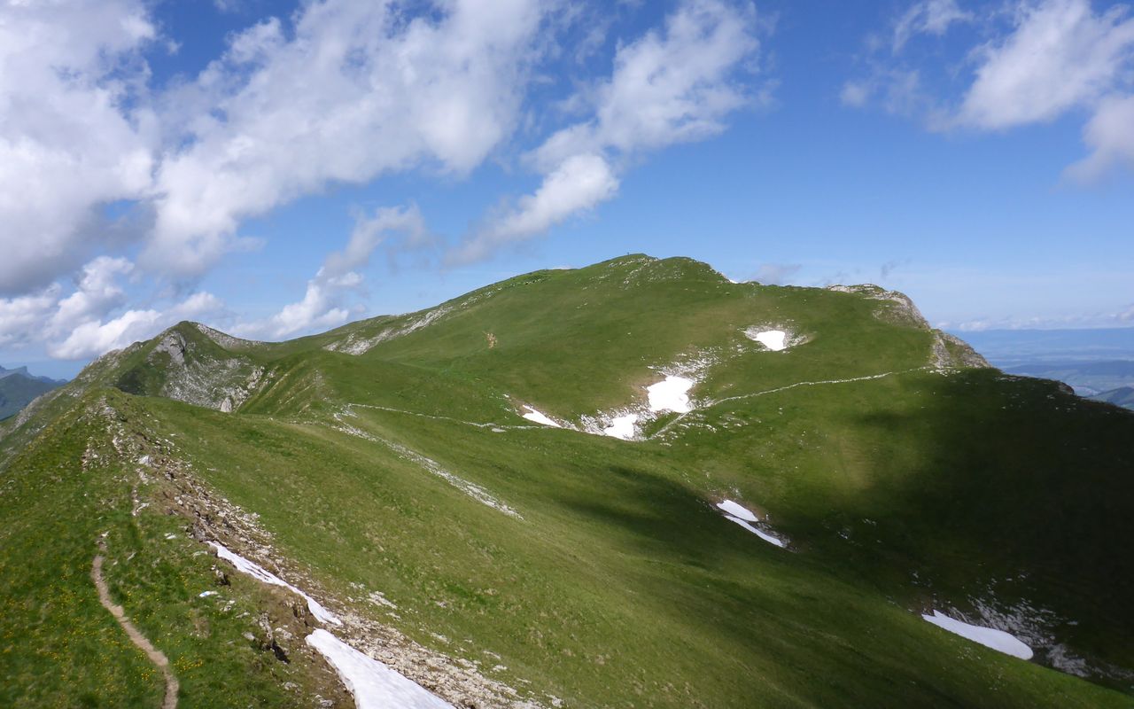
Im Fang – Pointe de Tosse – Hochmatt: 3 h

Hochmatt – Cheval Blanc – Schänis – Im Fang: 3 h

Difficulty / Material

The ascent on Arête du Verdy to Hochmatt is T5-, the rest is T3, mainly on marked trails.

Waypoints
Catering and overnight stay

Cabane des Marindes (1868 m)

In the sixties the "pro natura" organisation acquired an old, simple hut in Vallon des Morteys, which in 1967/68 was renovated and enlarged to a cabin by the CAS Gruyère.


The cabin sleeps 50, you do your own cooking (only soup and beverages are available), and it is open and has a warden from the beginning of June through the beginning of October. CAS Section La Gruyère, www.cas-gruyere.ch, for reservations call 079 790 45 33.

Neighbor summit

Sommet de la Gueyre (1897 m)

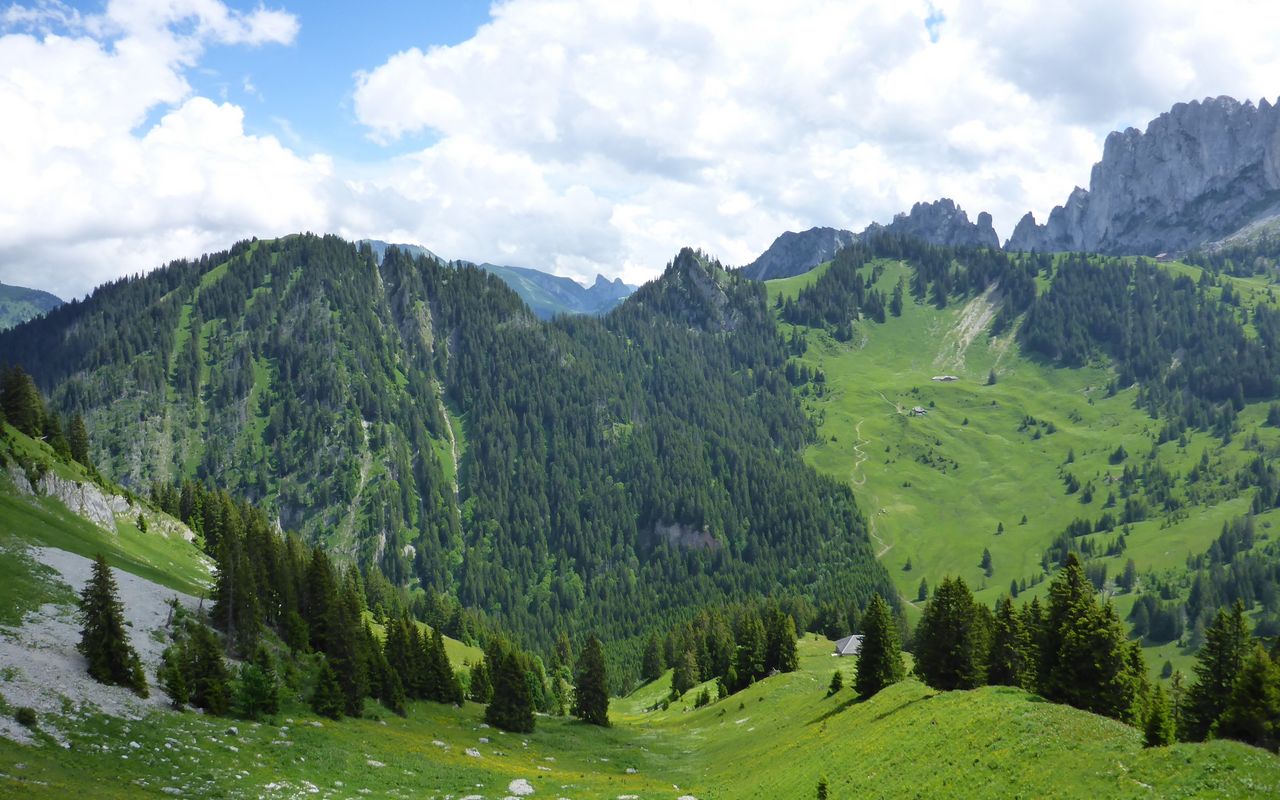
Between Gros and Petit Mont there are two mainly grassy and forested summits unnamed on the map: the cone-shaped Sommet de la Gueyre (ca. 1897 m) and Plan de Pralet (1871 m). The former is best accessible from the Hochmatt saddle (1816 m, unnamed on the map) on the N ridge. The latter has a path on the E face almost up to the highest point; T2.

Plan de Pralet (1871 m)

See Sommet de la Gueyre

Authors

Manuel Haas

Oliver Neumann

Oliver Neumann is an SAC tour guide and author for the SAC-Tourenportal. His area of work includes mountain and alpine hiking in the Freiburg Alps as well as snowshoe tours in the Jura, Bernese, Freiburg and Vaud Alps.

Our recommendations

SAC-Crocs

Equipment

SAC-Crocs

Price CHF 59.00
Member price CHF 49.00
Gipfelziele Freiburg

Berg- und Alpinwandern

Gipfelziele Freiburg

Price CHF 54.00
Member price CHF 45.00
Tourenportal/App-Abo Jahreszahlung

Subscription to the SAC Route Portal

Tourenportal/App-Abo Jahreszahlung

Price CHF 49.00
En famille vers les cabanes du CAS

Hütten

En famille vers les cabanes du CAS

Price CHF 54.00
Member price CHF 45.00
SAC-Hütten-Monopoly

At home

SAC-Hütten-Monopoly

Price CHF 69.90
Member price CHF 60.00
Les Alpes, un monde vivant

Ausbildung

Les Alpes, un monde vivant

Price CHF 64.00
Member price CHF 54.00
SAC-Taschenmesser

Equipment

SAC-Taschenmesser

Price CHF 54.00
Member price CHF 49.00
Hütten der Schweizer Alpen / Cabanes des Alpes suisses

Bildbände

Hütten der Schweizer Alpen / Cabanes des Alpes suisses

Price CHF 69.00
Member price CHF 59.00
feedback