From Salbithütte via Meiggelenstock to Wassen | Mountain hiking | Swiss Alpine Club SAC
Unterstütze den SAC Jetzt spenden

From Salbithütte via Meiggelenstock to Wassen (Normal route) Meiggelenstock 2416 m

  • Difficulty
    T4
  • Ascent
    1:45 h, 480 m
  • Descent
    2:45 h, 1670 m

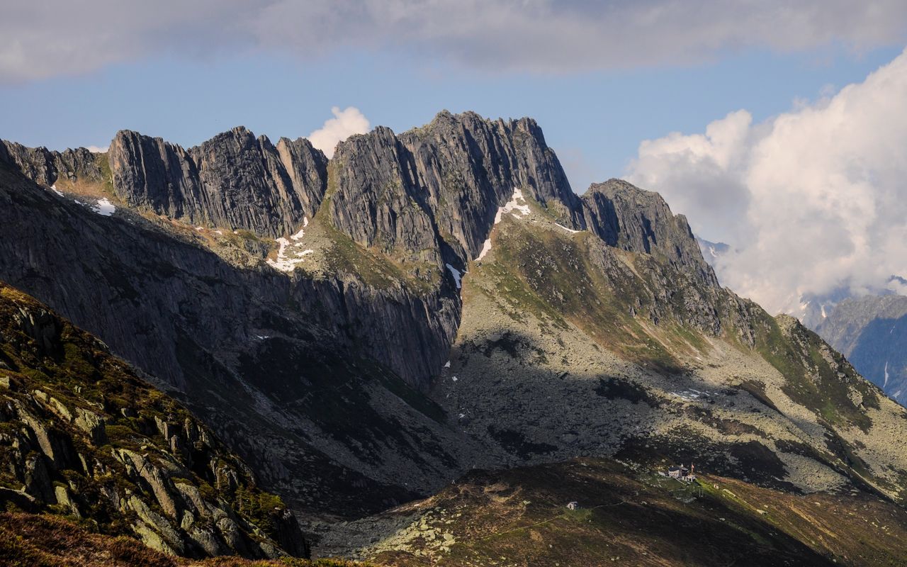
Surrounded by bold spires

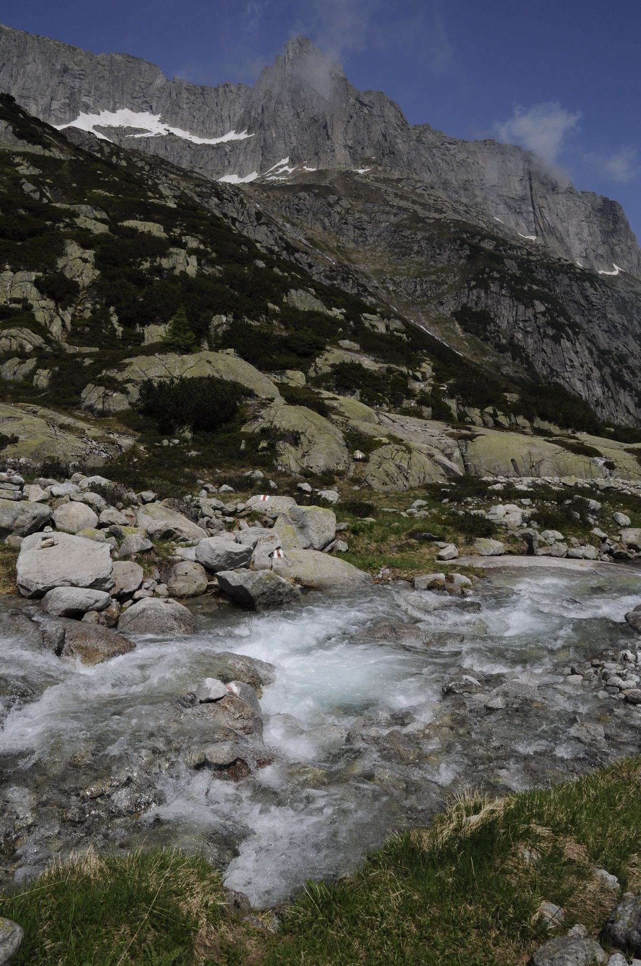
The granite peaks of the Salbit region are among the best climbing mountains Switzerland has to offer: sharp spires, steep fissures, perfect dièdres, highly structured walls, rough slabs and textbook crags. They can be admired from the hiking area around Meiggelenstock. Moreover, there are two panorama views to enjoy: one into the green gorge of the Reuss valley, the other over to the secluded lakes below Rohrspitzli, which, by the way, deserve an extended visit, too.

Route description

Salbithütte – Bandlücke – Kreuz
From Salbithütte the well-marked mountain trail bypasses the lowest point of Seeliboden, gains height quickly on the other side, bypasses some rocky escarpments and leads steeply, but elegantly up to Bandlücke (2357 m). The short detour to the vantage point is well worthwhile. From Bandlücke descend north across granite slabs, branch off at the first opportunity and traverse east across block fields to reach Meiggelenstock on its north ridge. The cross is at around 2370 m.
Kreuz - Meiggelenstock - Kreuz
Those who still crave a view, scramble up for a few minutes from the cross over rough blocks to the highest point at 2415 m. Back to the cross on the same route.
Kreuz - Meiggelstock - Bruchwald - Wassen
From the cross down to P. 2236 and to P. 1939 before the Rohrbach, where the mountain hiking trail to Wassen branches off to the right. Soon steeply through the forest "Bruchwald" down to Wattingen, where we meet the long-distance hiking trail "ViaGotthadro". On it to the left in the Reuss valley to Wassen, bus stop "Dorf".
Variant Rohrseen:
From Meiggelenstock go back to the bifurcation below Bandlücke and traverse across Rohrplatten to Lang See and Gross See. Then continue to Chli See, and, impressively, to Wildlauenengrat, and through the protective forest of the village you reach Wassen (T3, from Meiggelenstock to Wassen 4 h).

Additional information

Departure point
End point

Wassen UR, Dorf (916 m)

Difficulty / Material

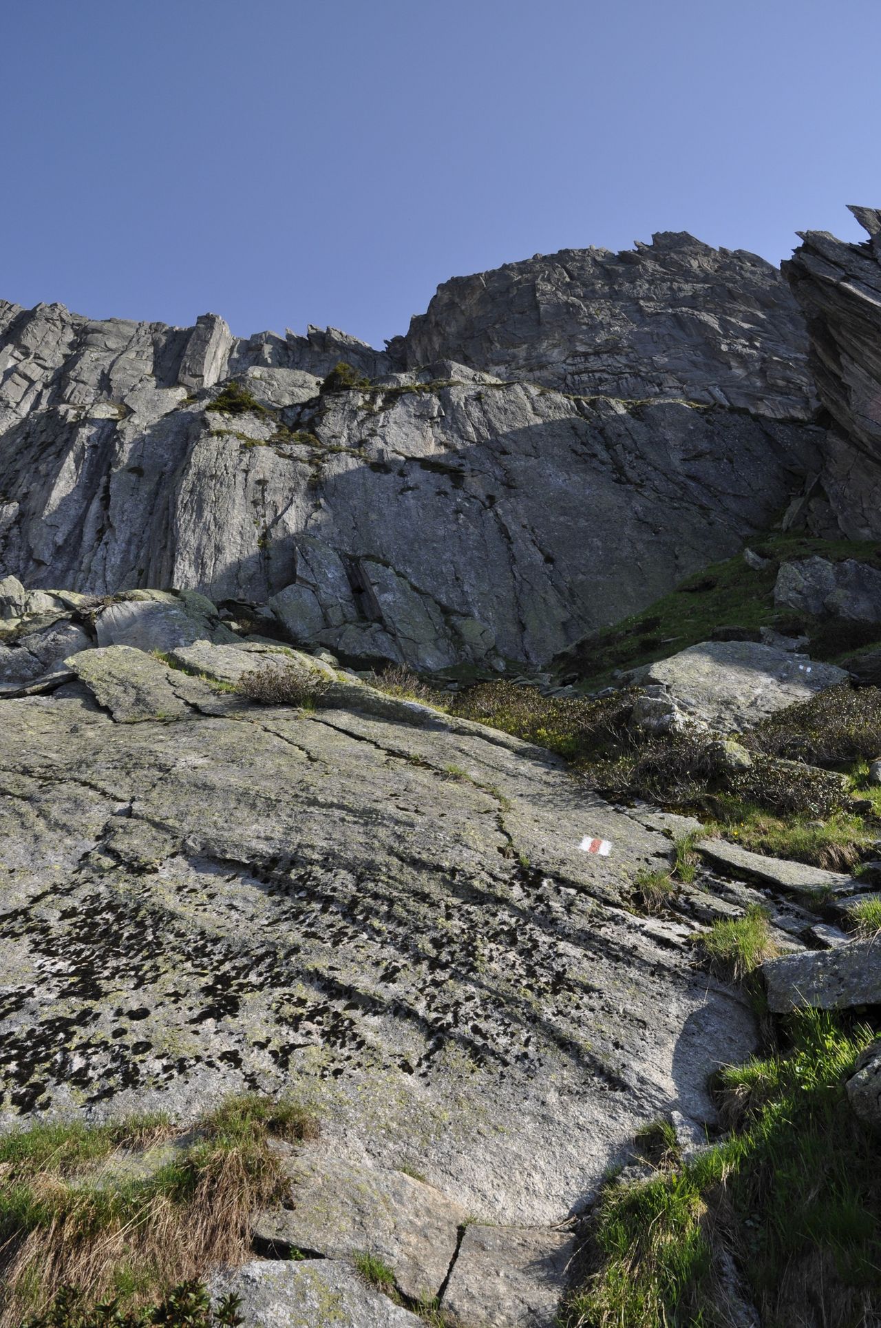
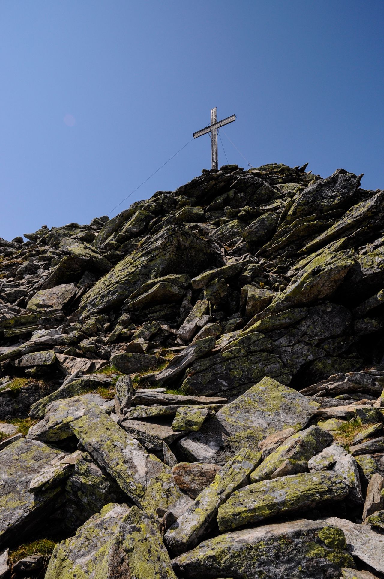
The most challenging passages are on the last few (not mandatory) metres from the Meiggelenstock cross to the highest point of Meiggelenstock. They are on huge, sometimes slippery but not very exposed boulders. On Bandlücke as well as on Meiggelenstock between P. 2236 and the cross the well-traced mountain trail leads up a steep face. On the pathless Rohrplatten you will have to trust the grip of your boots. Crossing the Rohrbach can cause some problems, especially in early summer.

Waypoints

Bandlücke (2357 m)

Nice passage, highest point of the tour

Author

Remo Kundert

Remo Kundert is a hiking guide and owner of the hiking tour operator Per Pedes Bergferien. He also works as a freelance photographer and alpine journalist, and has co-authored numerous hut guidebooks, alpine- and family hiking books.

Our recommendations

Gipfelziele Zentralschweiz Vierwaldstättersee

Berg- und Alpinwandern

Gipfelziele Zentralschweiz Vierwaldstättersee

Price CHF 54.00
Member price CHF 45.00
SAC-Crocs

Equipment

SAC-Crocs

Price CHF 59.00
Member price CHF 49.00
Tourenportal/App-Abo Jahreszahlung

Subscription to the SAC Route Portal

Tourenportal/App-Abo Jahreszahlung

Price CHF 49.00
SAC-Hütten-Monopoly

At home

SAC-Hütten-Monopoly

Price CHF 69.90
Member price CHF 60.00
SAC-Taschenmesser

Equipment

SAC-Taschenmesser

Price CHF 54.00
Member price CHF 49.00
Schneeschuhtouren Zentralschweiz

Schneeschuhtouren

Schneeschuhtouren Zentralschweiz

Price CHF 59.00
Member price CHF 49.00
Ausbildung Bergwandern / Alpinwandern

Ausbildung

Ausbildung Bergwandern / Alpinwandern

Price CHF 59.00
Member price CHF 49.00
Hütten der Schweizer Alpen / Cabanes des Alpes suisses

Bildbände

Hütten der Schweizer Alpen / Cabanes des Alpes suisses

Price CHF 69.00
Member price CHF 59.00
feedback