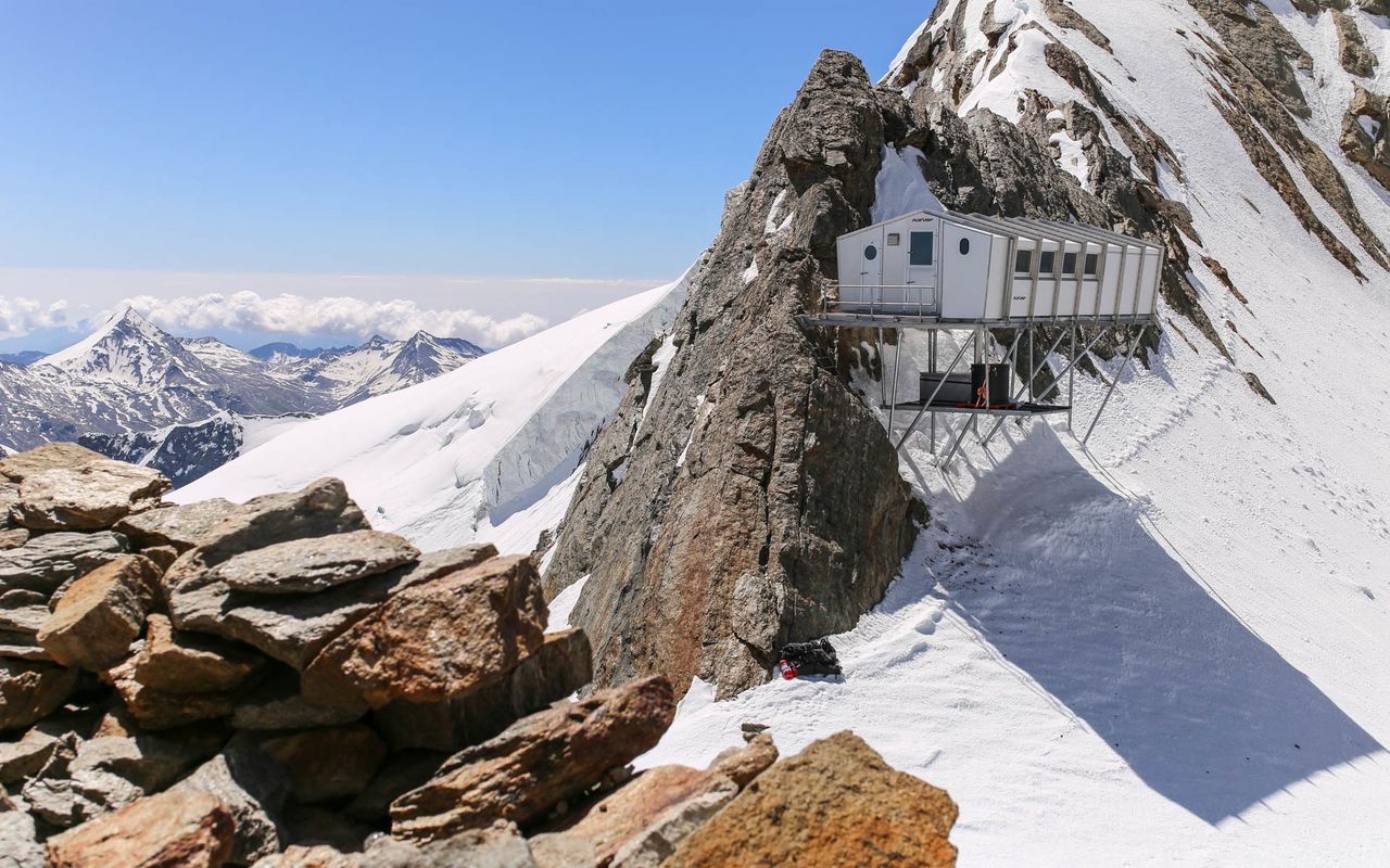
From Täschalp or the Täschhütte (Normal route) Mischabeljochbiwak SAC 3855 m
-
- Difficulty
- AD-, 2b
-
- Ascent
- 5–6 h, 1650 m
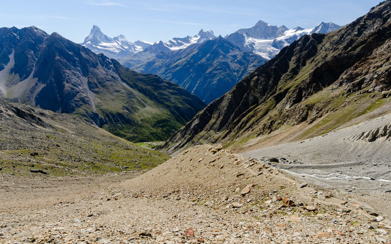
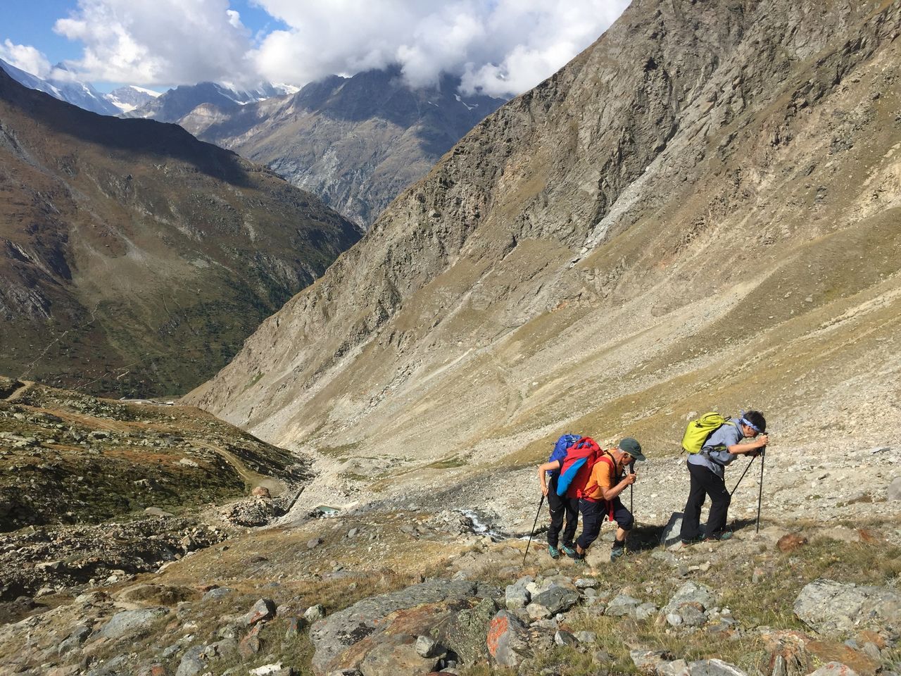
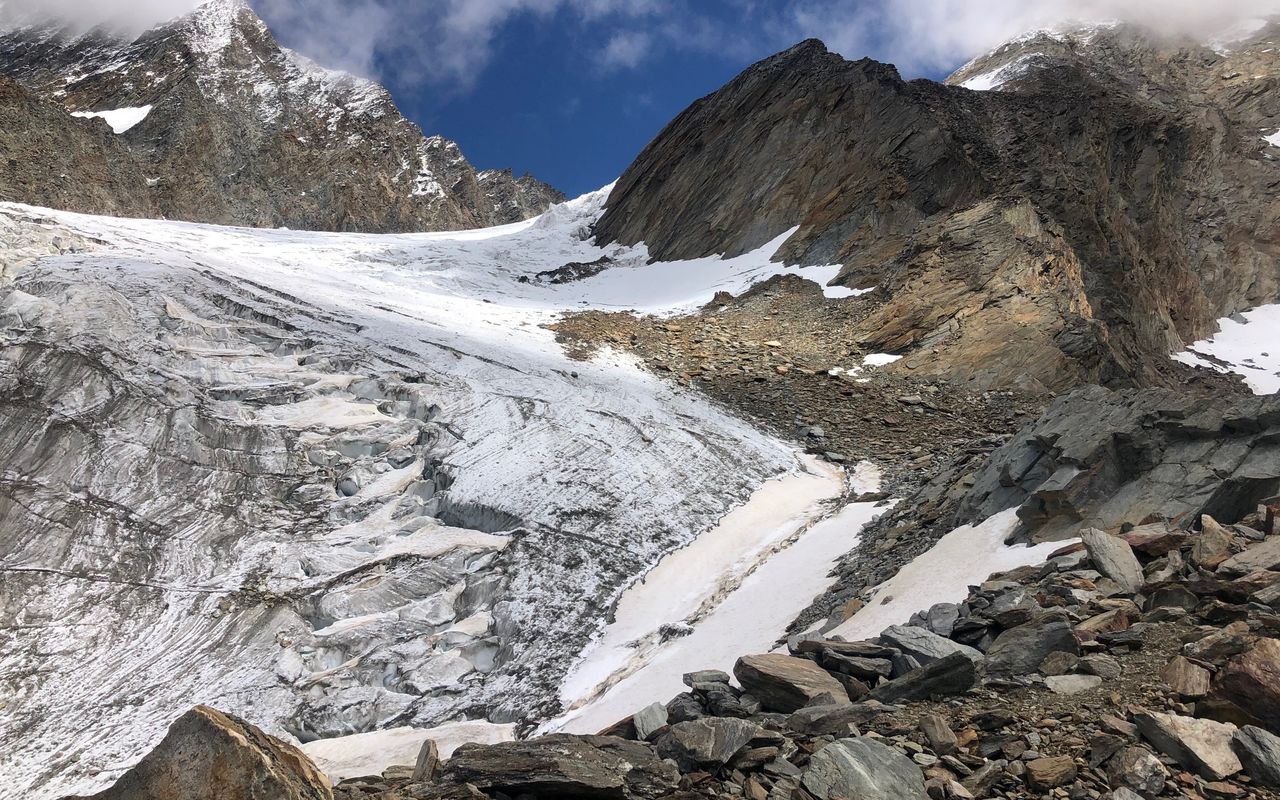
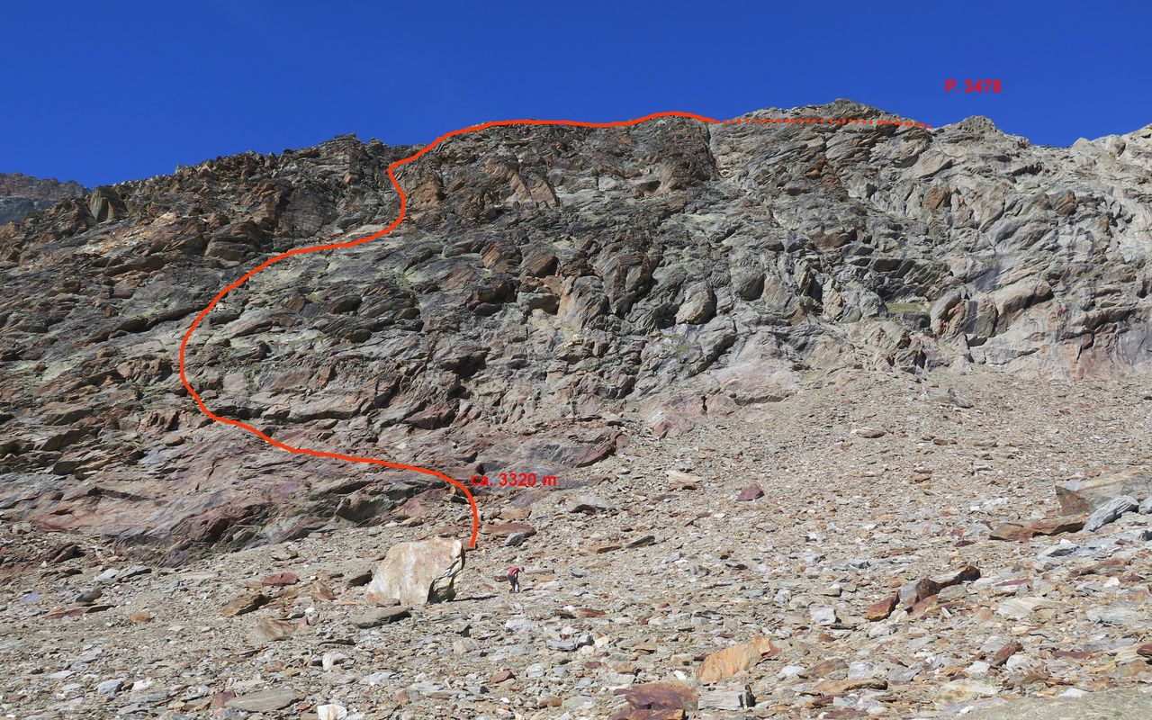
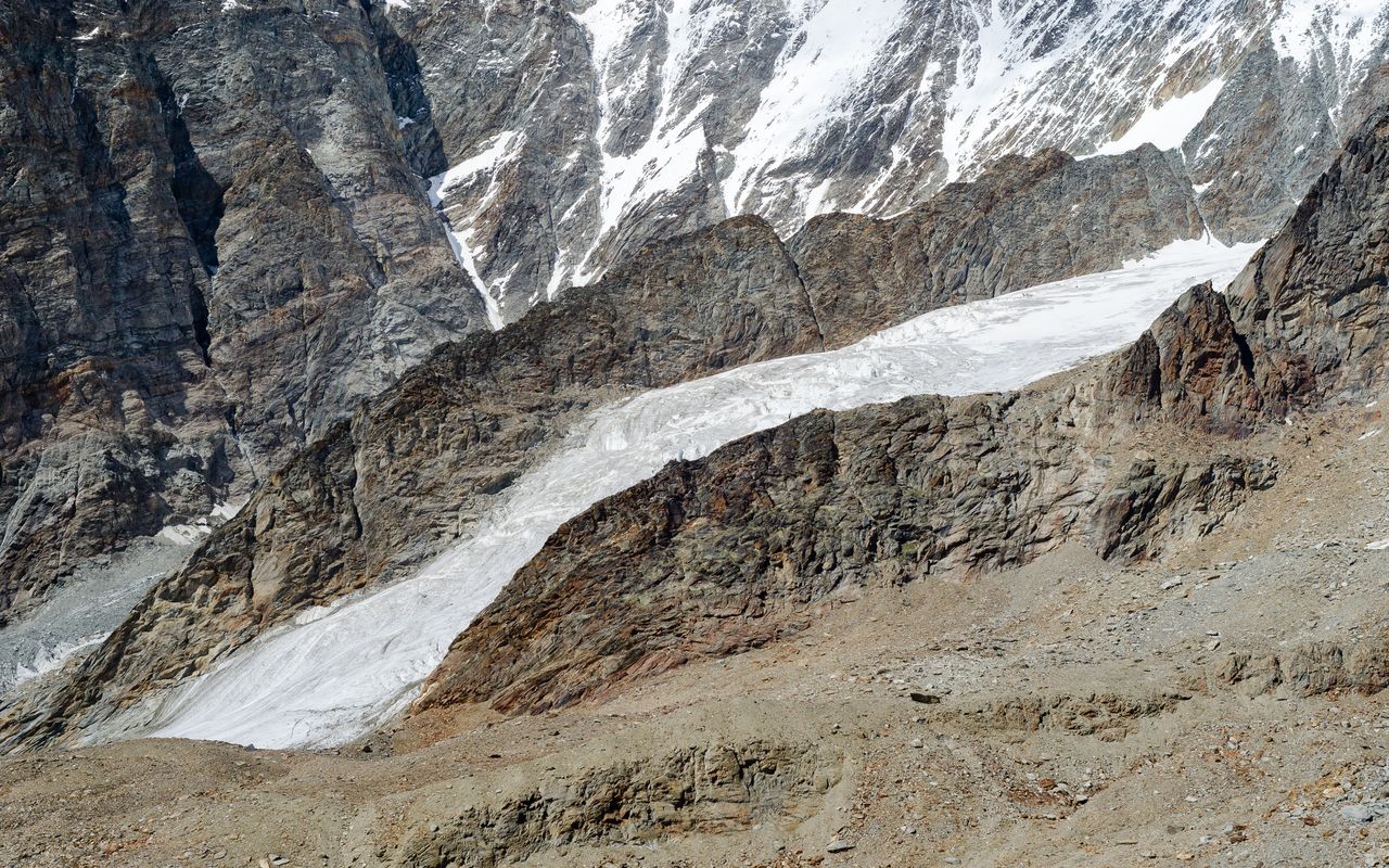
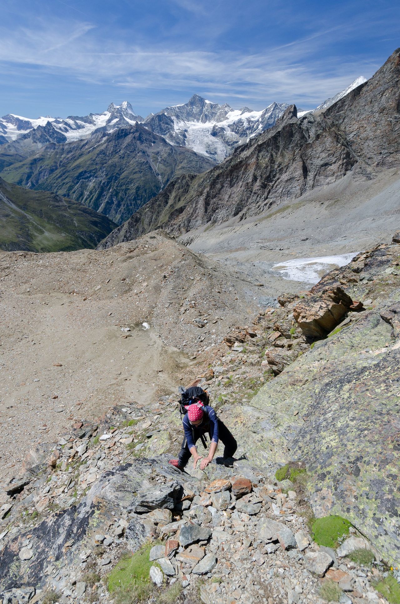
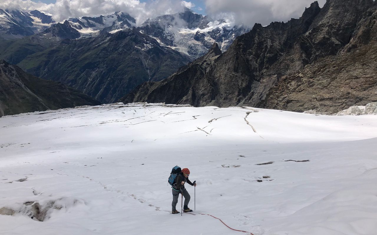
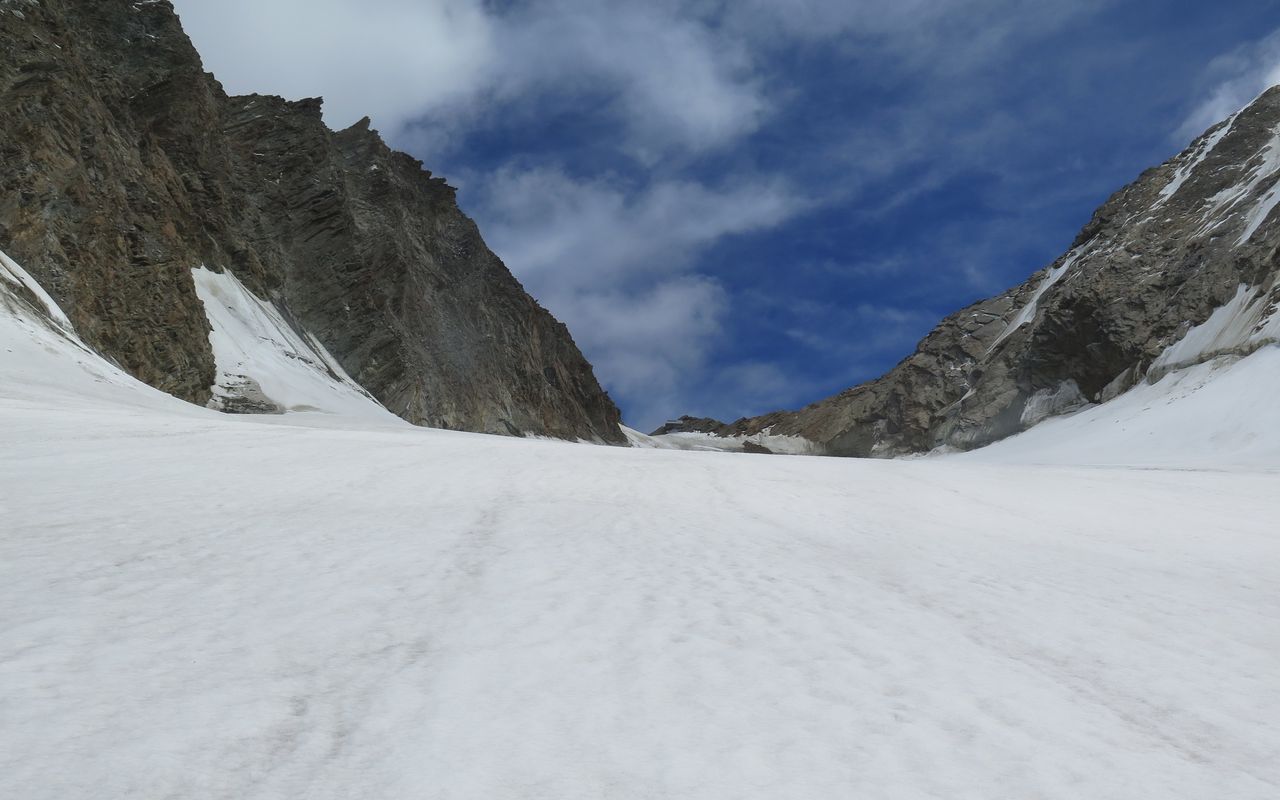
The direct route from Täschalp is often used in the descent, as it saves the detour to the Täschhütte. We also mention the access from the Täschhütte, as the height difference and the time required are less than when climbing from Täschalp. The route over the lower part of the Weingartengletscher can be complicated and requires great care due to numerous, often large crevasses. If the passage is not possible, it is advised to change to the variant over the rock ridge to join the glacier left (north) of P. 3748.


Route description
From the Täschalp (2205 m) follow tracks ENE beside the Rotbach. Continue onto the distinct moraine and follow it steeply up to the plateau. Cross the flat boulder fields of the plateau to reach a less defined moraine and follow this to P. 3220 m before a large rock ridge.
Now turn left (N) onto the crumbling Weingartengletscher, cross over towards its north edge, near to the rocks of P. 3631. Climb through the crevasse zone until it eases around 3600 m then follow the gently sloping firn to the Mischabeljoch (3847 m), 1 1/2 hrs. The bivouac is to the right of the 'joch' on the lowest rocks of the Alphubel's NNW ridge.
The Weingartengletscher can also be reached from the Täschhütte, this is the normal route (from the Zermatt valley) since the difference in altitude is less than that from Täschalp. The transition to the Weingartengletscher can be tricky, which is why the difficulties are higher (ZS- / 2) 4 ½ hours from the Täschhütte. From the Täschhütte (2701 m) a path leads north around the foothills of the Rotgrat and into Tälli before zigzagging up to the 'standing-stones' pass at 3140 m on the Wissgrat, 1 ½ hours. From here, and bad path leads down through a boulder labyrinth to the plateau of the Weingartensee (tarn). You cross the talus and scree fields NE and bypass the foot of the W Ridge of the Alphubel's north summit on the left. Now continue straight across to the rocky ridge below P. 3478. Variant over the rock ridge - this can also be used when starting at Täschalp: New Way: About 300 m west of P. 3478 at an altitude of approx. 3300 m you approach the cliff face. From a cluster of large free-standing boulders among the scree, approach the cliff base and locate a large cairn. The best route leads you first up and left over slabs, before cutting back right (multiple small cairns). It then zig zags carefully up (slings, maillon) via some small steeper rock steps (grade 2 - 3 max) to the ridge line. Turn right on the ridge (east) and follow until it merges with the debris-covered glacier's edge. Beware of black ice under the debris, and don crampons earlier rather than later. Cross to the centre of the glacier early to avoid the serac zone, weaving around some massive crevasses, trending generally leftwards (north) until the glacier begins to flatten. Then follow the the glacier up to the Mischabeljoch.
Additional information
- Departure point
-
Täschalp (2185 m)
Erreichbar mit PW oder Busbetrieb ab Täsch von Mitte Juni bis Mitte Oktober, Infos www.zermatt.ch; Ab dem späten Frühjahr erreichbar mit dem Alpentaxi.
-
- Waypoints
-
Ausgangspunkt der Variante.
-
-
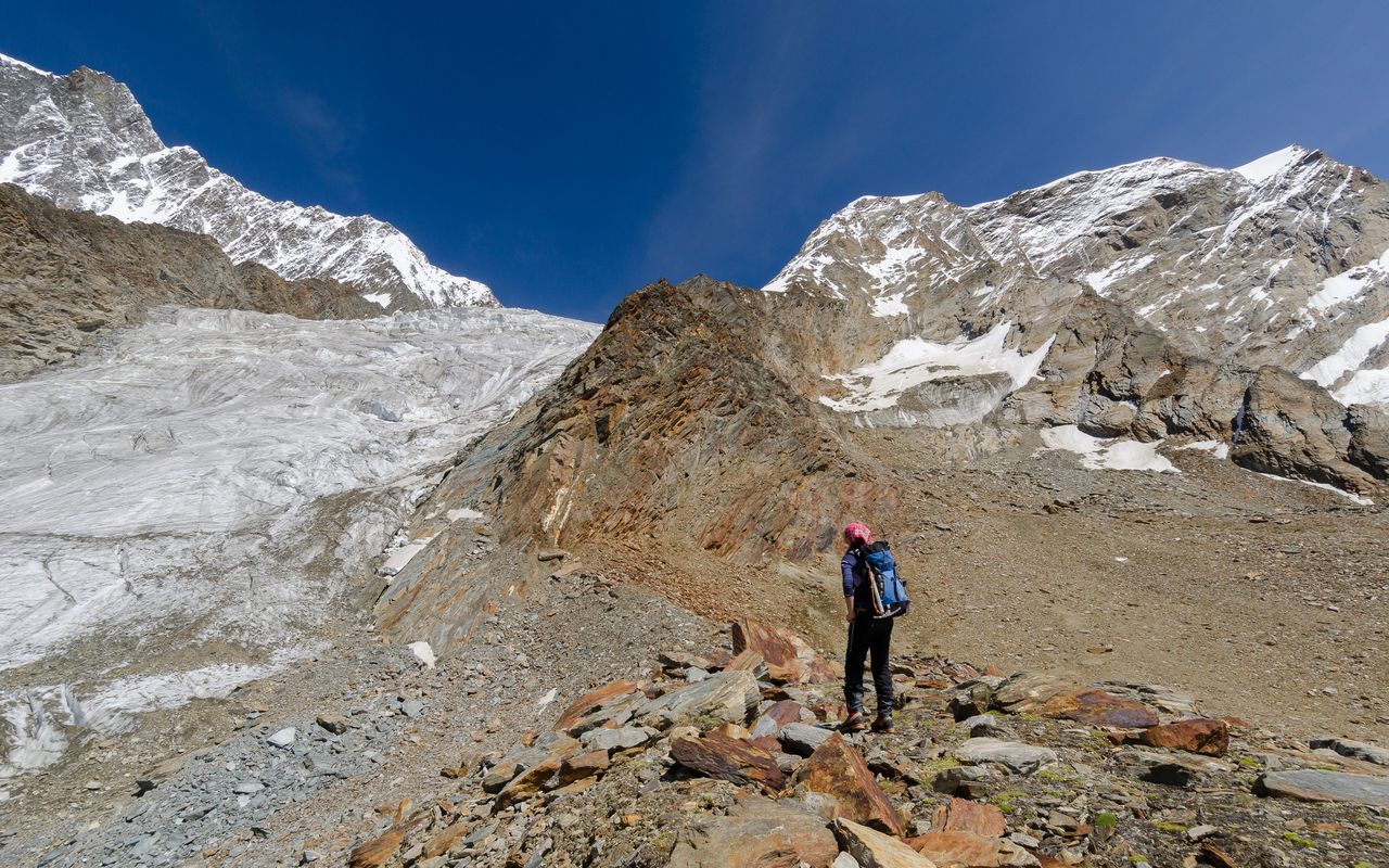
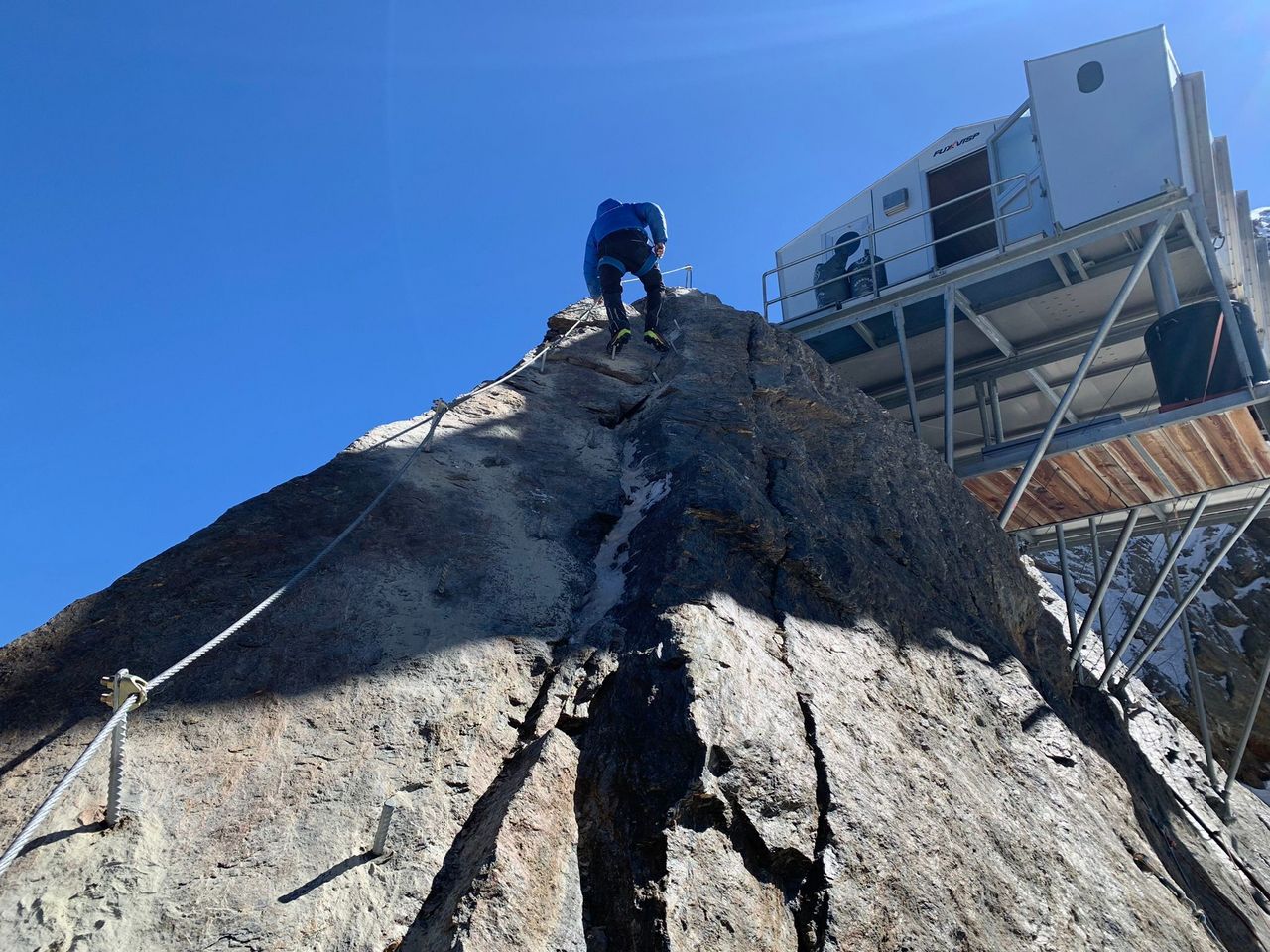
Unmittelbar unter dem Biwak liegt das gleichnamige Joch.
-