On the south-east face | Mountain hiking | Swiss Alpine Club SAC
Unterstütze den SAC Jetzt spenden

On the south-east face (Normal route) Radlefshoren 2602 m

  • Difficulty
    T4+
  • Ascent
    3:30 h, 1340 m
  • Descent
    3:15 h, 1490 m

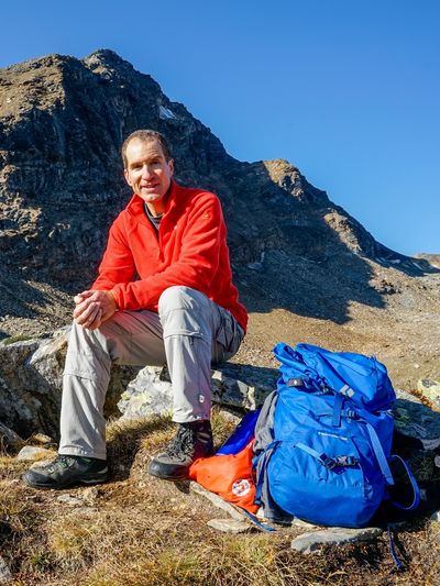
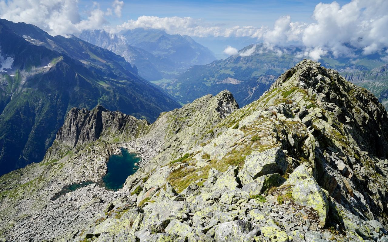
Solitary tour in the Trift region

On beautiful days, the Trift aerial cableway is very busy carrying hikers up, and once they arrive at the top, they all flock to the famous Trift bridge. Whoever branches off towards Radlefshoren, a few steps outside the summit station, normally enjoys a quiet day on a very charming summit in a rarely visited mountain region.

Route description

Triftbahn summit station – Radlefshoren
From the Triftbahn top station (Sunnige Trift) follow the alpine hiking trail until you reach the Triftwasser stream. Before the bridge over Triftwasser ascend pathless north-eastward. At an altitude of about 1420 m turn right (east) through a ditch and onto the next, forested rib, where a path begins. Follow this up through the forest. From ca. 1480 m the path leads through open terrain with grass and an old moraine; there is a splendid view to perfectly rounded boulders (Chlempenwang). Here the faint path disappears momentarily. At ca. 1720 m you should be on the lookout for the reappearing path in order not to miss the way through to the right (south-east); at one point you walk through an attractive crevice. Afterwards a more distinctive path leads to a small hut at Mälchsteinen (ca. 1910 m). If you love blueberries, allow for more time on this leg as of August! From Mälchsteinen follow a faint path eastward to a rib and continue on this rib past P. 2083 to a rocky ledge, which is easily climbed (ca. 2140 m). After that you will find only a very faint path. Continue to ascend northward, keeping slightly to the right below the rocky projection (ca. 2300 m), where from the right you can pass this rocky structure in a little valley. Then continue on a rib to Sandhibel (2443 m). From here you have a good view of the south-east face of Radlefshoren. Almost in the fall line of the summit (slightly east of it) you distinguish a stripe of rubble, which comes down between slabs. That is where you ascend. The rubble can be fairly well avoided on grass. At the end scramble to the summit over boulders.
Radlefshoren – Gadenlouwisee
Descent: go back on the south-east face to reach its foot. From there traverse up north-eastward to the saddle at P. 2500. Behind the saddle descend on scree and continue slightly right (north-north-eastward) towards a rib (old moraine). There you find sheep tracks leading down to Gadenlouwisee (2155 m). On this leg there is one exposed passage across a steep slab.
Gadenlouwisee – Gadmen
From Gadenlouwisee follow a marked mountain hiking trail with a few steep, rough passages via Hubel (1857 m) and through Farlouwiwald to Gadmen.

Additional information

Departure point

Triftbahn, Bergstation (1357 m)

Tickets mit zeitgenauer Platzreservation unbedingt im Voraus online kaufen, sonst muss mit langen Wartezeiten gerechnet werden, u.U. sind sogar den ganzen Tag keine Plätze mehr frei: www.grimselwelt.ch/bahnen/triftbahn

End point

Gadmen, Post (1205 m)

Time

Tickets for the Triftbahn are best bought online in advance, otherwise you have to expect very long waiting times: www.grimselwelt.ch/bahnen/triftbahn

Difficulty / Material

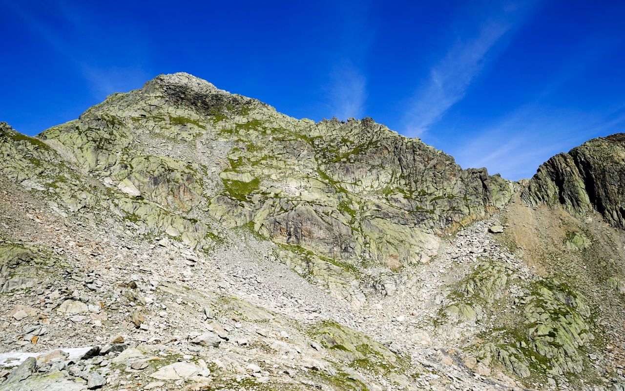
On the ascent there are long pathless passages, which with bad visibility make orientation difficult. The tracks between the Triftwasser and the Mälchsteinen are heavily overgrown during the growing season and may be difficult to find. Since the path is not maintained, they may become even less clear over time.

Grass, scree and some scrambling characterise the steep south-east face of the summit. In the upper part of the descent to Gadmen you encounter vast scree slopes.

Neighbor summit

Graui Stöckli (2775 m)

Graui Stöckli: this is a mountain with several summits. The western summit (2714 m), which could also be climbed from the aforementioned saddle at P. 2500, is not recommended due to the very unstable terrain. It is more advisable to climb P. 2775 starting from Windegghütte SAC: cross Triftbrücke, then ascend pathless through the valley called Drosi to the saddle between P. 2714 and P. 2775. Continue on the western ridge to the summit (2775 m). Descend on the north-east ridge and go on to Gadenlouwisee. T5.

Authors

Sabine Joss

Fredy Joss

Sabine und Fredy Joss

Alpine hiking, climbing and other mountain sports Sabine and Fredy Joss's passion. They have been writing and photographing for the SAC publishing house and the club magazine Die Alpen for many years. Sabine is also a biologist and tour guide; Fredy a proofreader and editor for various magazines.

Our recommendations

Skitouren Berner Alpen Ost

Skitouren

Skitouren Berner Alpen Ost

Price CHF 44.00
Member price CHF 34.00
SAC-Crocs

Equipment

SAC-Crocs

Price CHF 59.00
Member price CHF 49.00
Klettern Kombipaket Berner Oberland

Klettern

Klettern Kombipaket Berner Oberland

Price CHF 98.00
Member price CHF 79.00
Tourenportal/App-Abo Jahreszahlung

Subscription to the SAC Route Portal

Tourenportal/App-Abo Jahreszahlung

Price CHF 49.00
Gipfelziele Berner Oberland Grossformat

Berg- und Alpinwandern

Gipfelziele Berner Oberland Grossformat

Price CHF 54.00
Member price CHF 45.00
SAC-Hütten-Monopoly

At home

SAC-Hütten-Monopoly

Price CHF 69.90
Member price CHF 60.00
SAC-Taschenmesser

Equipment

SAC-Taschenmesser

Price CHF 54.00
Member price CHF 49.00
feedback