![[Translate to English:]](/fileadmin/Der_SAC/Unserer_Partner/CSS_cyan_rgb.svg)
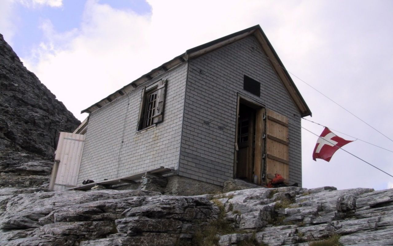
From Stechelberg (Normal route) Silberhornhütte SAC 2663 m
-
- Difficulty
- T5
-
- Ascent
- 5–6 h
It's long and its hard (T5)
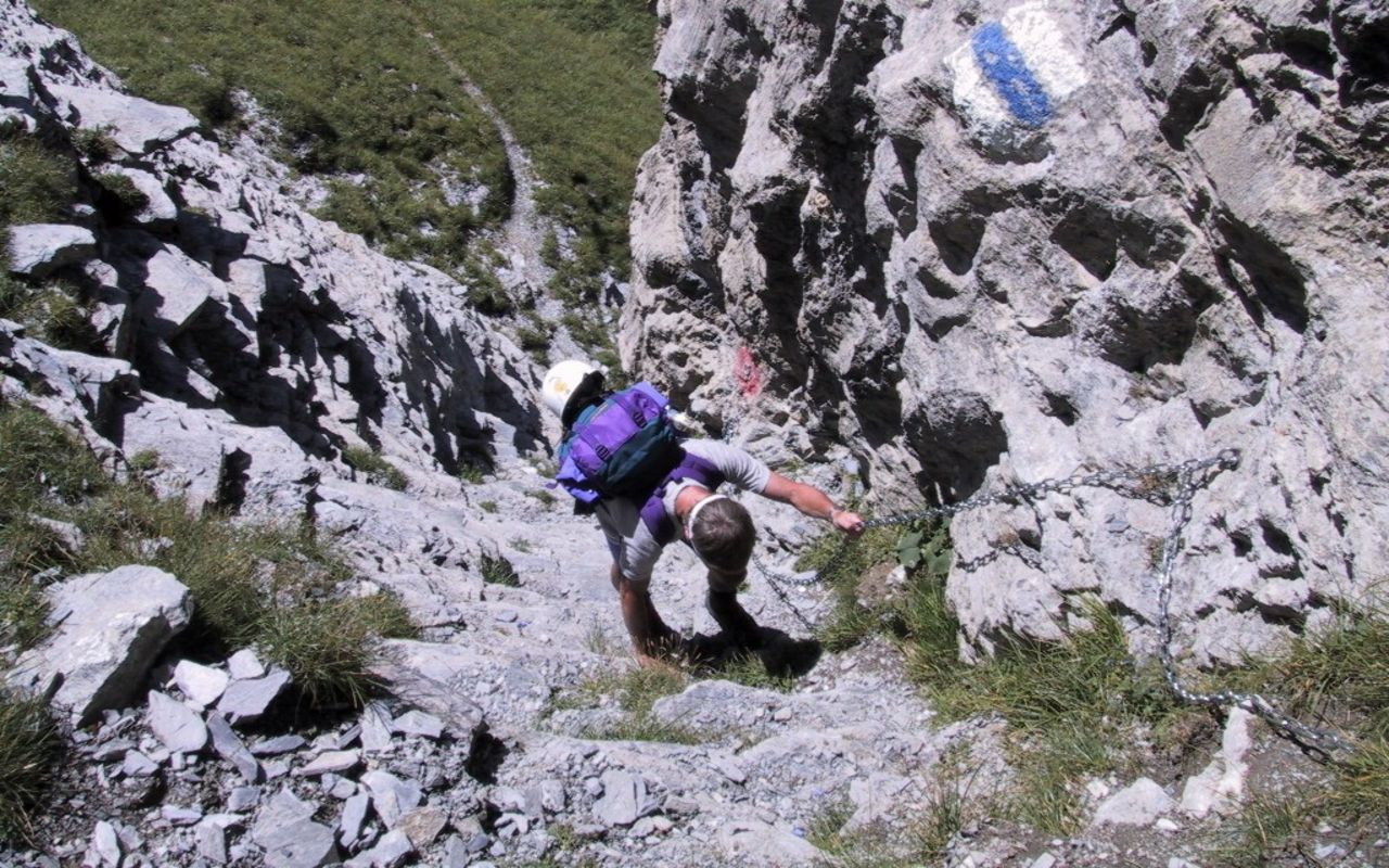
One of the longest hut paths in the Jungfrau Region. Under fresh snow or verglas the upper part is particularly tricky. Otherwise, it offers a varied ascent with magnificent views, both of the valley and the north facing walls of the Jungfrau.
Route description
Stechelberg (910m) to Bim Chalten Brunnen ca. 2000m
From Stechelberg (910 m) the trail leads along the east bank of the Weissen Lütschine river for about 400 m. Turn left before the Staldenbach stream and head up the mountain path to the north-east until you reach a cliff face named the Staldenflue. Head back to the southeast beneath the Staldenflue. At P. 1580, roughly 100 m before the hut of Altläger, the path branches off to the left. Cross the Schafbach and ascend the grassy slopes of Madfura to below the Bäreflue; another cliff band. Just below the cliff band, by a small spring: Bim Chalten Brunnen (2019 m), the path splits. The right branch leads to the the Rottalhütte and Rottalgrat, the left to the Silberhornhütte.
Bim Chalten Brunnen (2019 m) via Strälblatti (rocky slabs) to the Silberhornhütte 2663m
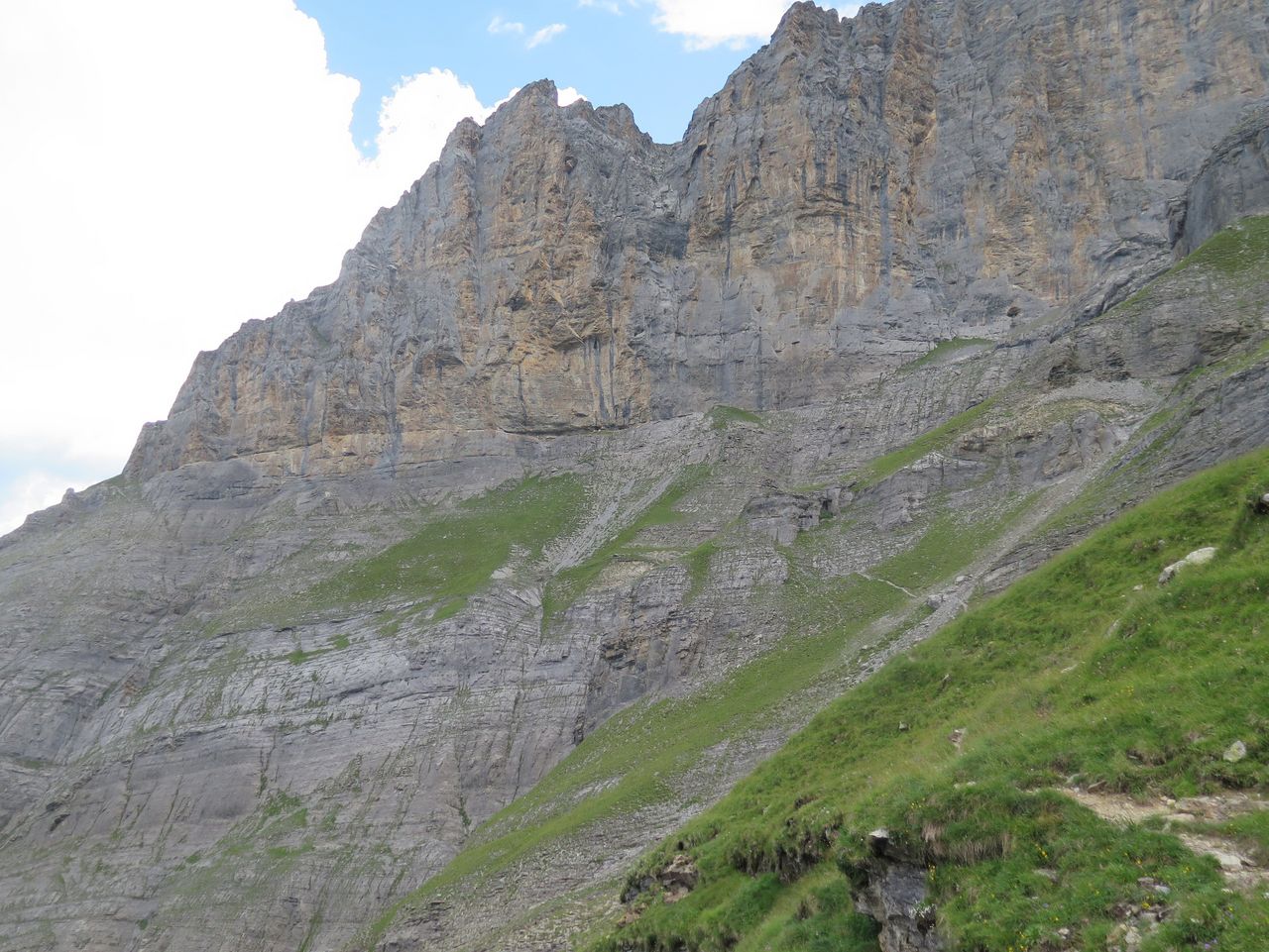
From the spring 'Bim Chalten Brunnen' take the left branching foot path. This crosses two streams that descend from the avalanche cone at the bottom of the 'Silberlouwena'. The marked path, made safer with artificial aids, then traverses below a large, strikingly reddish rock wall on loose rock bands to reach a promontory. Climb a wide chimney, this leads you into a large bowl (labelled 'Wart' on the map). Cross the 'Wart' on steep rock/ grass and scrub patches, traverse a wide, smoothly polished water channel and you will come to less steep grassy slopes. From here the gap to the east of the Rotbrätthoren (location of the Silberhornhütte) should be visible. Continue over the extensive Strälblatti (stratified limestone slabs) which, in dry conditions, do not present any problems, but which are rather challenging under fresh snow. At the top of the Strälblatti, a steeper cliff of gneiss hinders upward progression. Track more or less horizontally, leftwards along its base to the fall line of the hut. This final semicircular wall step is climbed by a short, almost vertical chimney to the right (south) via an iron ladder. A few more minutes and you'll be at the hut.
Note: If the Strälblatti are covered with fresh snow, it is advisable to descend below this to the northwest on the Gemschibeden and the then re-ascend along the upper reaches of the 'Mattenbach' stream to reach the foot of the Gneiss band.