Les Paccots – Teysachaux – Le Moléson | Mountain hiking | Swiss Alpine Club SAC
Unterstütze den SAC Jetzt spenden

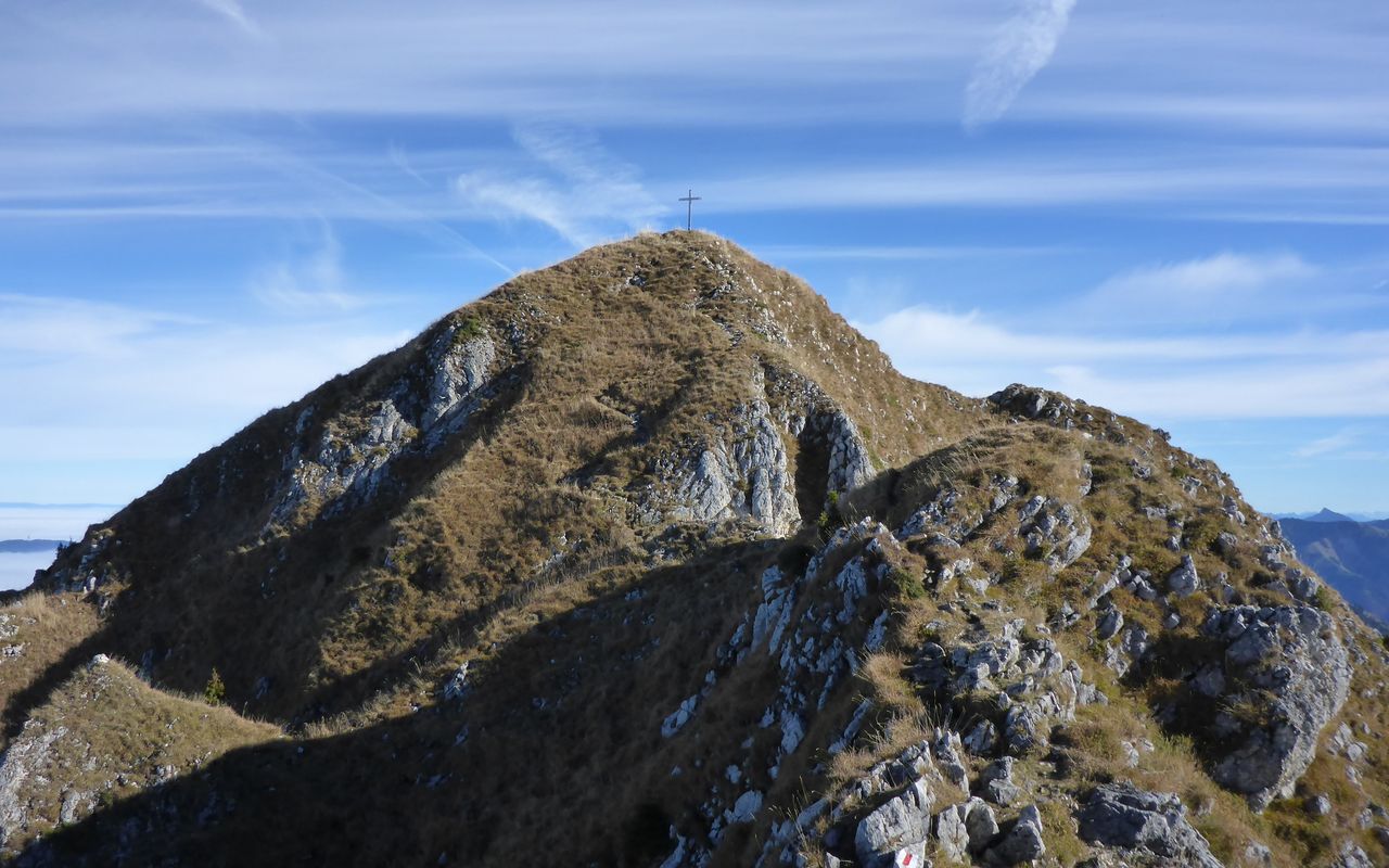
Les Paccots – Teysachaux – Le Moléson Teysachaux 1909 m

  • Difficulty
    T3
  • Ascent
    4:15 h, 1130 m
  • Descent
    3:15 h, 1470 m

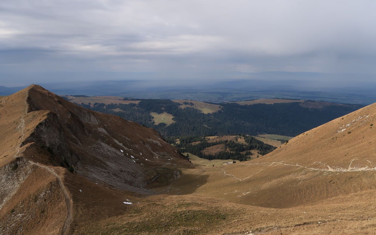
Walking from top to top

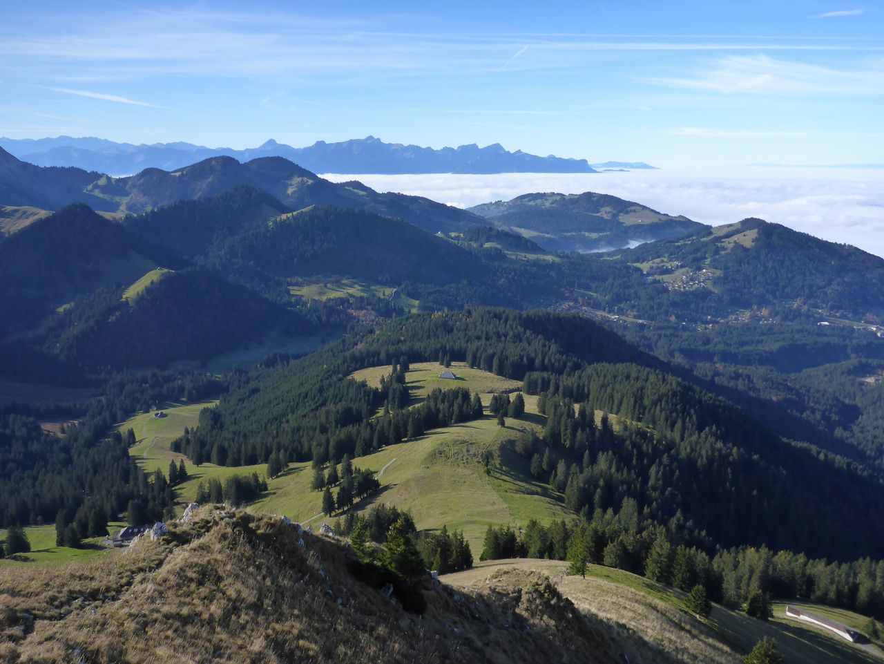
To the right you have the Alps (from Mont Blanc to Grand Combin to Wetterhorn), to the left the Mittelland and the Jura (from Hasenmatt above Solothurn to Grand Crêt d’Eau near Geneva), behind is the largest lake in Western Europe (Lake Geneva) and in front the second largest city in the canton of Fribourg (Bulle) and its best-known summit, Le Moléson. If you become tired on Le Moleson, there is an aerial cableway down to Moléson-sur-Gruyères.

Route description

Les Rosalys – Teysachaux
From Les Rosalys go eastward on the narrow road and take a shortcut to reach ca. 1240 m, then turn left to cross the bridge at 1226 m over the Veveyse de Châtel. Continue on the hiking trail via Vuipey d’en Bas to the "buvette" at Vuipey d’en Haut (1473 m). Now traverse to the SW ridge of Teysachaux and ascend on this ridge. From ca. 1750 m the ridge is interspersed with rocks, and the last stretch before the summit cross (1909 m) is fairly exposed.
Teysachaux – Le Moléson
The marked path descends on the steep, grassy and rocky E ridge until ca. 1770 m, then bypasses P. 1788 on the north-west. Continue on the path past a bifurcation to reach a flat passage at 1822 m, called Pointe de Tremetta. From there you hike on Crête de Moléson. P. 1938 is traversed or bypassed on the south side. At the saddle P. 1901 the hiking trail from the south merges. Now directly or past the Restaurant de l‘Observatoire and the summit station of the aerial cableway ascend to a saddle and to the summit of Le Moléson (2002 m).
Le Moléson – Plan-Francey
On a good trail descend the western bowl, then the western ridge and take the bifurcation to the right. Turn around the north foot of Moléson and descend to ca. 1480 m. Re-ascend to the intermediate station of the Moléson aerial cableway (1518 m) or the Plan-Francey mountain restaurant (1529 m).
Plan-Francey – Bulle
Hike northward on a wide trail via Grosses-Clés and Petites-Clés (and Cabane des Clés CAS) to In Maulatrê-d’Avau (1283 m). On paths in pastures and through forests go past a chapel to reach La Savarisa (ca. 1050 m). Now on a concrete, narrow road go to La Grosse-Oubèca, then again on a hiking trail traverse the pastures (climbing over some fences) to a crossroads at P. 868. Continue on the marked route via Prâ-dè-Ma to the southern outskirts of Bulle. Cross the Trême on a foot-bridge and turn right to reach the railway station past the swimming baths.
Variant 1: ascent via Petit Mology
Direct ascent off the «Sentier Panoramique»; http://www.les-paccots.ch.
Variant 2: descent to Les Paccots
On the SW side of Moléson branch off to Gros-Plané (1477 m) and hike back to Les Paccots. 1 h less than the descent to Bulle. This variant is also the first leg of «Grande Traversée» from Moléson-sur-Gruyère to Leysin; http://www.id-rando.ch.
Variant 3: descent from Crête de Moléson to Moléson-sur-Gruyère
On the marked hiking trail descend to Tsuatsau Dessus and Gros-Moléson and on to Moléson-sur-Gruyère; T2, P. 1901 – Moléson-sur-Gruyère ca. 1¾ h.

Additional information

Departure point

Les Paccots, Les Rosalys (1107 m)

An der tpf-Buslinie Châtel-St-Denis – Les Paccots.

End point

Bulle, Bahnhof (770 m)

Bahnverbindungen nach Fribourg, Montbovon und Palézieux.

Time

Total time: 7½ h

Ascent to Teysachaux: 2¾ h

Traverse to Moléson: 1½ h

Descent to Plan-Francey: 1 h

Continuation to Bulle: 2¼ h

Difficulty / Material

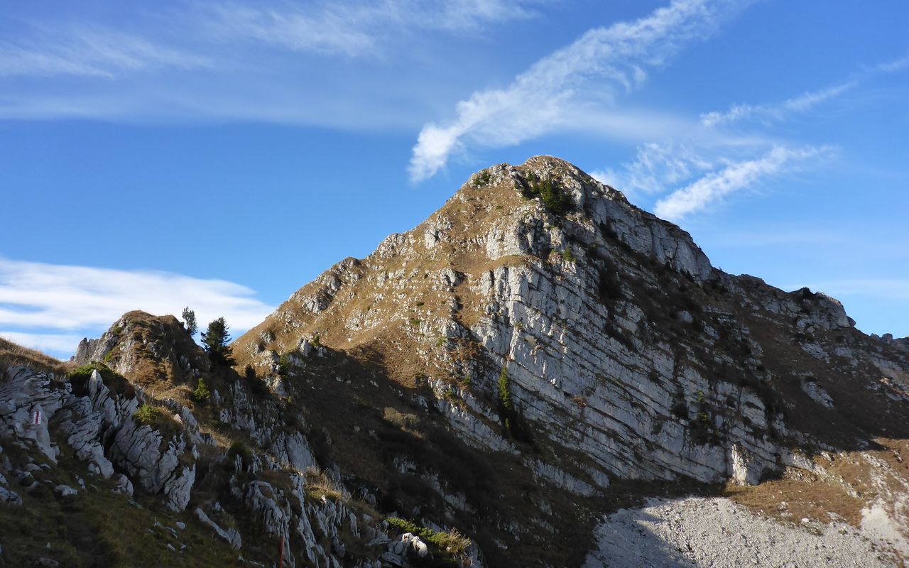
Between the Teysachaux SW ridge and Le Moléson the grade of difficulty is T3, the rest T2 and T1, mostly marked.

Waypoints

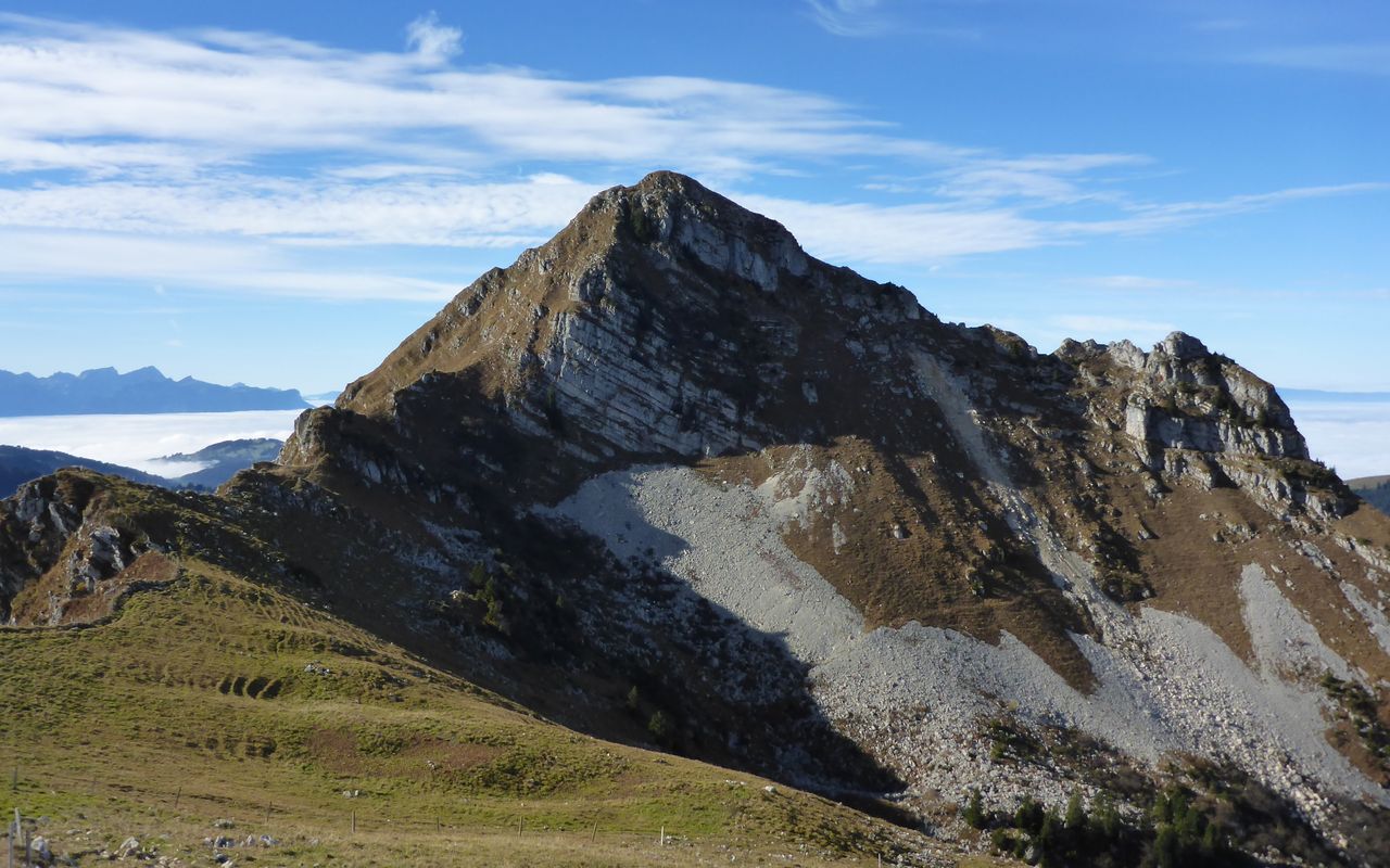
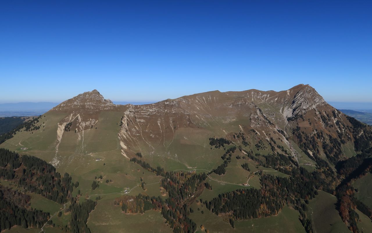
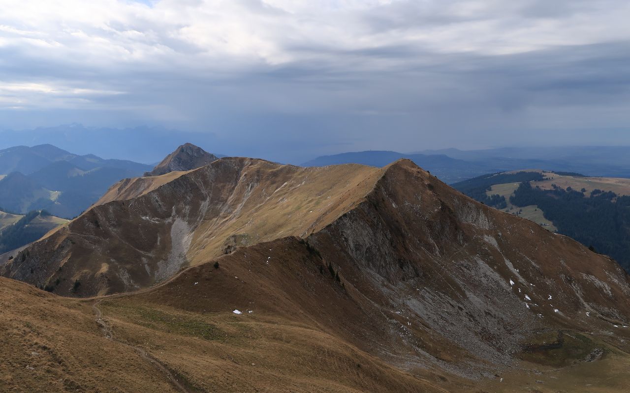
Crête du Moléson P. 1938 (1938 m)

This is the ridge linking Teysachaux to Le Moléson, formerly named Arête de Tremetta.

Crête du Moléson (1913 m)

Verbindungsgrat zwischen Teysachaux und Lé Moléson, früher auch Arête de Tremetta genannt.

Le Moléson (2002 m)

Viewed from the north, Moléson is a mighty mountain. Its east and north-west faces are rocky and very steep; they are separated by a distinct north-east ridge. An outcrop of the north-east ridge is called Petit Moléson (P. 1936). To the south Le Moléson sends out a ridge called Arête de Tremetta, linked by a narrow saddle between Bonne Fontaine and Tsuatsau Dessus.

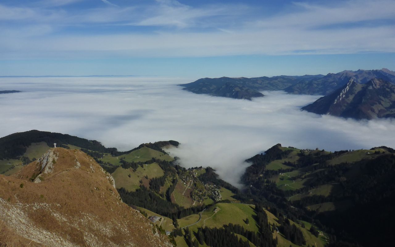
Moléson-sur-Gruyères (1103 m)

End-point of variant 3.

Various

Cabane des Clés (1352 m)

Located at the north foot of Moléson, the cabin offers a marvellous view to La Gruyère. It sleeps 20, and on week-ends and school holidays there is a warden. It is closed in November. CAS Section La Gruyère, www.cas-gruyere.ch, for reservations go to cles@cas-gruyere.ch or call 079 625 1707.

Neighbor summit

Sommet des Clés (1453 m)

The three grassy and forested summits Sommet des Clés (1453 m), Les Maulatreys (1389 m) and La Provêta (1237 m) are located north of Le Moléson. Unnamed on the map, they are easily accessible in pastures. As are the Mology summits (north P. 1551 and south P. 1574) south of and below Teysachaux.

Les Maulatreys (1389 m)

Description see Sommet des Clés

La Provêta (1237 m)

Description see Sommet des Clés

Le Mology (1573 m)

This is a modest hill without a name on the map. Its name comes from the alp in the saddle between the main summit and the north summit (1551 m). It is a winter target.

Authors

Daniel Anker

Daniel Anker is a Bernese author and photographer. The historian has written around 40 ski tour, hiking, via ferrata and mountain bike guide books as well as detailed monographs on individual peaks in Switzerland.

Oliver Neumann

Oliver Neumann is an SAC tour guide and author for the SAC-Tourenportal. His area of work includes mountain and alpine hiking in the Freiburg Alps as well as snowshoe tours in the Jura, Bernese, Freiburg and Vaud Alps.

Our recommendations

SAC-Crocs

Equipment

SAC-Crocs

Price CHF 59.00
Member price CHF 49.00
Gipfelziele Freiburg

Berg- und Alpinwandern

Gipfelziele Freiburg

Price CHF 54.00
Member price CHF 45.00
Tourenportal/App-Abo Jahreszahlung

Subscription to the SAC Route Portal

Tourenportal/App-Abo Jahreszahlung

Price CHF 49.00
En famille vers les cabanes du CAS

Hütten

En famille vers les cabanes du CAS

Price CHF 54.00
Member price CHF 45.00
SAC-Hütten-Monopoly

At home

SAC-Hütten-Monopoly

Price CHF 69.90
Member price CHF 60.00
Les Alpes, un monde vivant

Ausbildung

Les Alpes, un monde vivant

Price CHF 64.00
Member price CHF 54.00
SAC-Taschenmesser

Equipment

SAC-Taschenmesser

Price CHF 54.00
Member price CHF 49.00
Hütten der Schweizer Alpen / Cabanes des Alpes suisses

Bildbände

Hütten der Schweizer Alpen / Cabanes des Alpes suisses

Price CHF 69.00
Member price CHF 59.00
feedback