Traverse north ridge–west ridge | Mountain hiking | Swiss Alpine Club SAC
Unterstütze den SAC Jetzt spenden

Traverse north ridge–west ridge Tochuhorn 2660 m

  • Difficulty
    T5
  • Ascent
    2:30 h, 710 m
  • Descent
    1:30 h, 710 m

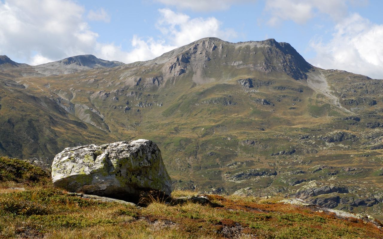
Short, but challenging tour above Simplonpass

The large Tochuhorn with its two summits is a beautiful vantage point above Simplonpass. The ascent is rather short, but the north ridge has a few climbing passages, which give the tour a challenging touch. Thus the traverse of Tochuhorn becomes a multifaceted hiking tour. There are other routes to the mountain which offer no difficulties, making it a rewarding destination for pure pleasure seekers.

Route description

Simplonpass – beginning of the north ridge
From the bus stop Simplon Pass hike to the hamlet of Hopsche west of Hopschusee. The white-red-white marked mountain hiking trail ascends west to P. 2165, where a number of bifurcations follow. Always take the right path, which leads up to P. 2372 (Gälmji) between Staldhorn and Tochuhorn. On this bifurcation choose the left trail, now marked white-blue-white, which leads to Lengritz on the north side of Tochuhorn. At first the trail ascends westward across grassy knolls interspersed with rocks to ca. 2510 m, then, traversing a depression full of scree, descends slightly to P. 2493 on the edge of the north ridge.
Beginning of the north ridge – Tochuhorn – to the beginning of the mountain hiking trail
Now leave the trail and ascend straight ahead southward on the ridge. Right at the beginning a few metres are covered with loose gravel, but afterwards the rocky and grassy ridge gets fairly stable. There are some exposed and short passages in the grades I and II. The difficulties could be avoided by bypassing them on steep grass on the east side, but those slopes are fairly slippery and therefore no alternative to the rock. Further up the ridge reclines, and one soon reaches the secondary summit at P. 2648. Over a saddle (P. 2624) one reaches the grassy main summit without difficulties. The descent first runs westwards over the ridge that leads down to Undre Rossusee (at P. 2473 m, name missing on newer maps). At an altitude of about 2560 m, one can leave the ridge and descend southwards over wide grassy slopes to reach the mountain path coming from Nanzlicke.
Beginning of the mountain hiking trail – Simplonpass
Hike back to Simplonpass on this mountain hiking trail.
Alternative ascent on the east and south face
Follow the main route until above Gälmji. Before the trail leads down to the depression with the scree continue ascending until below the east face of Tochuhorn (the map shows the communal border with a dotted line). A faint path leads round the east and south side of Tochuhorn to the saddle at P. 2624 between the two summits. Cairns every now and then show the way; this route is only slightly shorter than the main route. There are some exposed passages, T4–.

Additional information

Departure and arrival point

Simplonpass, Simplonblick (2006 m)

Unterkunft im Simplon Hospiz nahe der Haltestelle: www.gsbernard.ch/simplon/hospiz/

Difficulty / Material

The majority of the hike is on mountain hiking trails and on rather easy terrain. A few grade I and II climbing passages on the north ridge, however, raise the overall difficulty to T5.

Waypoints

Gälmji (2372 m)

Col on the main route

Üsseri Nanzlicke (2601 m)

Col on Spitzhorli (neighbour summit)

Gibidumpass (2200 m)

Col on the variant on Spitzhorli (neighbour summit)

Giw, Bergstation (1962 m)

Endpoint (summit station) of the variant on Spitzhorli (neighbouring summit).

Visperterminen, Busterminal (1336 m)

Endpoint of the der variant on Spitzhorli (neighbour summit)

Neighbor summit

Staldhorn (2462 m)

Staldhorn (2463 m) east of Tochuhorn is a beautiful vantage point, which can easily be combined with the tour to Tochuhorn. Add ca. 30 min.

Spitzhorli (Simplonpass) (2736 m)

Simplon Pass – Üsseri Nanzlicke – Spitzhorli 2½ h. ascent, 1½ Std. descent, T3 (there are markings until the breach, after that faint paths). The descent from Üssere Nanzlicke to Nanztal and the ascent across Gibidumpass to Giw (chair lift to Visperterminen, bus to Visp) make a nice tour. The route is marked. Spitzhorli – Giw 4 Std.

Author

Fredy Joss

Sabine und Fredy Joss

Alpine hiking, climbing and other mountain sports Sabine and Fredy Joss's passion. They have been writing and photographing for the SAC publishing house and the club magazine Die Alpen for many years. Sabine is also a biologist and tour guide; Fredy a proofreader and editor for various magazines.

Our recommendations

Walliser Alpen

Alpine Touren

Selection guide

Walliser Alpen

Price CHF 49.00
Member price CHF 39.00
SAC-Crocs

Equipment

SAC-Crocs

Price CHF 59.00
Member price CHF 49.00
Tourenportal/App-Abo Jahreszahlung

Subscription to the SAC Route Portal

Tourenportal/App-Abo Jahreszahlung

Price CHF 49.00
SAC-Hütten-Monopoly

At home

SAC-Hütten-Monopoly

Price CHF 69.90
Member price CHF 60.00
SAC-Taschenmesser

Equipment

SAC-Taschenmesser

Price CHF 54.00
Member price CHF 49.00
Bergsport Sommer

Ausbildung

Bergsport Sommer

Price CHF 59.00
Member price CHF 49.00
Ausbildung Bergwandern / Alpinwandern

Ausbildung

Ausbildung Bergwandern / Alpinwandern

Price CHF 59.00
Member price CHF 49.00
feedback