Vanil Noir – Vanil de l'Ecri – Pointe de Paray | Mountain hiking | Swiss Alpine Club SAC
Unterstütze den SAC Jetzt spenden

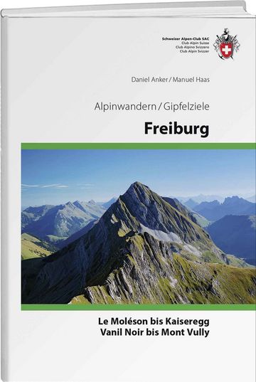
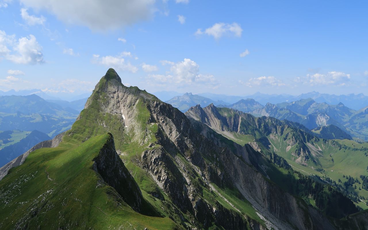
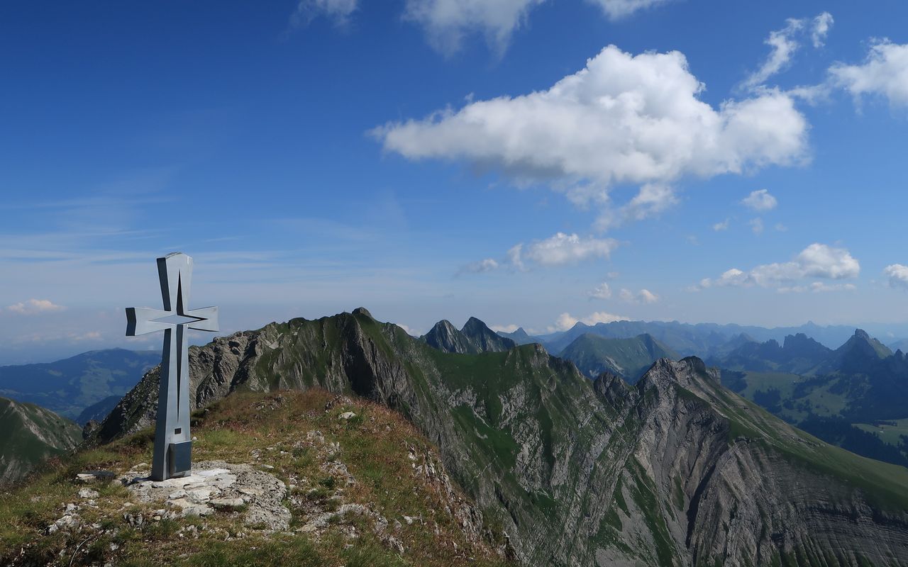
Vanil Noir – Vanil de l'Ecri – Pointe de Paray Vanil Noir 2389 m

  • Difficulty
    T5
  • Ascent
    6:30 h, 2000 m
  • Descent
    4 h, 2000 m

Double triple

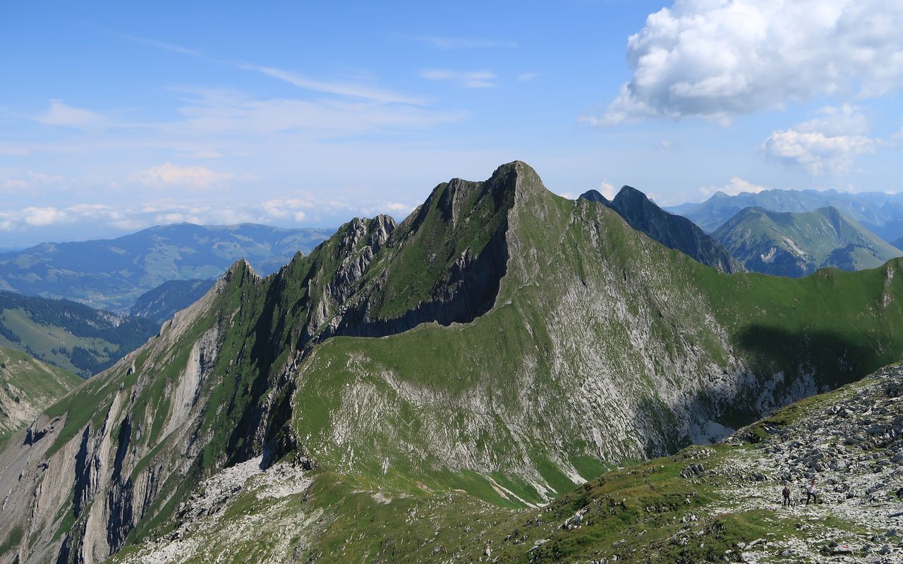
Vanil Noir, Vanil de l’Ecri and Pointe de Paray are one of the iconic three peak ensembles of the canton of Fribourg. The other known ensemble consists of Dents de Broc, Dent du Chamois and Dent du Bourgo.

Route description

Grandvillard – Cabane de Bounavaux – Col de Bounavaletta
From the Grandvillard railway station follow the road to the village of Grandvillard. Above the village take the road towards Les Baudes and Bounavau until a marked trail branches off to the right. Again on the road ascend to the ditch of the Rio des Marais. Now branch off to the left and follow the hiking trail along the creek to the bifurcation at P. 1264. From there ascend the alp access trail via Les Baudes and La Coudré (1367 m) to reach Cabane de Bounavaux (1636 m). Continue to Col de Bounavaletta (1995 m) via Bounavaletta.
Col de Bounavaletta – Tête de l'Herbette – Vanil Noir – Plan des Eaux
On a steep, rather slippery path ascend the W ridge of Tête de l’Herbette and follow some ledges to a col (2181 m). Ascend the NE ridge to reach the summit. The direct access on the W ridge without the traverse to P. 2181, as described in the printed version of the Fribourg alpine hiking guide, is not recommended (rotten rock). Continue on the exposed ridge (solid rock). Bypass a tower on the E side. Finally climb down to Pas de la Borière (2315 m), where you reach the normal route (equipped with steel cables). Do not traverse the grassy E face, but instead follow the blue-white markings leading up on the right-hand side. You reach the N ridge and the summit cross on Vanil Noir (2389 m). Descend the E ridge to a shoulder. From there traverse the steep S face interspersed with rock. The chains are a great help, but this is a precarious stretch nevertheless. Take a deep breath when you reach Plan des Eaux (2239 m).
Plan des Eaux – Vanil de l'Ecri – Pointe de Paray
A faint path follows the N ridge up to Vanil de l’Ecri (2376 m), which is called Sur Combe on the Vaudois side. There is a summit cross and a summit book. Descend a narrow path in schrofen and grass on the left-hand side past a grassy knoll to reach Plan l’Ecri (2234 m). Follow the grassy ridge, which looks more difficult than it is, to Pointe de Paray (2374 m). There is a summit cross and a summit book.
Pointe de Paray – Rochers de St-Jacques
Descend the ridge for a short while, then turn left following yellow and red markings, to reach a grassy and rocky W ridge on block terrain. It is very steep and exposed. Spectacularly the trail winds its way down to a saddle (1958 m), where the difficulties end. Follow the trail marked with yellow pegs across some rocks towards Tête de St-Jacques (unnamed on the map). The trail traverses its grassy SW face, but scramble up to the modest summit (P. 1992). On the W ridge descend to a saddle (ca. 1860 m) and on grass re-ascend to Rochers de St-Jacques (1901 m).
Rochers de St-Jacques – Grandvillard
Return to the saddle and pathless descend northward to the Petsernetse bowl. On its western edge is a cabin (ca. 1697 m, called «Petz» by the locals). Follow the zigzagging alp access trail south-westward to reach the bottom station of the material ropeway above Le Revers. Follow the road (or try to cut the bends in pastures) until a hairpin bend at ca. 1145 m. 100 metres from there a trail branches off to reach the ditch of Rio des Marais (known from the ascent) and the hiking trail to Cabane de Bounavaux. Follow the trail to Grandvillard.
Variant 1: leaving out the Tête de l'Herbette summit
Traverse the E face of Tête de l’Herbette on karst terrain to reach Pas de la Borière, a rocky breach, which requires some scrambling assisted by steel cables.
Variant 2: direct descent leaving out Rochers de St-Jacques
From the saddle at P. 1958 at the foot of the W ridge of Pointe de Paray descend northward to a small lake on a faint path or sometimes pathless. Continue at the foot of Le Curtillet to the cabin at Petsernetse.

Additional information

Departure and arrival point

Grandvillard/ Villars-sous-Mont, Bahnhof (739 m)

An der tpf-Linie Palézieux – Bulle – Montbovon.

Time

Total hiking time: 10½ h

Grandvillard railway station – Cabane de Bounavaux: 3 h

Cabane de Bounavaux – Tête de l’Herbette – Vanil Noir: 2¾ h

Vanil Noir – Vanil de l’Ecrit – Pointe de Paray: 1½ h

Pointe de Paray – Tête de St-Jacques – Rochers de St-Jacques: 1¼ h

Rochers de St-Jacques – Grandvillard railway station: 2 h

Difficulty / Material

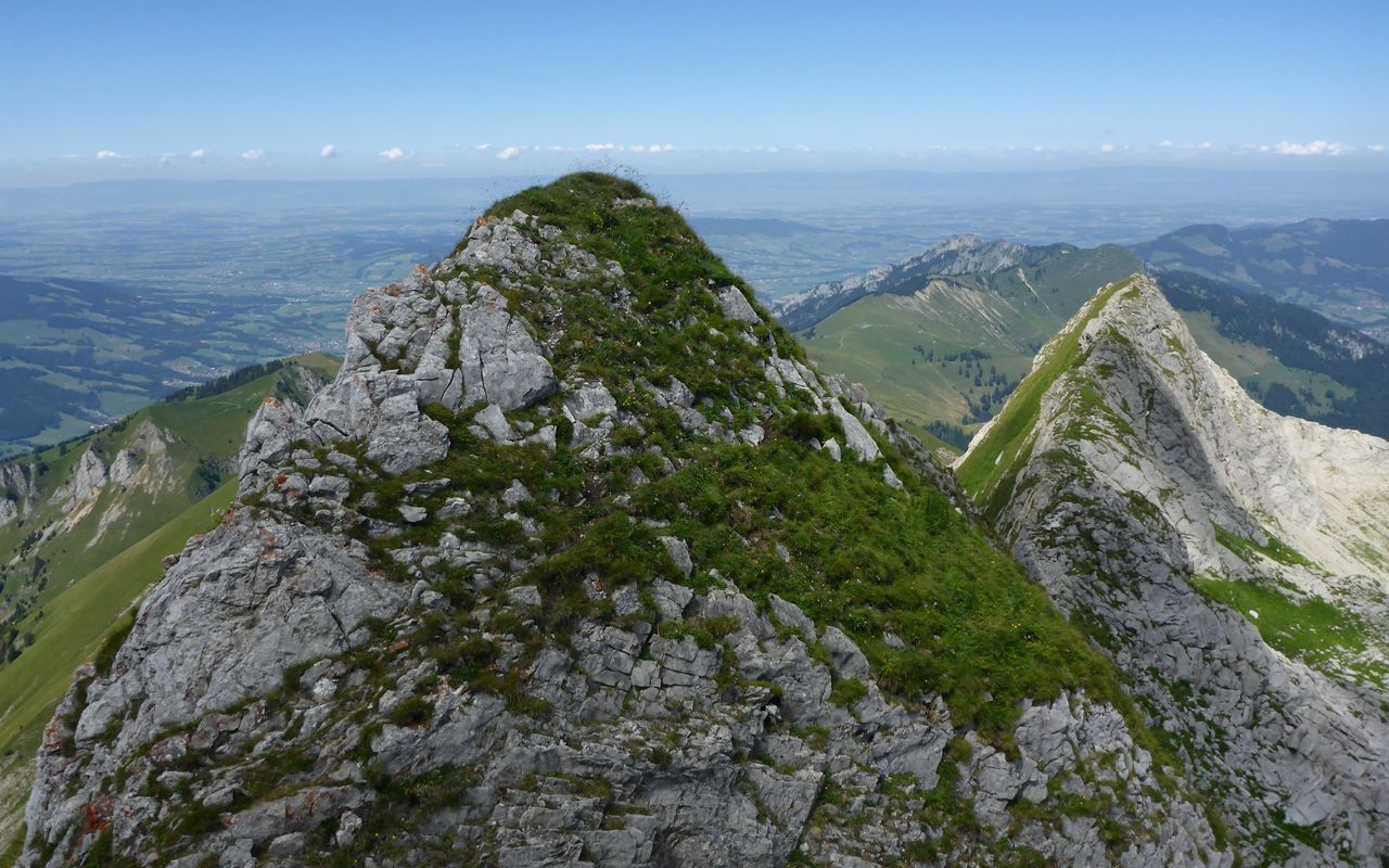
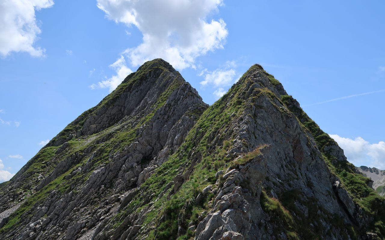
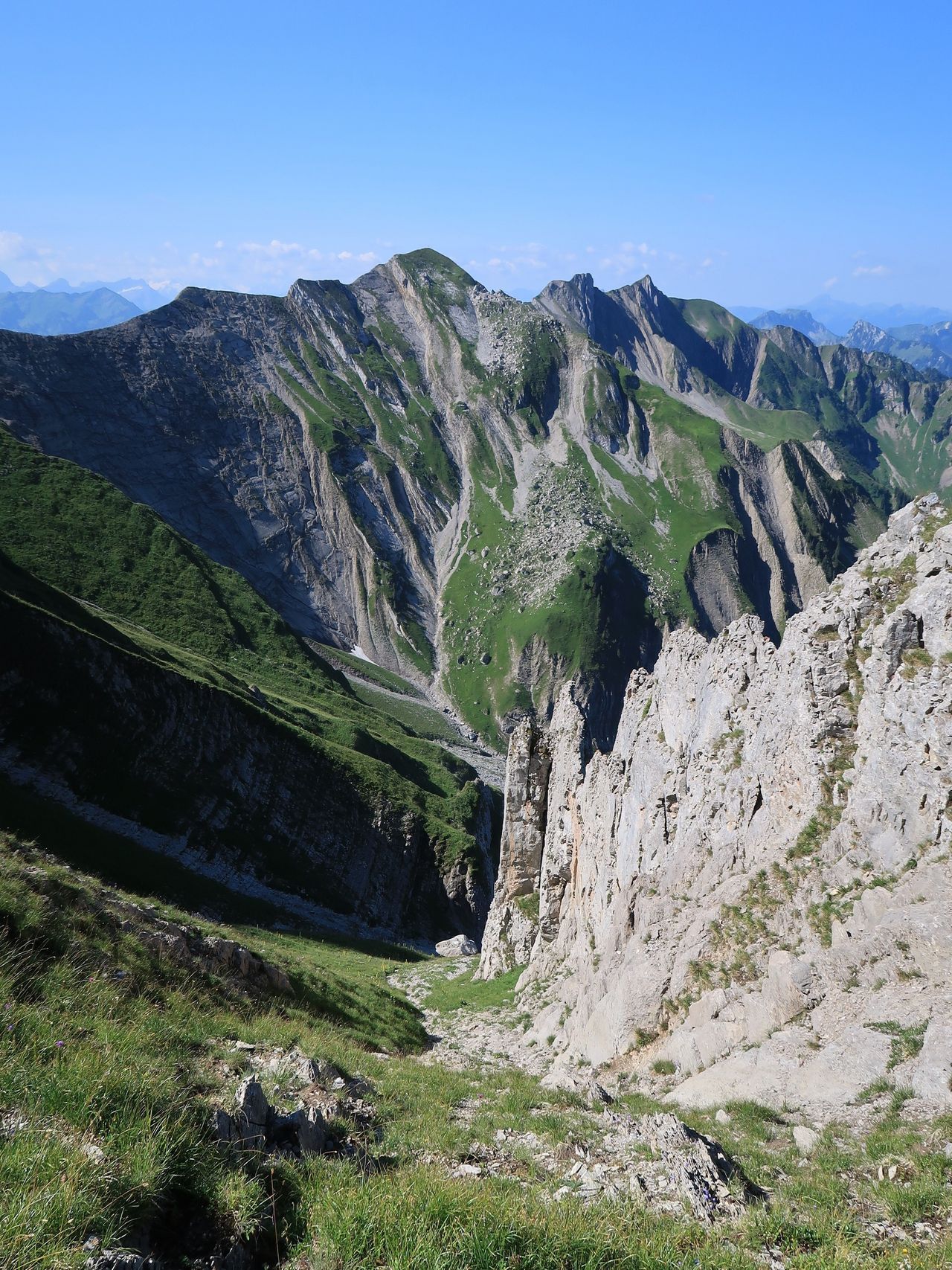
Traversing Tête de l’Herbette and the N ridge of Vanil Noir is T5, the descent from Vanil Noir on the south side and the W ridge is T4+, the rest is T3.

Waypoints

Grandvillard, Dorf (761 m)

On weekdays Grandvillard can also be reached by bus from Bulle. Compared to the train you save 40 min.

Col de Bounavaletta (1995 m)

Übergang zwischen Vallée du Motélon und Vallon de Bounavaux, zwischen Tsermon und Tête de l'Herbette gelegen.

Tête de l'Herbette (2261 m)

Felsiger Gipfel im Vanil Noir Nordgrat.

Col du Plan des Eaux (2239 m)

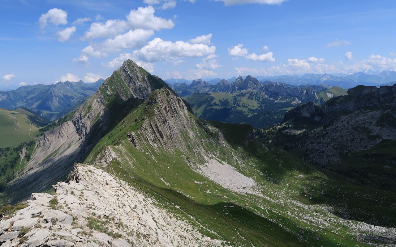
Übergang zwischen Vallon de Bounavaux und Vallon des Ciernes Picat, zwischen Vanil Noir und Vanil de l'Ecri gelegen; ohne Namen auf der LK.

Sur Combe / Vanil de l'Ecri (2376 m)

Zweithöchster Berg des Kantons Freiburg, zwischen Vanil Noir und Pointe de Paray gelegen.

Pointe de Paray (2374 m)

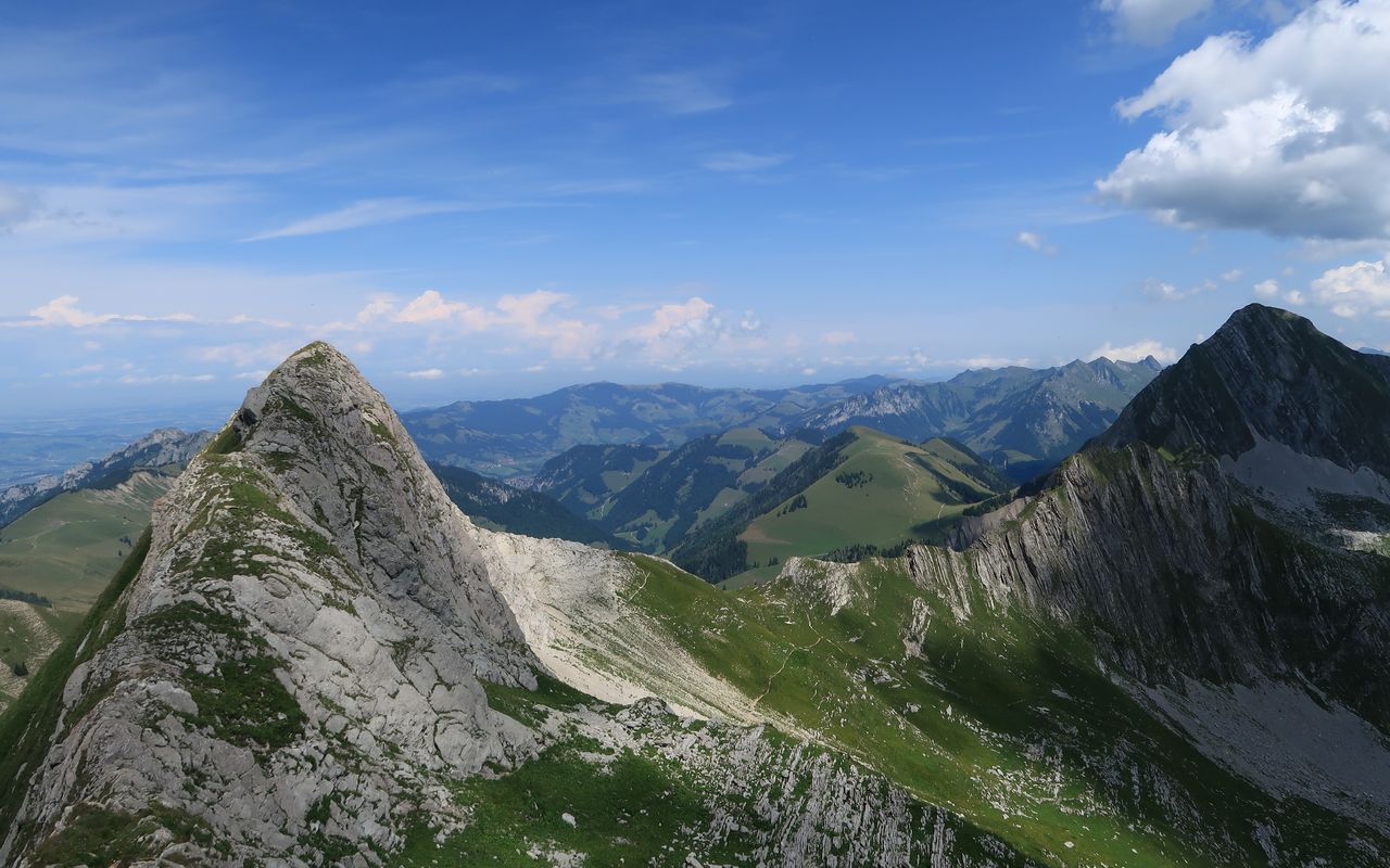
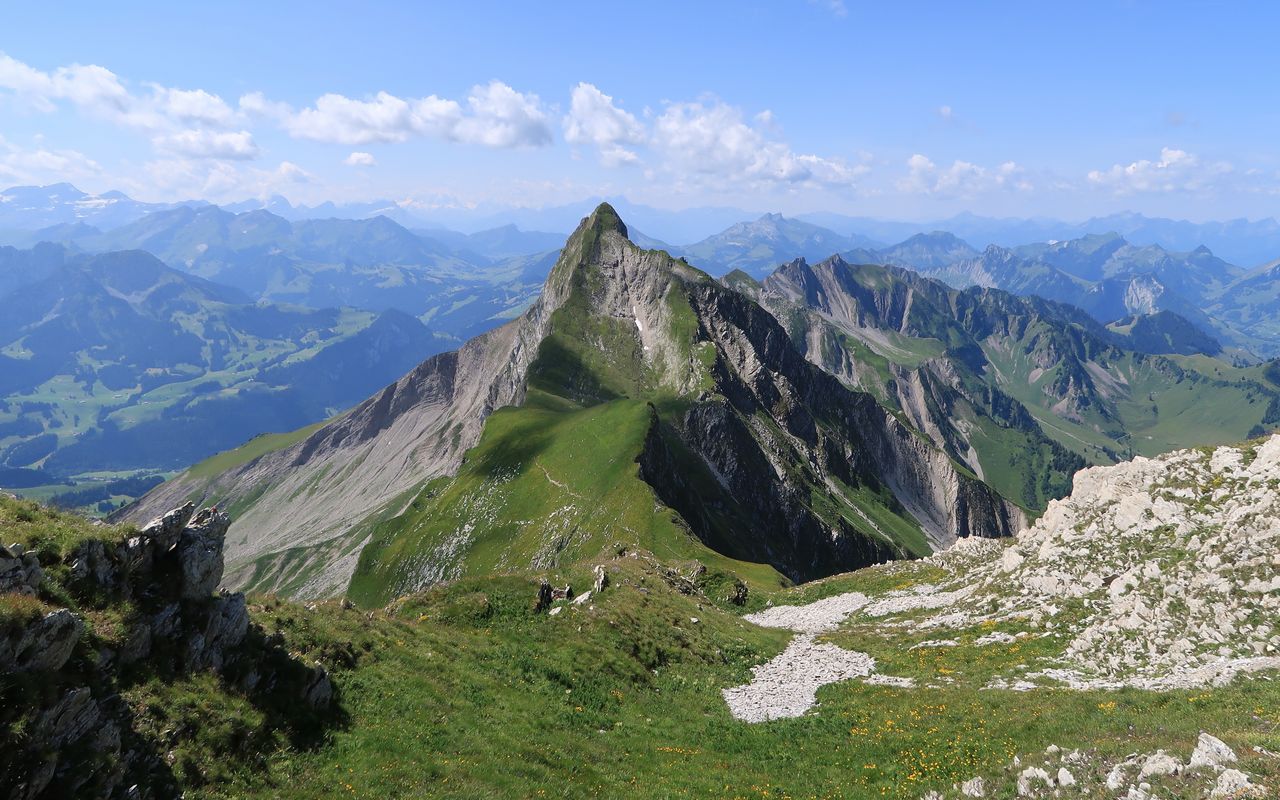
Dritthöchster Berg des Kantons Freiburg, zwischen Vanil de l'Ecri und Gros Perré gelegen.

Rochers de St-Jacques (1901 m)

Gipfel im Nordwestgrat der Pointe de Paray.

Tête de St-Jacques (1992 m)

Neben Tsermon und Le Curtillet der südlichste der drei Vorgipfel vor Vanil Noir, Vanil de l'Ecri und Pointe de Paray.

Catering and overnight stay

Cabane de Bounavaux (1636 m)

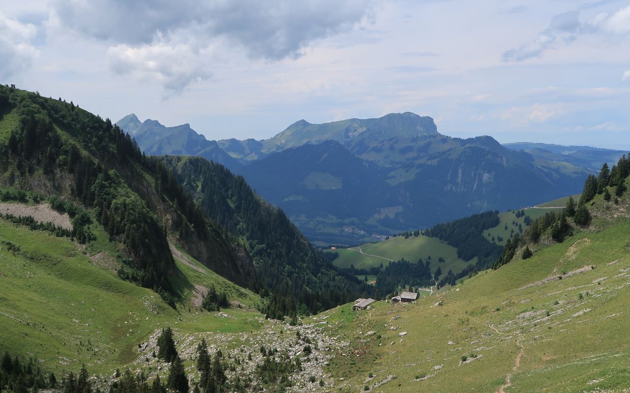
Located in the Vallon de Bounavaux, it sleeps 55. You do your own cooking, only soup and beverages are available). The cabin is open and has a warden from the beginning of June through the beginning of October. SAC Section La Gruyère, www.cas-gruyere.ch, for reservations call 079 603 68 78.

Neighbor summit

Vanil de l'Aille (1662 m)

Thanks to its lone standing position, Vanil de l'Aille could be an excellent viewpoint. However, it is not, because it is completely overgrown by trees. If you want to climb it anyway, you have the choice of two routes. From Le Revers (ca. 1309 m) follow the forested and overgrown ridge (T4). Alternatively, from L’Aille follow a very steep ridge directly to the summit. In the upper part you need to find your own way through a number of rocky ledges on the south and the east side of the summit (T5, unclear on the descent).

Authors

Manuel Haas

Oliver Neumann

Oliver Neumann is an SAC tour guide and author for the SAC-Tourenportal. His area of work includes mountain and alpine hiking in the Freiburg Alps as well as snowshoe tours in the Jura, Bernese, Freiburg and Vaud Alps.

Our recommendations

SAC-Crocs

Equipment

SAC-Crocs

Price CHF 59.00
Member price CHF 49.00
Gipfelziele Freiburg

Berg- und Alpinwandern

Gipfelziele Freiburg

Price CHF 54.00
Member price CHF 45.00
Tourenportal/App-Abo Jahreszahlung

Subscription to the SAC Route Portal

Tourenportal/App-Abo Jahreszahlung

Price CHF 49.00
En famille vers les cabanes du CAS

Hütten

En famille vers les cabanes du CAS

Price CHF 54.00
Member price CHF 45.00
SAC-Hütten-Monopoly

At home

SAC-Hütten-Monopoly

Price CHF 69.90
Member price CHF 60.00
Les Alpes, un monde vivant

Ausbildung

Les Alpes, un monde vivant

Price CHF 64.00
Member price CHF 54.00
SAC-Taschenmesser

Equipment

SAC-Taschenmesser

Price CHF 54.00
Member price CHF 49.00
Hütten der Schweizer Alpen / Cabanes des Alpes suisses

Bildbände

Hütten der Schweizer Alpen / Cabanes des Alpes suisses

Price CHF 69.00
Member price CHF 59.00
feedback