From Sertig Sand | Mountain hiking | Swiss Alpine Club SAC
Unterstütze den SAC Jetzt spenden

From Sertig Sand Älplihorn (Monstein) 3006 m

  • Difficulty
    T5
  • Ascent
    4 h
  • Descent
    3 h

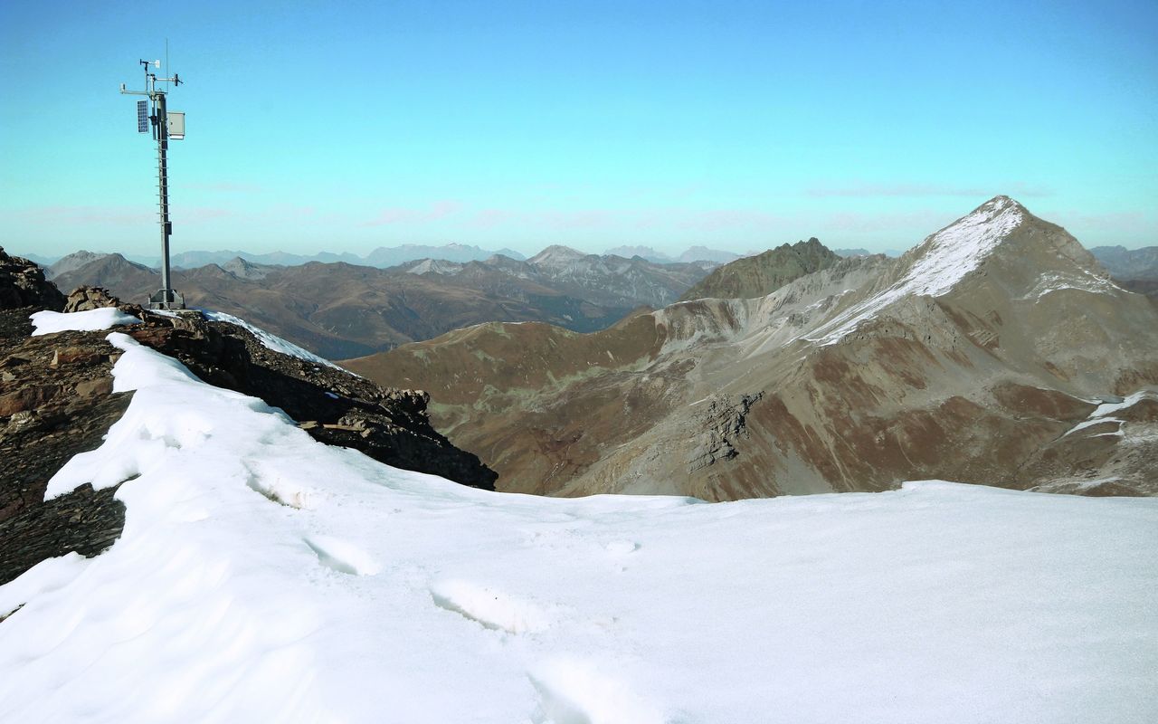
In the heart of the Grisons

The journey to the very end of Sertigtal is already an event, as Sertig is a Walser valley in pristine condition. It is located in a mountainous world which is characteristic for the Grisons: a number of small valleys formed by now dwindling glaciers lead up to schistose threethousanders with views beyond the borders of Switzerland.

Route description

Walserhuus - Alpeli
From Sertig Walserhuus go to the hamlet of Grossalp. Now follow a faint path in steep pastures to reach the Alpeli plain.
Alpeli - Älplihorn – Fanezfurgga
From Alpeli ascend in glacier schrofen until the summit head of Älplihorn. In a talus interspersed with big boulders go westward to reach the south ridge, which rises from Bärentällifurgga to merge with the south-west ridge. Ascend, at first easily, then exposed (go off the ridge line, slightly sidestepping onto the west face, T5), you reach the summit. The descent is back to Bärentällifurgge on the ascent route. Now, in steep talus go directly down to a picturesque small lake in Bärentälli and continue pathless southward to Fanezfurgga in glacier schrofen.
Fanezfurgga - Sertig
You easily reach Sertig on a hiking trail in Ducantal.
Variant: from/to Monstein
Ascent and descent can also be undertaken from Monstein (1636 m) via Fanezmeder. Hike in Mitteltälli directly to Mitteltälligrat (south-west ridge): 1400 metres of vertical height. T4 and 7 h until the south-west ridge. Chrachenhorn can be accessed via Rüggschboden and following the scree-covered north-west ridge (1200 metres of vertical height, 6 h, T4).

Additional information

Departure and arrival point

Sertig, Sand (1859 m)

Time

Sertig Walserhuus - Älplihorn: 4 h

Älplihorn - Fanezfurgge - Sertig Walserhuus: 3 h

Difficulty / Material

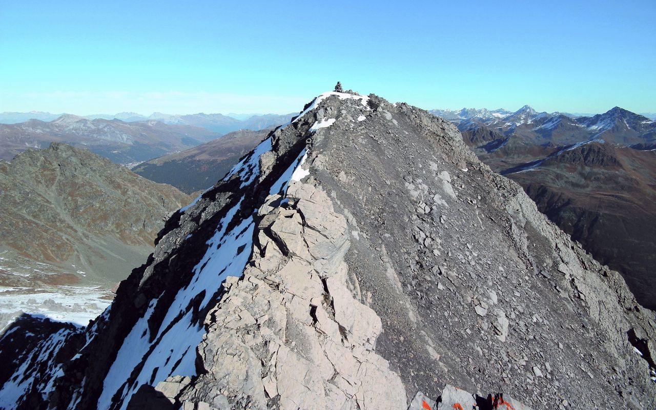
The cruxes are several exposed traverses immediately before the summit.

Waypoints

Davos Monstein (1619 m)

Starting point and endpoint of the variant

Neighbor summit

Chrachenhorn (2891 m)

Those who have time and stamina can climb Chrachenhorn from Fanezfurgge. There are two adjoining rocky escarpments to overcome. Either you bypass them on the south or you scramble up between them. 350 metres of vertical height, 2 h, T4–T5.

Authors

David Coulin

David Coulin works as a communications manager, photojournalist and author. In addition, he provides mountain experiences throughout Switzerland and has published several alpine hiking and snowshoeing guides through the SAC.

Fabian Lippuner

Our recommendations

SAC-Crocs

Equipment

SAC-Crocs

Price CHF 59.00
Member price CHF 49.00
Tourenportal/App-Abo Jahreszahlung

Subscription to the SAC Route Portal

Tourenportal/App-Abo Jahreszahlung

Price CHF 49.00
SAC-Hütten-Monopoly

At home

SAC-Hütten-Monopoly

Price CHF 69.90
Member price CHF 60.00
Graubünden Süd

Skitouren

Graubünden Süd

Price CHF 44.00
Member price CHF 34.00
SAC-Taschenmesser

Equipment

SAC-Taschenmesser

Price CHF 54.00
Member price CHF 49.00
Familienausflüge zu SAC-Hütten

Hütten

Familienausflüge zu SAC-Hütten

Price CHF 54.00
Sales price CHF 20.00
Ausbildung Bergwandern / Alpinwandern

Ausbildung

Ausbildung Bergwandern / Alpinwandern

Price CHF 59.00
Member price CHF 49.00
Hütten der Schweizer Alpen / Cabanes des Alpes suisses

Bildbände

Hütten der Schweizer Alpen / Cabanes des Alpes suisses

Price CHF 69.00
Member price CHF 59.00
feedback