![[Translate to English:]](/fileadmin/Der_SAC/Unserer_Partner/CSS_cyan_rgb.svg)

© Swisstopo (5701325910)
FAQ Route Portal Frequently asked questions
We collected the most frequent questions and answers concerning the Swiss Alpin Club route portal.
If you have questions regarding Swiss Alpine Club route portal, please check our FAQ first. Please contact us if you need additional information.
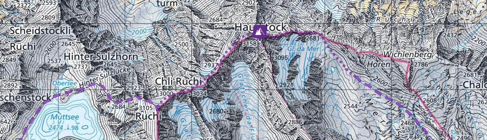
The the maps functions, the symbols and routes (types and colors of lines and disciplines) can be found on the map reference page.
The routes indicated on the route portal maps are approximate routes only. This applies especially to pathless terrain and for steep to very steep terrain. The best route is mainly determined by the actual conditions, especially in winter and on glaciers.
For the reasons mentioned above, the SAC cannot guarantee the accuracy and reliability of the routes shown on the map. Therefore, it is not possible to download whole routes directly as GPX. A drawing function for own tracks is integrated in the tour portal. You can draw your own route and then download it for your Smartphone or GPS device. This function is available to subscribers only.
Yes, descriptions can be printed by clicking on the symbol "print" you find on top of each route page. The print function is accessible to everyone with a free SAC login.
All content on the SAC touring portal was carefully prepared by the authors. The SAC publishers and the authors are trying to keep the information updated.
Please use our feedback form to report important amendments or mistakes. This form can be found in all destinations and route description in the sidebar.
Yes, we appreciate your contributions to further improve this platform in order to enable other nature lovers to have a safe and enjoyable mountain experience in Switzerland.
The SAC can publish safety-relevant information as a situation warning. Please inform us about (or changes to) current situation warnings using this feedback form,
Yes, you can create a free SAC login and purchase a annual subscription. This will give you access to all route descriptions and functions of the sac route portal or the SAC App.
The SAC route portal contains approx. 7000 routes in six mountain sports disciplines. More touring destinations are continuously published and in the route archive you will find excerpts from the SAC guides, which contain (almost) every route to practically every peak in Switzerland.
You can resign yourself, you have to proceed as follows:
- Log in
- Click on «Subscriptions» in your personal area
- Click on «Cancel subscription»
The SAC ensures that for the disciplines snowshoe hiking and ski touring within wildlife protection areas and Swiss game reserves, only routes that comply with the applicable protection rules appear. Some printed SAC ski touring guides (e.g. "Zentralschweizer Voralpen und Alpen", 2015) still contain routes that are no longer permitted today. In the map view for winter disciplines, the wildlife protection areas are shown by default.
For climbing, the SAC maintains a database with protection regulations that are visible on the tour portal. The SAC ensures that no routes are published in places where climbing is prohibited.
The SAC promotes eco-friendly travel: The majority of the routes are linked to a starting point that can be reached by train, bus or Alpine taxi. However, there are also remote routes without a nearby public transport connection. All public transport stops are shown on the map. Some of them are only served seasonally.