Traverse from Dagro to Capanna Quarnei | Mountain hiking | Swiss Alpine Club SAC
Unterstütze den SAC Jetzt spenden

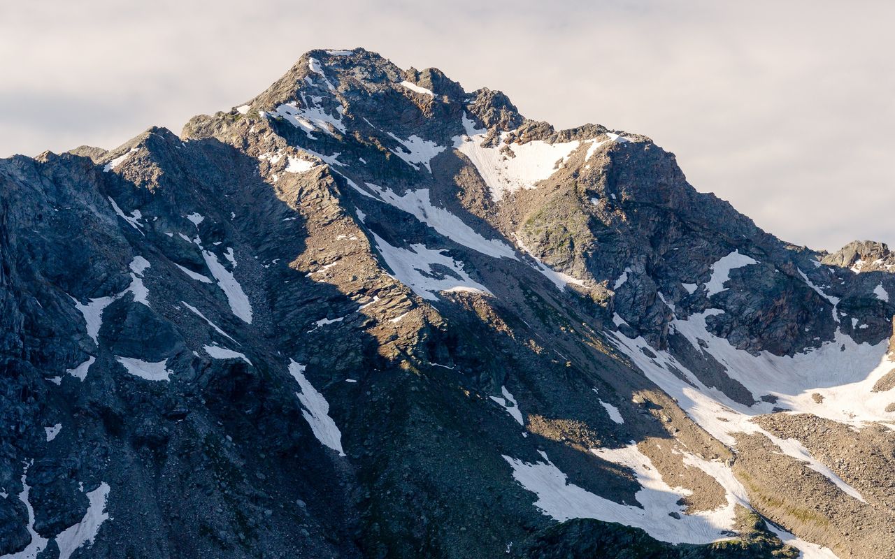
Traverse from Dagro to Capanna Quarnei (Normal route) Cima di Gana Bianca 2842 m

  • Difficulty
    T4-
  • Ascent
    7:30 h, 1550 m
  • Descent
    850 m

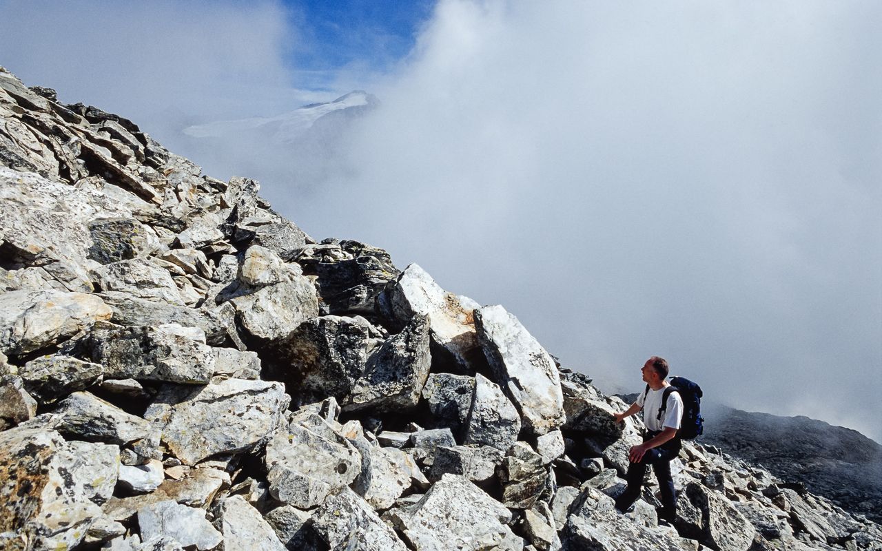
Gane bianche e rosse

The shortest and quickest connection between Dagro and Capanna Quarnei is the gentle «Sentiero dei Monti» via Monda and Vipéra; above this trail, mostly around the timberline, runs the equally well maintained «Sentiero degli Alpi» via Alpe di Cióu and Prato di Cüm. Both trails are well marked and offer a beautiful view into Val Malvaglia, the largest side valley of Valle di Blenio. However, there is a third variant, running on the "outside" and entering Val Malvaglia "through the roof": past Cima di Piancabella to the west, below Cima di Gana Rossa, across Cima di Gana Bianca and finally across Gane di Terra Rossa down to Capanna Quarnei. A «gana» (or «ganna») is a rockslide zone with large boulders or a field of coarse scree. And that is exactly what you encounter: between Piano del Simano and Piano dell’Alpe you hike on huge boulders trying to keep your balance.

Route description

Dagro – Capanna Prou
From the station of the aerial cableway at Dagro (ca. 1410 m) a comfortable trail, short-cutting a small road several times, leads via Pianzei to Cascina di Dagro (1617 m). Continue on the marked hiking trail to the timberline at Alpe di Prou (2015 m, self-catering cabin, always open).
Capanna Prou – Alpe Pièi
From Prou on a seemingly horizontal trail, which is actually going up and down, hike north-westward to Stabiói (2020 m), where we take the upper trail to continue to Lavill (2023 m). Here again we choose the upper trail, which leads on the sheep pastures of Grüssett and through some creekbeds to the knoll of Alpe Pièi (2246 m).
Alpe Pièi – Cima di Gana Bianca – Laghetto dei Corti
From Alpe Pièi we follow the creek until 2300 m, cross it there and go eastward to reach a terrace with several distinct cairns. Go up the valley past the eastern edge of the scree front. It pays off to search for grassy patches in the occasionally tiresome scree (there are more of these patches than the map makes you believe). Now into the little valley, which comes down from the saddle between Cima di Gana Bianca and P. 2820. Ascend in this valley, and further up hike over more open scree slopes with rocky steps built in to the aforementioned saddle at about 2780 m. Now on the easy south-east block ridge it‘s ten minutes to the summit of Cima di Gana Bianca (2843 m). From the summit of Cima di Gana Bianca go back to the saddle. Now descend exactly eastward following the markings on very stony terrain (some would even call it a stone desert). A steep couloir requires some caution; here and there you need the help of your hands. From about 2600 m the terrain becomes easier, but it is still made of blocks and coarse scree. As soon as you bypass the last, distinct rocky outcrop, turn north-eastward. On open terrain traverse Gane di Terra Rossa to finally reach pastures briefly before P. 2345. Descend to Laghetto dei Corti (2181 m).
Laghetto dei Corti – Capanna Quarnei
From Laghetto dei Corti the marked «Sentiero degli Alpi» leads down to Alpe di Quarnei (2046 m). There we cross the Orino on a bridge, and going southward in open pastures we reach Capanna Quarnei (2109 m) at its splendid location.

Additional information

Departure point

Dagro (1410 m)

Von der Haltestelle Malvaglia/Filovia zur nahen Talstation der Kleinseilbahn nach Dagro www.filoviamalvaglia.ch. Die Bergstation befindet sich etwas oberhalb der Siedlung Dagro auf 1410 m und verfügt auch über eine Einkehrmöglichkeit (Ristoro Sass Malt, www.sassmalt.ch ).

End point
Time

Dagro – Capanna Prou 2 h.

Capanna Prou – Cima di Gana Bianca 3 h 30 min.

Cima di Gana Bianca – Capanna Quarnei 2 h.

Difficulty / Material

There are no real technical difficulties; the hands are needed only a few times on the descent (between 2750 m and 2650 m). However, for long stretches the tour goes on scree and blocks and requires surefootedness and strong ankles. Those who are not used to this kind of terrain will need more time for the already long tour and will remember it for a very long time. In foggy weather or otherwise bad visibility the orientation on the stretch from Alpe Pièi across the summit down to Laghetto dei Corti is very difficult (despite the scarce markings across Gane di Terra Rossa).

Waypoints

Capanna Prou (2015 m)

A cabin which sleeps roughly 15 people, no warden, always open.

Rifugio Lavill (2023 m)

Unattended Refuge with 10 beds and normally open from May to October.

Author

Marco Volken

Marco Volken is a freelance photographer and alpine journalist. He has co-authored numerous books on the Alpine region, including illustrated books, non-fiction books, hut guides, hiking and club guides, ski touring and climbing guidebooks.

Our recommendations

Primo soccorso

Ausbildung

Primo soccorso

Price CHF 39.00
Member price CHF 33.00
SAC-Crocs

Equipment

SAC-Crocs

Price CHF 59.00
Member price CHF 49.00
Tourenportal/App-Abo Jahreszahlung

Subscription to the SAC Route Portal

Tourenportal/App-Abo Jahreszahlung

Price CHF 49.00
SAC-Hütten-Monopoly

At home

SAC-Hütten-Monopoly

Price CHF 69.90
Member price CHF 60.00
Klettern Tessin / Ticino

Klettern

Klettern Tessin / Ticino

Price CHF 64.00
Member price CHF 54.00
SAC-Taschenmesser

Equipment

SAC-Taschenmesser

Price CHF 54.00
Member price CHF 49.00
Hütten der Schweizer Alpen / Cabanes des Alpes suisses

Bildbände

Hütten der Schweizer Alpen / Cabanes des Alpes suisses

Price CHF 69.00
Member price CHF 59.00
feedback