South face (from Geisspfadsee) | Mountain hiking | Swiss Alpine Club SAC
Unterstütze den SAC Jetzt spenden

South face (from Geisspfadsee) (Normal route) Grosses Schinhorn 2937 m

  • Difficulty
    T4
  • Ascent
    4:30 h, 1430 m
  • Descent
    3:30 h, 1560 m

Enchanted mountain lakes and signs of rock crystal hunters

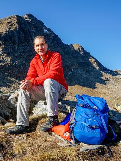
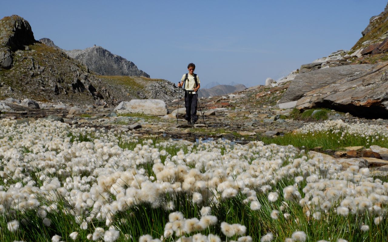
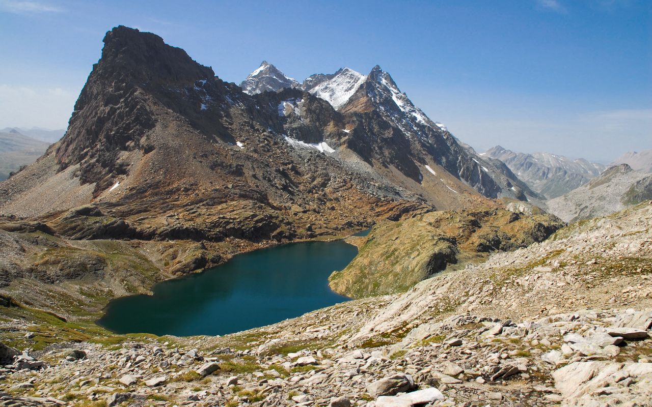
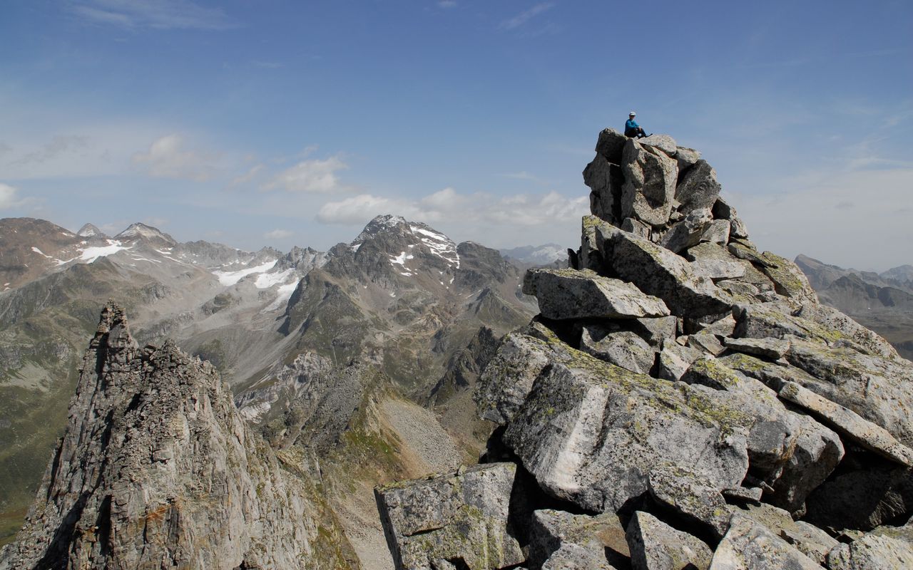
Those who climb Grosses Schinhorn (or Punta di Valdeserta as it is called in Italian), experience an interesting cross-section of the multifaceted Binntal: the famous mineral quarry, larch woods, enchanted mountain lakes, fields of cotton grass, schrofen terrain and talus among jagged ridges and a summit made of high-piled boulders. For a long time on the ascent Grosses Schinhorn seems unobtrusive, but all of sudden you stand on an exposed peak with a dizzying panoramic view.

Route description

Fäld – Geisspfadsee
From Fäld continue on the road, then on the mountain hiking trail, which crosses the road a few times, to the Lengenbach mineral quarry. Now follow the hiking trail to Manibode, then hike eastward on steeper scree slopes into a depression with patches full of cotton grass. Continue via P. 2449 to Geisspfadsee.
Geisspfadsee – Grosses Schinhorn
On the north-eastern shore of Geisspfadsee leave the mountain trail and ascend north-eastward, at first fairly steeply, then northward and more gently on schrofen and rubble fields towards Mittelbergpass. On this segment you encounter signs of rock crystal hunters such as old fissures. From ca. 2700 m do not keep too much to the east and Mittelberg, but ascend through a distinct depression to Mittelbergpass. On the col you may leave your backpack, as there are only 20 min. to the summit. From the col climb the scree slope with occasionally enormous boulders up to the summit. The highest point is very exposed; it is made of giant wedged boulders.
Descent
At first descend on the same route via Geisspfadsee to the bifurcation at P. 2146. Instead of descending to Manibode it pays off hiking to the scenic Mässersee, then on to Schäre, where one crosses the ascent route. Then continue via Mässerchäller along the wooded side of the valley and finally on the road to Binn.
Variant via the Geisspfad
More comfortable, but somewhat longer than the steep grassy slope above Geisspfadsee described above: continue on the hiking trail to the Geisspfad / Passo della Rossa pass and then northeast on a good, marked trail to the Grampielpass. From there, cairns guide you up towards Schinhorn.
Alternative ascent through Hotäl
Ascend from Fäld to Mässersee and to ca. 2165 m just above the lake. From here ascend east-north-eastward on a faint path leading into Hotäl. The faint path gradually disappears, and a few cairns show the way. Ascend through the stony Hotäl to the nameless lake. Go along the lake on the south shore and continue on scree slopes to Mittelbergpass and the summit. The loose gravel makes hiking more difficult than on the main ascent; it is therefore not recommended for the descent. Ascending on the variant and descending on the main route via Geisspfadsee make an interesting round-trip. Same distance as the main route.

Additional information

Departure point

Binn, Fäld (1518 m)

In the winter season Schneetourenbus:

schneetourenbus.ch/strecken/ernen-binn-faeld

Between April and mid-June, Fäld can be reached by Alpine cab from Ernen or Binn:

alpentaxi.ch

End point

Binn, Dorf (1400 m)

Difficulty / Material

There are white-red-white markings as far as Geisspfadsee. After that there is no path and under the summit you encounter enormous block fields. The summit with its wedged boulders is exposed.

Waypoints

Mittelbergpass (2824 m)

Col just below the summit of Grosses Schinhorn

Author

Fredy Joss

Sabine und Fredy Joss

Alpine hiking, climbing and other mountain sports Sabine and Fredy Joss's passion. They have been writing and photographing for the SAC publishing house and the club magazine Die Alpen for many years. Sabine is also a biologist and tour guide; Fredy a proofreader and editor for various magazines.

Our recommendations

Walliser Alpen

Alpine Touren

Selection guide

Walliser Alpen

Price CHF 49.00
Member price CHF 39.00
SAC-Crocs

Equipment

SAC-Crocs

Price CHF 59.00
Member price CHF 49.00
Tourenportal/App-Abo Jahreszahlung

Subscription to the SAC Route Portal

Tourenportal/App-Abo Jahreszahlung

Price CHF 49.00
SAC-Hütten-Monopoly

At home

SAC-Hütten-Monopoly

Price CHF 69.90
Member price CHF 60.00
SAC-Taschenmesser

Equipment

SAC-Taschenmesser

Price CHF 54.00
Member price CHF 49.00
Bergsport Sommer

Ausbildung

Bergsport Sommer

Price CHF 59.00
Member price CHF 49.00
Ausbildung Bergwandern / Alpinwandern

Ausbildung

Ausbildung Bergwandern / Alpinwandern

Price CHF 59.00
Member price CHF 49.00
feedback