![[Translate to English:]](/fileadmin/Der_SAC/Unserer_Partner/CSS_cyan_rgb.svg)
Traverse Jöchliturm – Nädliger (Normal route) Jöchliturm 2335 m
-
- Difficulty
- T4
-
- Ascent
- 4–4:30 h, 1500 m
-
- Descent
- 2 h, 1500 m
Over the "yoke" (Jöchli) instead of under it!
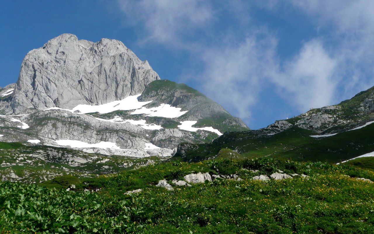
While the neighbouring Wildhuser Schofberg is very popular among hikers, hardly anybody knows Jöchliturm. Not even swisstopo, the Swiss map maker, knew its name and charted it simply as P. 2335. The summit is only a stone’s throw away from Nädliger with its limestone cliffs full of fossils, which is reachable on one of the most splendid hiking trails of the region. The round trip to Jöchliturm requires some stamina, as the Gamplüt aerial cable way saves only about 200 metres of vertical height. It is important to carry enough water because of the steep, sunny slopes. There are no restaurants on this side of the Alpstein range.

Route description
Additional information
- End point
-
Gamplüt, Bergstation (1349 m)
-
- Time
-
Wildhaus - Zwinglipasshütte: 2 ½ h
Zwinglipasshütte - Nädliger - Jöchliturm: 2- 2: ½ h
Jöchliturm - P. 2197 - Schöferhütte - Gamplüt: 2 h
Add ½ hour if you do not ride the gondola down.
If you undertake the tour in the opposite direction, you have a number of variants to continue to the Alpstein range, e.g. climbing Altmann or crossing Rotsteinpass.
- Difficulty / Material
-
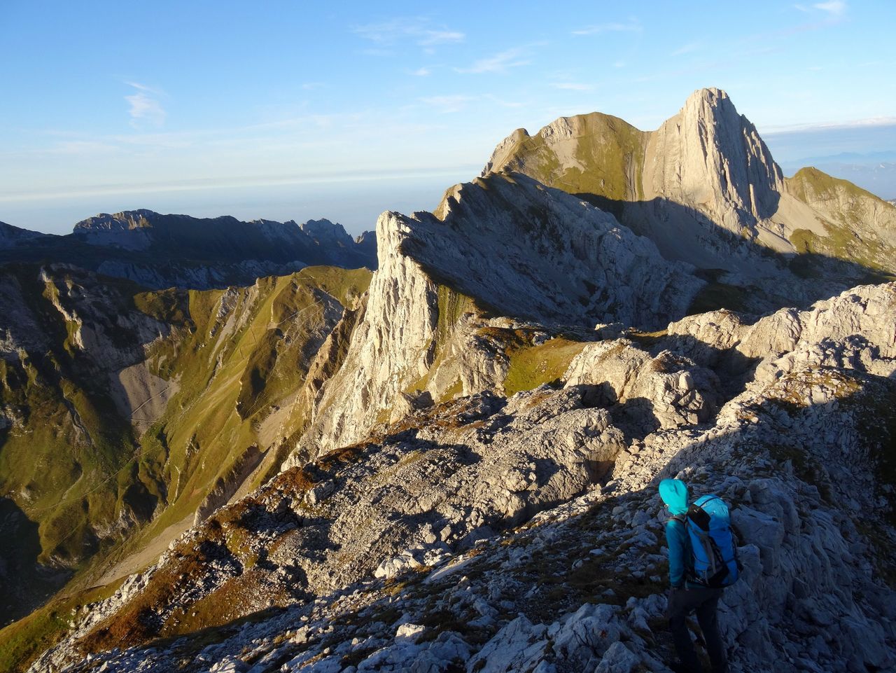
The traverse Jöchli–Nädliger is well-marked (white-blue). There are exposed passages, some requiring the use of hands. There is a risk of rock fall on the steep slope below Jöchli.
- Waypoints
-
During the holiday season and on week-ends from May to October there is a warden at Zwinglipasshütte SAC.
-
-
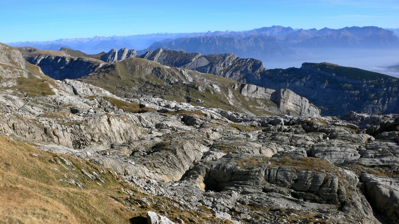
The itinerary is across several summits of the Nädliger ridge
-
-
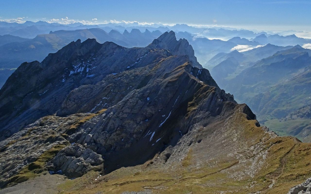
Col immediately below Jöchliturm
-
- Catering and overnight stay
-
Teselalp
During the season Teselalp serves food and beverages.
- Neighbor summit
-
Wildhuser Schofberg / Schafberg (2373 m)
Wildhuser Schofberg (2373 m): if you are too late or too early in the season to undertake the tour described here, you can hike the south face of Schofberg. And those who have enough strength left and an additional hour at their disposal can include the huge, cone-shaped summit dominating the upper Toggenburg, Wildhuser Schofberg. From P. 2196 take the marked hiking trail to the secondary summit (T3). A steel cable helps you to scramble down to the breach, which separates the main summit from the secondary summit. From the breach climb up to the highest point (2373 m, T4, exposed).
-