From Wägitalersee | Ski tour | Swiss Alpine Club SAC
Unterstütze den SAC Jetzt spenden

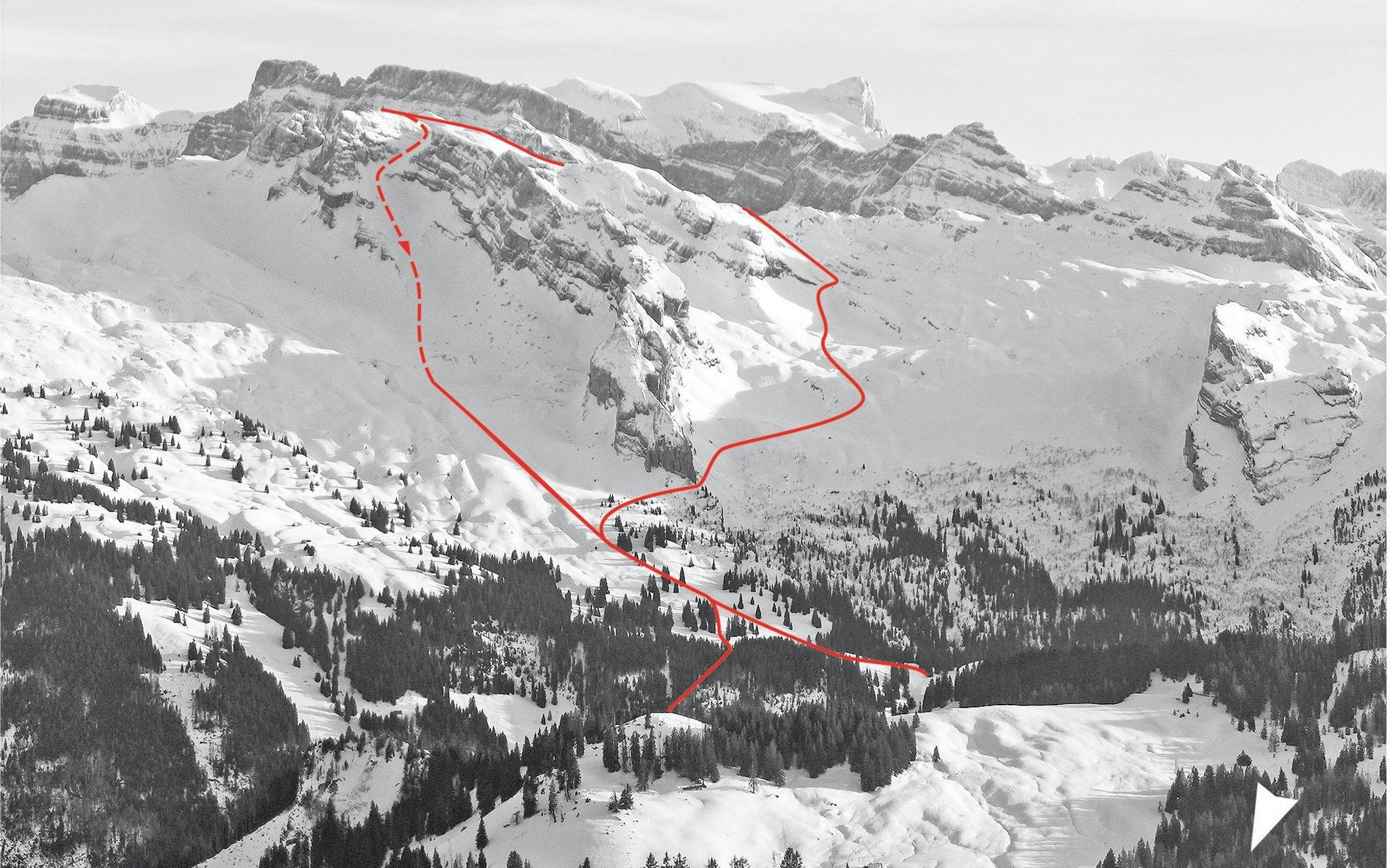
From Wägitalersee (Normal route) Mutteristock 2294 m

  • Difficulty
    AD-
  • Ascent
    4–4:30 h, 1380 m
  • Descent
    1380 m
  • Exposure
    NW

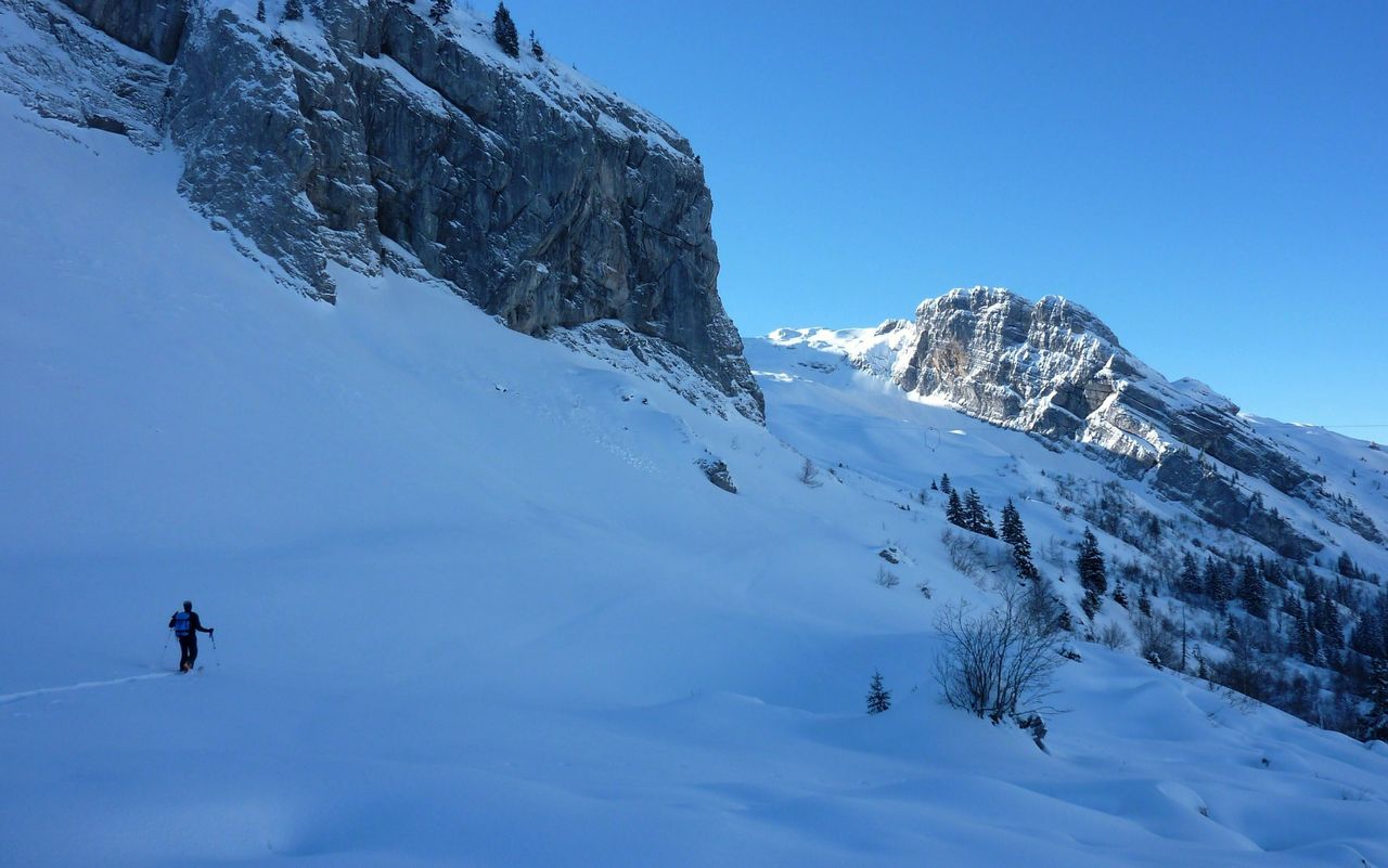
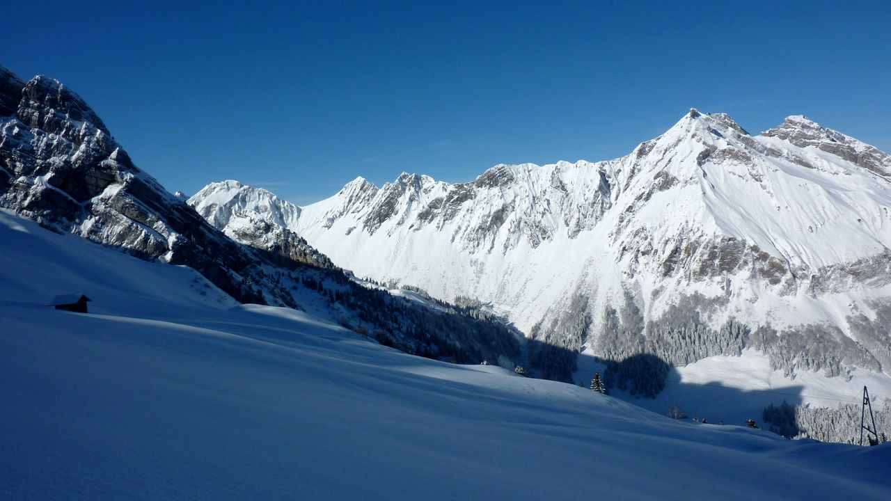
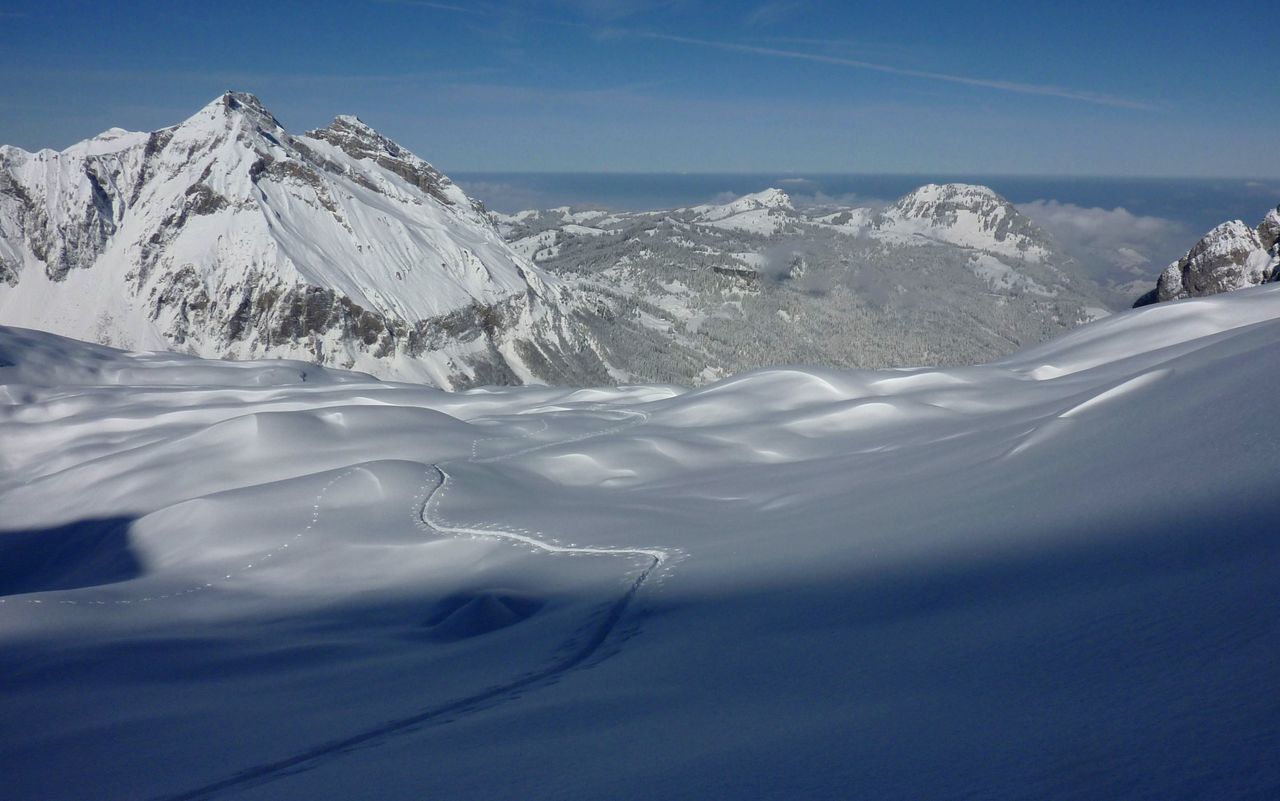
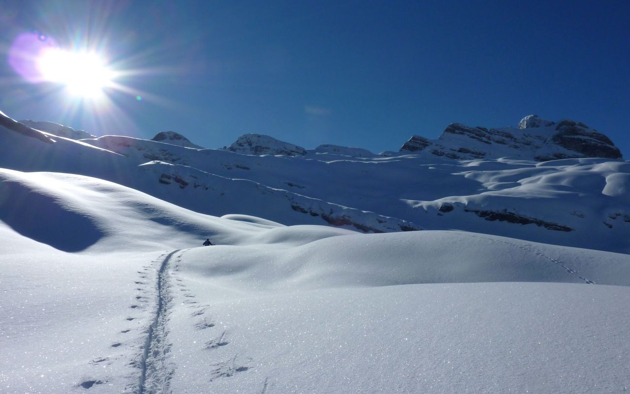
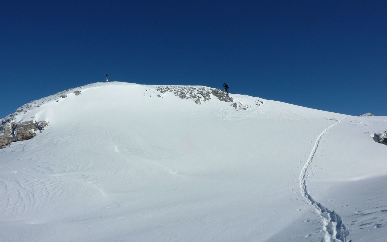
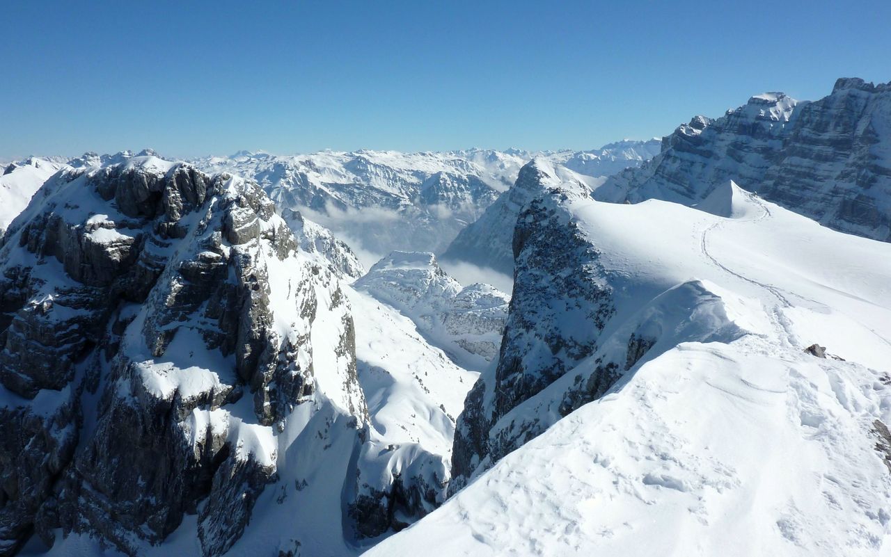
This is an outstanding route in a marvellous landscape. Due to its proximity to Zurich, it is always well-visited. The sharp karst limestone requires a thick layer of snow. Moreover, the starting point is at a relatively low altitude. If there is not enough snow on the first, steep slopes of Schwantli, the variant on the alp access road via Aberen comes into play. There is no public transportation between the Innerthal bus stop and the end of the lake Hinterbruch. Alpentaxi, Mobility (car sharing), hitch-hiking, walking (1 hour) or renting a bicycle at the Stausee restaurant are the alternatives.

Route description

Wägitalersee – Mutteristock
From Hinterbruch (918  m) at the southern end of Wägitalersee ascend steeply south-eastward on the summer trail to reach Rinderweid (1307 m) via Schwantli (1031  m) and Chruter. From Rinderweid continue north of Lufthütte to the summer trail, which leads southward to Mutteri (1658  m) past the outcrops of Mutteriberg. Ascend south-east in complex terrain to the foot of Rund Chopf (2049 m). Continue to a rocky rib and ascending eastward, you reach the ridge (north-east of Torberg, Torberglücke). Overcoming a short, slightly exposed escarpment, ascend to the highest point.
Variant via Aberen
The itinerary on the alp access road to Abern Oberalp and on the summer trail to Rinderweid via Aberen is more pleasurable than the route via Schwantli. Add 20–30 minutes.
Descent
Ski down on the ascent route as far as Rindwerweid. From there you have a more direct descent: on steep slopes ski down westward to reach the bridge across the Aberenbach (998 m). Follow the alp access road down to the lake.

Additional information

Departure and arrival point

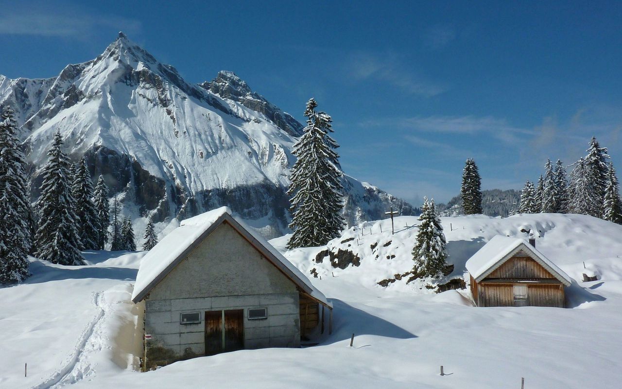
Wägitalersee, Hinterbruch (918 m)

The starting point Hinterbruch on the very end of Wägitalersee is reachable from the bus stop Innerthal on foot (5.6 km, 1 h 20 min.), or by rental bike (bike rental at Gasthaus Stausee, Tel. 055 446 12 79, www.gasthaus-stausee.ch ) or by boat taxi (Tel. 055 446 13 44, waegitalersee.ch ), or by www.alpentaxi.ch, or by Mobility car sharing at Siebnen-Wangen train station, or by hitching a ride.

Crux

At Torberglücke there is a short exposed passage. Be careful with hard snow (crampons!), the passage can also be bypassed to the west.

Remarks

The Stausee restaurant rents out bicycles, even in winter.

Route number

240a

Our recommendations

Gipfelziele Zentralschweiz Vierwaldstättersee

Berg- und Alpinwandern

Gipfelziele Zentralschweiz Vierwaldstättersee

Price CHF 54.00
Member price CHF 45.00
Skitouren Glarus - St. Gallen - Appenzell

Skitouren

Skitouren Glarus - St. Gallen - Appenzell

Price CHF 44.00
Member price CHF 34.00
Tourenportal/App-Abo Jahreszahlung

Subscription to the SAC Route Portal

Tourenportal/App-Abo Jahreszahlung

Price CHF 49.00
SAC-Hütten-Monopoly

At home

SAC-Hütten-Monopoly

Price CHF 69.90
Member price CHF 60.00
SAC-Rohner Socken - Copper Jet

Equipment

SAC-Rohner Socken - Copper Jet

Price CHF 29.90
Member price CHF 25.00
Klettern Alpstein

Klettern

Klettern Alpstein

Price CHF 64.00
Member price CHF 54.00
SAC-Taschenmesser

Equipment

SAC-Taschenmesser

Price CHF 54.00
Member price CHF 49.00
Bergsport Sommer

Ausbildung

Bergsport Sommer

Price CHF 59.00
Member price CHF 49.00
Schneeschuhtouren Zentralschweiz

Schneeschuhtouren

Schneeschuhtouren Zentralschweiz

Price CHF 59.00
Member price CHF 49.00
Klettern St. Galler Oberland

Klettern

Klettern St. Galler Oberland

Price CHF 69.00
Member price CHF 59.00
Ausbildung Bergwandern / Alpinwandern

Ausbildung

Ausbildung Bergwandern / Alpinwandern

Price CHF 59.00
Member price CHF 49.00
Hütten der Schweizer Alpen / Cabanes des Alpes suisses

Bildbände

Hütten der Schweizer Alpen / Cabanes des Alpes suisses

Price CHF 69.00
Member price CHF 59.00
feedback