Rigi Hochflue | Mountain hiking | Swiss Alpine Club SAC
Unterstütze den SAC Jetzt spenden

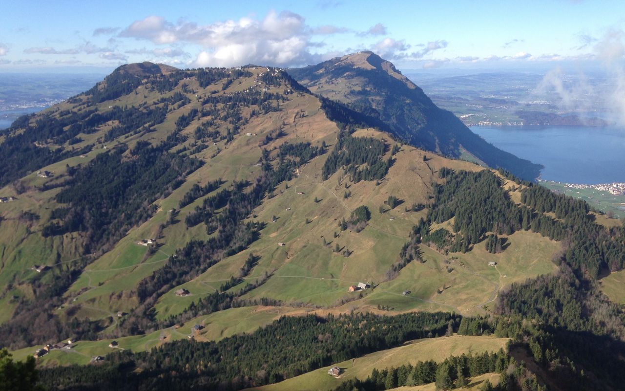
Rigi Hochflue (Normal route) Rigi Hochflue 1698 m

  • Difficulty
    T5-
  • Ascent
    2 h, 610 m
  • Descent
    2:15 h, 1310 m

On the wild side of Rigi

One mountain, three ridges and three very rewarding access possibilities: on Rigi Hoflue you are spoilt for choice. Every access has its quirks, and they are all marked white-blue-white. The one from the north-west offers a 30 m high ladder. The one from the south-west goes across slabby limestone steps. The eastern ridge, here described as the ascent, offers everything that makes alpine hiking in the foothills so interesting and attractive.

Route description

Urmiberg/Timpel – Egg
From Timpel, the summit station of the Urmiberg cable car (www.urmiberg.ch, Tel. 041 820 14 05) hike up to the ridge and continue westward on a small road to Egg (1287 m).
Egg - Rigi Hoflue
At Egg the steep trail (marked white-blue-white) to Spitz begins. Grassy and slabby, often wet passages on the north face alternate with stretches on the ridge offering a splendid view. Every once in a while steel cables help to overcome slippery passages. After Spitz the path winds its way over hill and dale and stones and roots out on a grassy ridge and leads to the upper end of a distinct scree gully. Here the ascent in two parts begins. At first a massive steel cable leads the way very directly up a steep meadow with good footholds. After a gentle passage in between there are still 30 metres left to the summit ridge. They go through a very steep grassy and rocky gully with a lot of holds and footholds. Iron rungs and a thin steel cable effectively facilitate the ascent. Once you reach the ridge through a breach, there is a distinct trail leading up to the summit of Hoflue on the sunny side of the mountain.
Rigi Hoflue - Zilistock
The descent south-westward is technically easier, but not less interesting. Along the bright limestone wall there is a narrow path, generously equipped with steel cables, across the rocky slabs with occasional pine trees down to Alp Zilistock, where the more exposed passages come to an end.
Zilistock - Ochsenalp - Gersau
From the alp an interesting descent at first goes up south-westward to the overgrown ridge. Soon the path on the ridge becomes more distinct. It leads past P. 1436 and then descends mostly through the forest to the clearing of Ochsenalp (1031 m). Follow the marked trail through Glattenwald to Chollerboden. To the left of the building there is an overgrown, in the beginning very faint path leading directly down to Sellenweid. Then follow the road. Shortly after the second bend go down to Sellen. On the Via Crucis past Büel go to the road along the lakeshore and to the jetty of Gersau right next to the bus stop.

Additional information

Departure point

Urmiberg, Bergstation (1128 m)

Informationen zur Seilbahn Brunnen–Urmiberg: www.urmiberg.ch

End point

Gersau, pier (435 m)

Time

Urmiberg/Timpel – Rigi Hoflue 2 h.

Rigi Hoflue – Gersau 2¼h.

Difficulty / Material

The challenging sections are located on the steep, often slightly wet and slippery northern flank of the Spitz and Hoflue. All sections are well secured with steel cables and in the upper part with iron rungs. Those on the Spitz lead through craggy terrain and in the steep forest over roots and around rocky outcrops. Those in the final ascent to the Hoflue are mainly steep passages up the meadow (secured with steel cables) and in the rocky part just before the ridge. Iron rungs have been added there.

On the ridge section from Zilistock to Ochsenalp one follows a sometimes rather indistinct trail, which is more demanding in terms of orientation than it is technically difficult.

Waypoints

Author

Remo Kundert

Remo Kundert is a hiking guide and owner of the hiking tour operator Per Pedes Bergferien. He also works as a freelance photographer and alpine journalist, and has co-authored numerous hut guidebooks, alpine- and family hiking books.

Our recommendations

Gipfelziele Zentralschweiz Vierwaldstättersee

Berg- und Alpinwandern

Gipfelziele Zentralschweiz Vierwaldstättersee

Price CHF 54.00
Member price CHF 45.00
SAC-Crocs

Equipment

SAC-Crocs

Price CHF 59.00
Member price CHF 49.00
Tourenportal/App-Abo Jahreszahlung

Subscription to the SAC Route Portal

Tourenportal/App-Abo Jahreszahlung

Price CHF 49.00
SAC-Hütten-Monopoly

At home

SAC-Hütten-Monopoly

Price CHF 69.90
Member price CHF 60.00
SAC-Taschenmesser

Equipment

SAC-Taschenmesser

Price CHF 54.00
Member price CHF 49.00
Schneeschuhtouren Zentralschweiz

Schneeschuhtouren

Schneeschuhtouren Zentralschweiz

Price CHF 59.00
Member price CHF 49.00
Ausbildung Bergwandern / Alpinwandern

Ausbildung

Ausbildung Bergwandern / Alpinwandern

Price CHF 59.00
Member price CHF 49.00
Hütten der Schweizer Alpen / Cabanes des Alpes suisses

Bildbände

Hütten der Schweizer Alpen / Cabanes des Alpes suisses

Price CHF 69.00
Member price CHF 59.00
feedback