Hinterbergen - Vitznauerstock – Vitznau | Mountain hiking | Swiss Alpine Club SAC
Unterstütze den SAC Jetzt spenden

Hinterbergen - Vitznauerstock – Vitznau (Normal route) Vitznauerstock / Gersauerstock 1450 m

  • Difficulty
    T4-
  • Ascent
    1:15 h, 460 m
  • Descent
    2 h, 1080 m

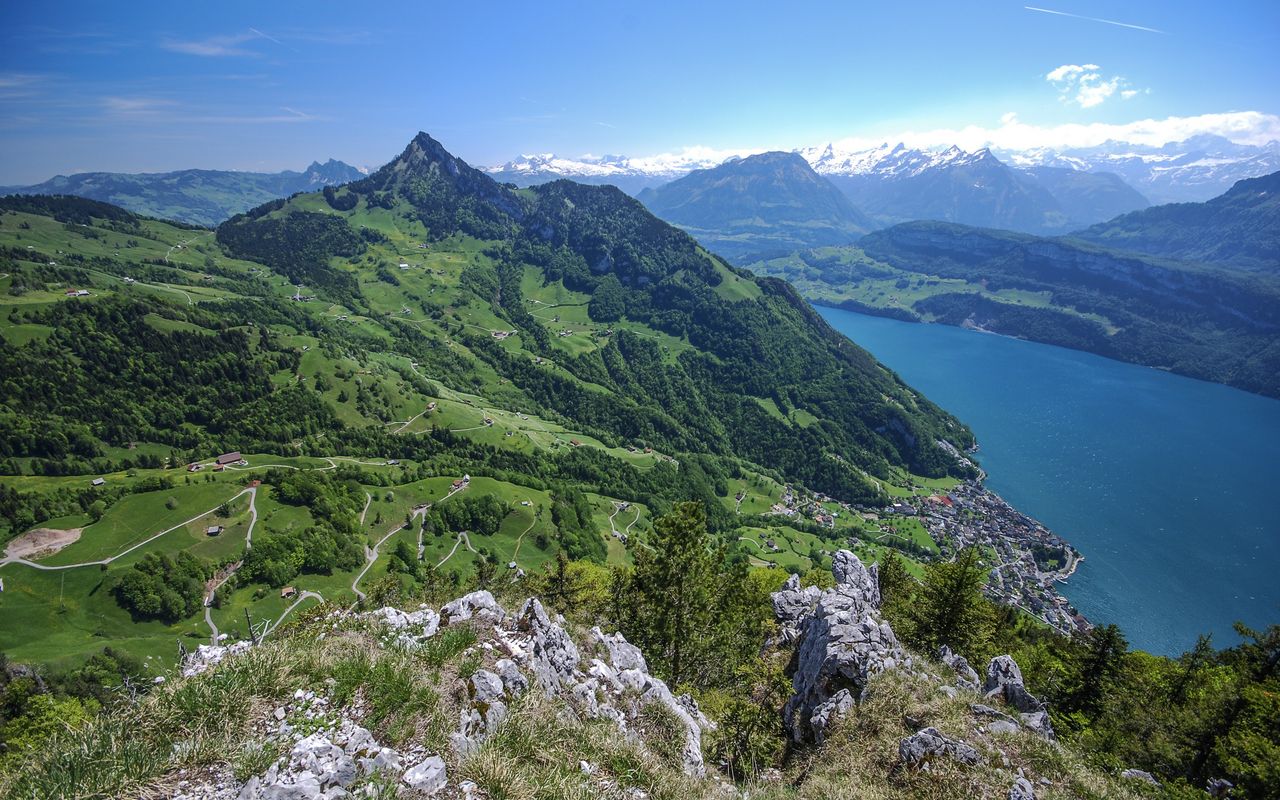
The summit on the sunny side of Rigi

Fans of aerial cable cars consider Wissifluh-Bahn a rarity. The cabins are fixed to one wire cable only, which serves as the carrier and the traction wire cable at the same time (as compared to an ordinary cable car, which is suspended to the carrier wire cable and hauled by a second wire cable). The simple technique has been successfully in operation since 1908. Those who want to do without a whole hour of descent after visiting the summit of Vitznauerstock can do so by using this unique cable car.

Route description

Hinterbergen – Fälmisegg
From the Hinterbergen station (cable car Tel. 041 397 24 71, www.hinterbergen.ch) hike past the restaurant at Eselberg. Follow, slightly ascending, a small road south-eastward to the col P. 1176 at Fälmisegg on the border between the cantons of Lucerne and Schwyz. The path to Vitznauerstock runs along this border, at first slightly on the Lucerne side of the ridge. It zigzags up a steep meadow and from ca. 1270 m an equally steep forest.
Fälmisegg - Vitznauerstock
Shortly after Fälmisegg the first small rocky ledges appear. The trail becomes less steep and follows exactly the contours of the rock wall. Later you overcome a 4 m high chimney with the help of a metal ladder. Now follows a slightly exposed passage along another rock face. Continue across a ridge to an almost horizontal, vast forested terrain. The highest point of Vitznauerstock or Gersauerstock is in this forest, just a few metres off the main itinerary. However, the summit is completely overgrown with trees and offers no view whatsoever. A wide trail leads to an excellent vantage point offering a view eastward. It is about 50 m to the south-east and below the summit at P. 1450. Another vantage point, offering a view westward, is at the huge cross 100 m south-westward further on the ridge.
Vitznauerstock - Wissifluh
From the summit the well visible trail leads roughly along the ridge and in a few bends and curves and zigzags down to Oberurmi. Steeper passages are equipped with ropes. In contrast to the ascent, however, these passages are never exposed. Shortly before Oberurmi you exit the sparse forest into the meadow. Follow the trail through a depression to Ausserurmi (1070 m), where there is a last, special vantage point. After, you reach the Wissifluh restaurant within 10 minutes.
Wissifluh - Vitznau
Those who do not take the cable car down are in for a very rewarding descent. At first a wide path goes north-eastward and almost horizontally on a rocky ledge into a circular deep valley. At P. 912 it descends directly to St. Antoni. Now hike down the steep Brustwald to reach a clearing. Hike past the massive construction to control the Altdorfbach to the valley station of the two cable cars (Buholz). Then, in a few minutes you reach the centre of Vitznau.

Additional information

Departure point

Hinterbergen, Bergstation (1060 m)

Jetonbetrieb, Informationen zur Seilbahn Vitznau–Hinterbergen: www.hinterbergen.ch

End point

Vitznau, Station (435 m)

Time

Hinterbergen – Vitznauerstock 1 h 15 min.

Vitznauerstock – Wissifluh 1 h.

Wissifluh - Vitznau 1 h.

Difficulty / Material

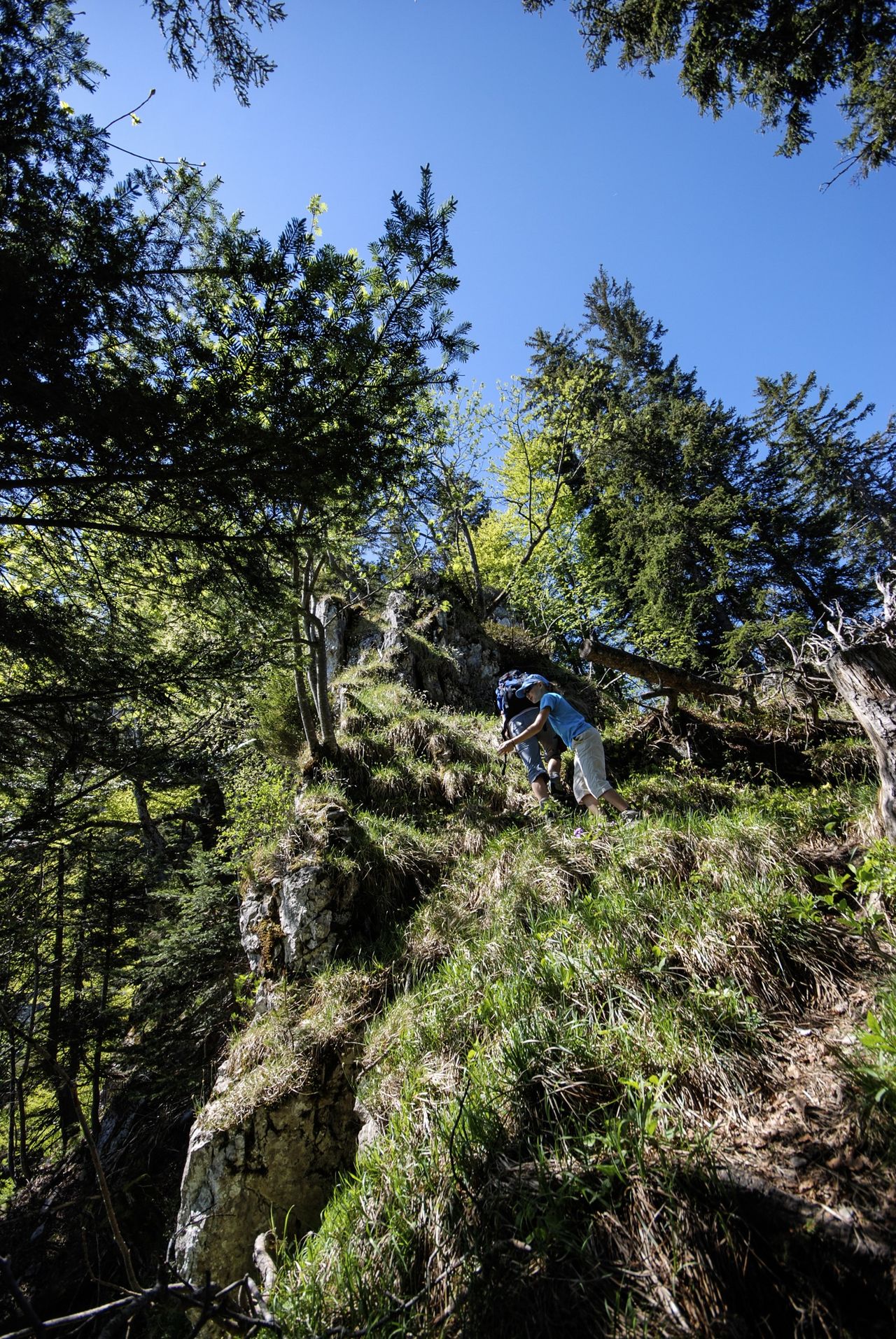
The most challenging passage of this tour is the rocky ledge that is the last stretch (10 minutes) to the summit. The narrow path, everywhere equipped with good steel cables, goes along the steep face as far as an iron ladder leading through a chimney. This reaches the summit plateau.

The first section of the descent from the Wissifluh to Müllersegg is also demanding (for a red-and-white marked mountain trail).

Waypoints

Author

Remo Kundert

Remo Kundert is a hiking guide and owner of the hiking tour operator Per Pedes Bergferien. He also works as a freelance photographer and alpine journalist, and has co-authored numerous hut guidebooks, alpine- and family hiking books.

Our recommendations

Gipfelziele Zentralschweiz Vierwaldstättersee

Berg- und Alpinwandern

Gipfelziele Zentralschweiz Vierwaldstättersee

Price CHF 54.00
Member price CHF 45.00
SAC-Crocs

Equipment

SAC-Crocs

Price CHF 59.00
Member price CHF 49.00
Tourenportal/App-Abo Jahreszahlung

Subscription to the SAC Route Portal

Tourenportal/App-Abo Jahreszahlung

Price CHF 49.00
SAC-Hütten-Monopoly

At home

SAC-Hütten-Monopoly

Price CHF 69.90
Member price CHF 60.00
SAC-Taschenmesser

Equipment

SAC-Taschenmesser

Price CHF 54.00
Member price CHF 49.00
Schneeschuhtouren Zentralschweiz

Schneeschuhtouren

Schneeschuhtouren Zentralschweiz

Price CHF 59.00
Member price CHF 49.00
Ausbildung Bergwandern / Alpinwandern

Ausbildung

Ausbildung Bergwandern / Alpinwandern

Price CHF 59.00
Member price CHF 49.00
Hütten der Schweizer Alpen / Cabanes des Alpes suisses

Bildbände

Hütten der Schweizer Alpen / Cabanes des Alpes suisses

Price CHF 69.00
Member price CHF 59.00
feedback