Traverse Drättehorn – Hoganthorn – Schwalmere | Mountain hiking | Swiss Alpine Club SAC
Unterstütze den SAC Jetzt spenden

Traverse Drättehorn – Hoganthorn – Schwalmere Drättehorn 2793 m

  • Difficulty
    T4
  • Ascent
    5 h, 1100 m
  • Descent
    3:45 h, 2300 m

Large traverse with shorter variants

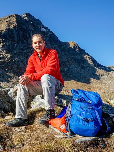
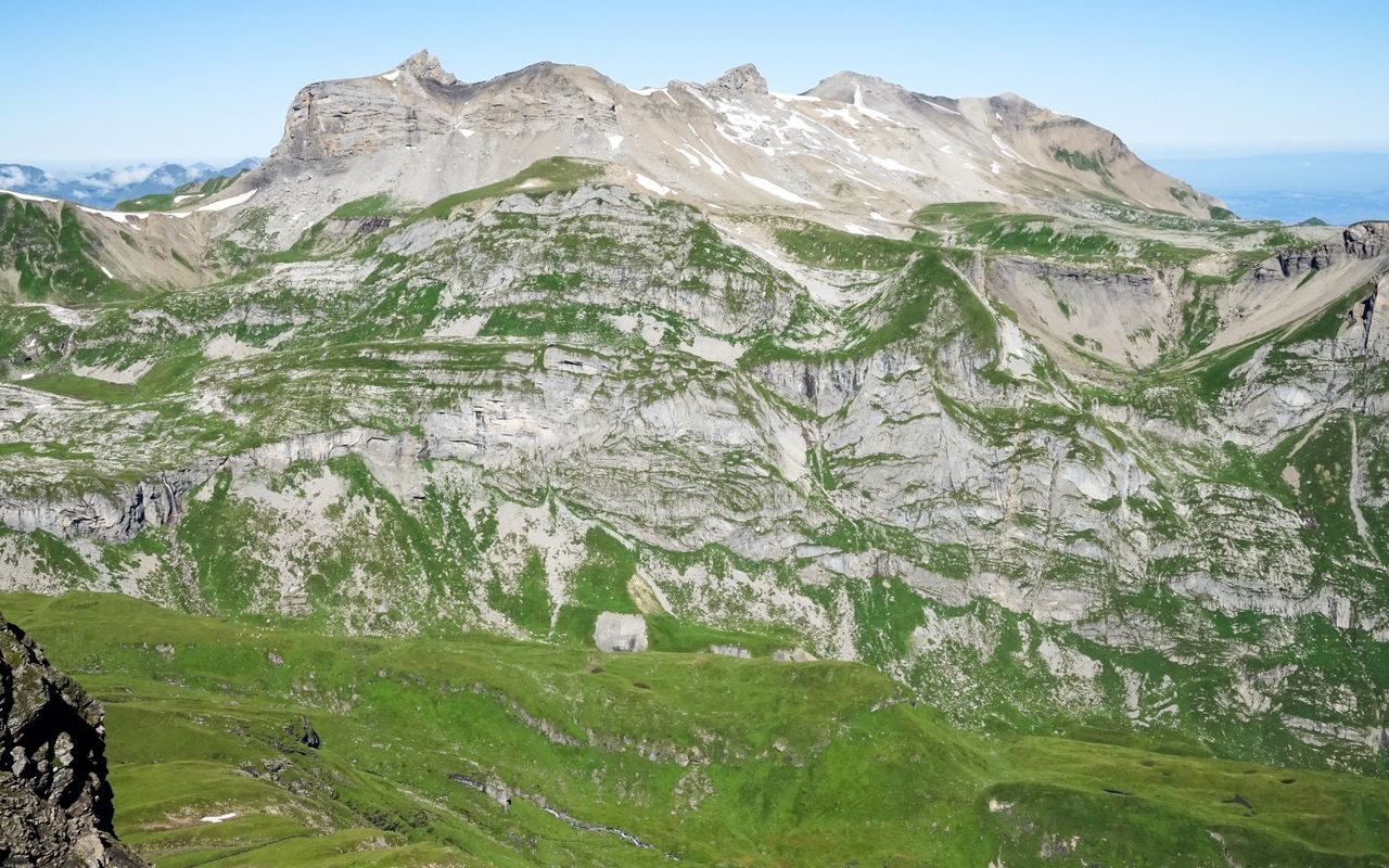
This long tour across three summits requires some stamina, especially on the descent, and some skills in rock and scree. Hikers who normally prefer more pleasurable tours should not be put off by the size of the entire tour. Each summit is a very rewarding destination in its own right.

Route description

Birg aerial cableway station– Chilchfluepass
From the Birg aerial cableway station follow the marked mountain hiking trail down to Schilthornhütte, then hike on a steep, dusty and somewhat slippery trail up to Bietenlücke. On the other side descend equally steep to Soustal (intermittent faint trail, snow until late into the summer). Then hike south-westward up again via Hüenderegg to Chilchfluepass (2454 m).
Chilchfluepass – Drättehorn
From Chilchfluepass go northward on a faint path (no more markings) across Chienegg to the saddle at P. 2523. From there hike westward on grassy slopes and scree (faint path) round the ledge south of Drättehorn to reach its western ridge. About 100 metres before its western end, the ledge can be easily climbed over on several ledges (pale blue markings, I–II, T5–, precarious when wet or icy). On the western ridge (short scrambling passages) ascend until below the characteristic summit structure. On ledges and scree hike up to the Drättehorn summit.
Drättehorn – Hoganthorn – Sattel P. 2673 (beginning of a mountain hiking trail)
From Drättehorn go back below the summit structure, then hike on temporarily arduous scree through the north-western slopes to the ridge which connects Hoganthorn. Now continue on the ridge or slightly west of it. A first rocky fortress (P. 2735) is bypassed on the left (west). From the following saddle Hoganthorn can be reached directly over the ridge.
Sattel P. 2673 – Schwalmere – Descent to Grütschalp
Descend back to the saddle and continue north-eastward on the mountain hiking trail. Around P. 2371 before Lobhörner leave the trail and hike eastward to the pit of Chantbach. Descend on steep grassy slopes with a few unmarked faint paths along the creek, go through a narrow passage (south of P. 2351) and continue on wider slopes, where the faint trails are slightly more visible. Descend to Soustal and walk, again on a mountain hiking trail, to Sousläger and through Spryssewald to Grütschalp (several marked hiking trails; the one via P. 1542 is the shortest).
Alternative: From Drättehorn back to Schilthorn
From the Drättehorn summit take the same route back to Chilchfluepass and continue to Hüenderegg. Now ascend southward on a very steep slope between Chilchflue and Schilthorn (ice-axe helpful). There are various faint trails on the earthy and rubbly ground. On warm days, when the ground is soft, the ascent is without problems. If it is frozen (the slope is exposed to the north!), however, the ascent is difficult and dangerous. You reach the ridge west or east of P. 2828. Then walk on the mountain hiking trail to Schilthorn. 2 h, T5–, snowfields until late into the summer. In good conditions this face can also be descended, which shortens the acces to Drättehorn.

Additional information

Departure point

Birg (Schilthornbahn) (2684 m)

www.schilthorn.ch

Difficulty / Material

It is a long tour with a many metres of vertical height to negotiate, but without greater difficulties. There are some passages on scree which require sure-footedness. Easy scrambling is needed on Drättehorn and Hoganthorn (I). On the north-west side of Bietenlücke you will encounter snowfields until late into the summer.

Waypoints

Schilthornhütte (2433 m)

The cabin is reached shortly after the start of the tour.

Bietenlücke (2639 m)

Col in the first part of the tour from Birg to Chilchfluepass.

Chilchfluepass (2453 m)

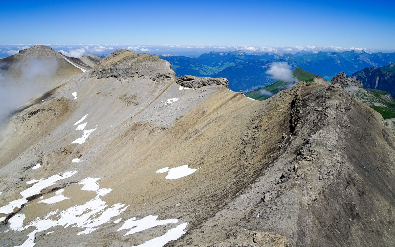
That is where the unmarked and partly pathless part of the tour begins.

Hoganthorn (2775 m)

Second summit on the long traverse.

Schwalmere (2777 m)

Third summit on the long traverse.

Sattel (BE, Schilthorn) (2798 m)

This saddle is crossed on the alternative way back from Drättehorn to Schilthorn.

Schilthorn (BE) (2969 m)

Endpoint of the alternative way back from Drättehorn

Neighbor summit

Höji Sulegg (2413 m)

Magnificent traverse of the whole ridge from Kleines Lobhorn to Höji Sulegg, for example from Sulwald via Lobhornhütte SAC. T3+. There are faint paths with short, exposed passages.

Kleines Lobhorn (2519 m)

Magnificent traverse of the whole ridge from Kleines Lobhorn to Höji Sulegg, for example from Sulwald via Lobhornhütte SAC. T3+. Three are faint paths with short, exposed passages.

Author

Fredy Joss

Sabine und Fredy Joss

Alpine hiking, climbing and other mountain sports Sabine and Fredy Joss's passion. They have been writing and photographing for the SAC publishing house and the club magazine Die Alpen for many years. Sabine is also a biologist and tour guide; Fredy a proofreader and editor for various magazines.

Our recommendations

Skitouren Berner Alpen Ost

Skitouren

Skitouren Berner Alpen Ost

Price CHF 44.00
Member price CHF 34.00
SAC-Crocs

Equipment

SAC-Crocs

Price CHF 59.00
Member price CHF 49.00
Klettern Kombipaket Berner Oberland

Klettern

Klettern Kombipaket Berner Oberland

Price CHF 98.00
Member price CHF 79.00
Tourenportal/App-Abo Jahreszahlung

Subscription to the SAC Route Portal

Tourenportal/App-Abo Jahreszahlung

Price CHF 49.00
Gipfelziele Berner Oberland Grossformat

Berg- und Alpinwandern

Gipfelziele Berner Oberland Grossformat

Price CHF 54.00
Member price CHF 45.00
SAC-Hütten-Monopoly

At home

SAC-Hütten-Monopoly

Price CHF 69.90
Member price CHF 60.00
SAC-Taschenmesser

Equipment

SAC-Taschenmesser

Price CHF 54.00
Member price CHF 49.00
feedback