Jaun – Schopfenspitz – Schwarzsee | Mountain hiking | Swiss Alpine Club SAC
Unterstütze den SAC Jetzt spenden

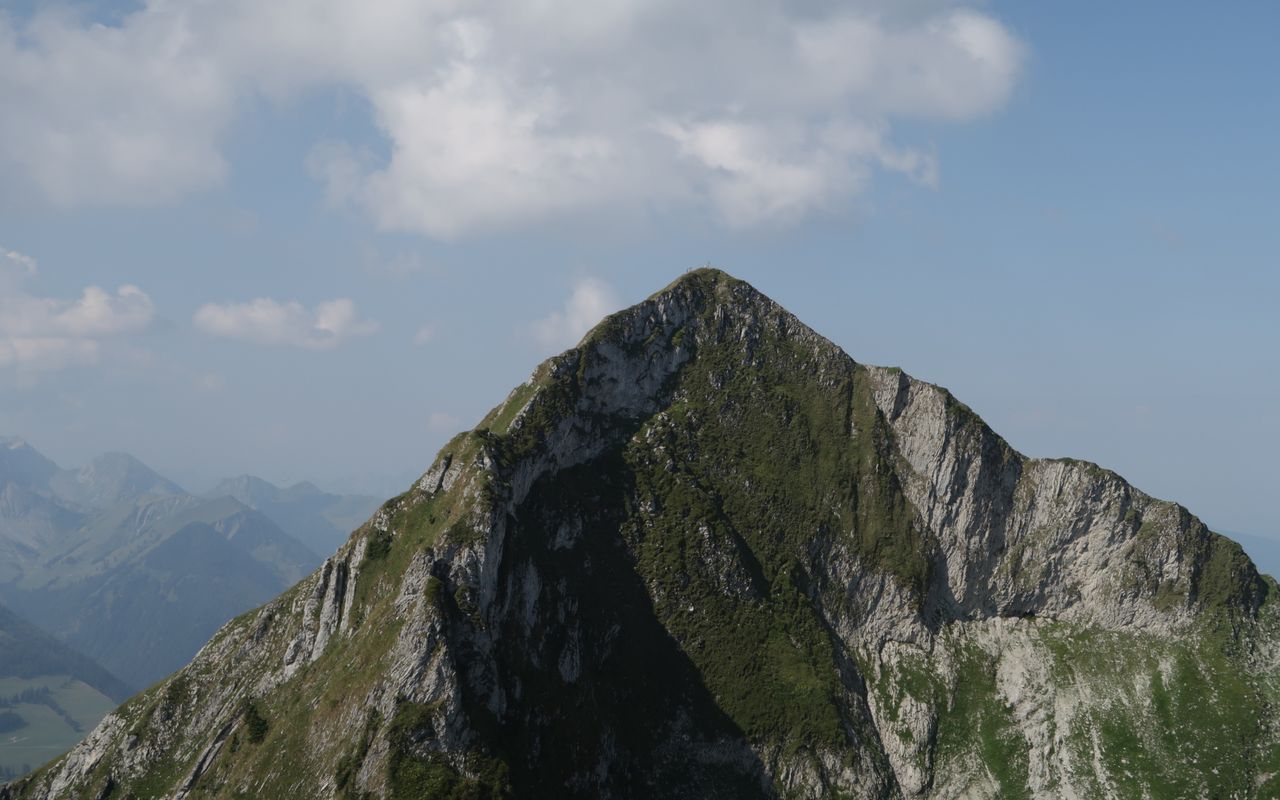
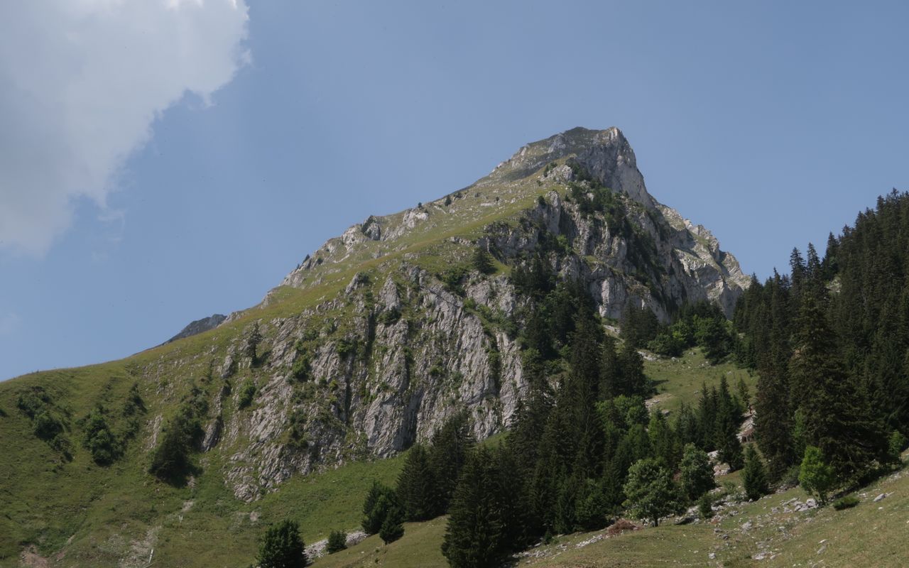
Jaun – Schopfenspitz – Schwarzsee Gros Brun / Schopfenspitz 2104 m

  • Difficulty
    T3
  • Ascent
    3:30 h, 1090 m
  • Descent
    2:30 h, 1050 m

A classic between Jaun an Schwarzsee

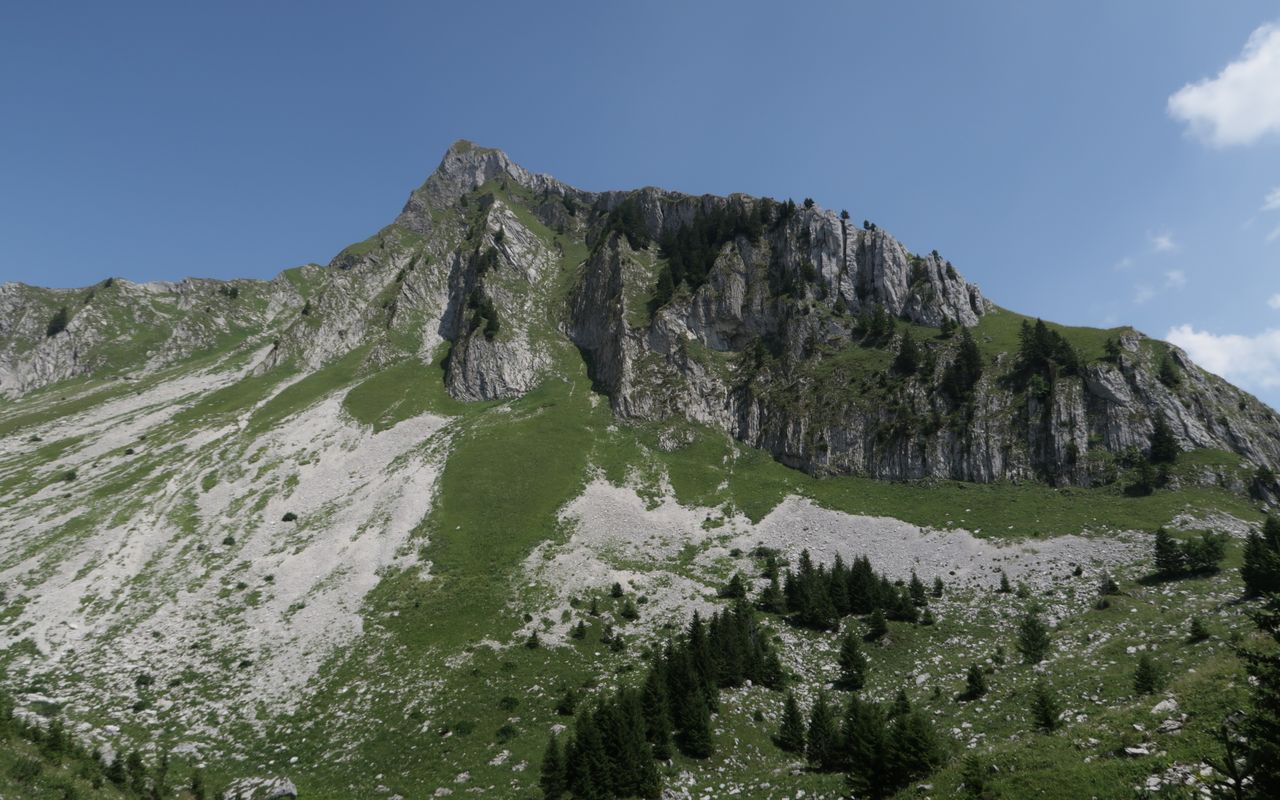
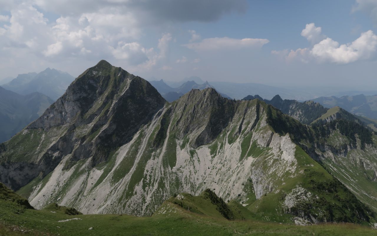
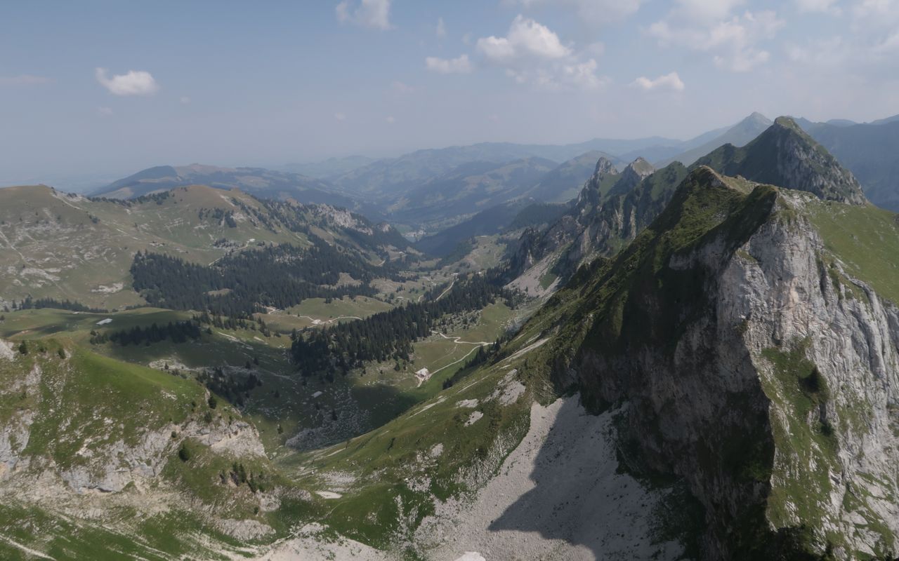
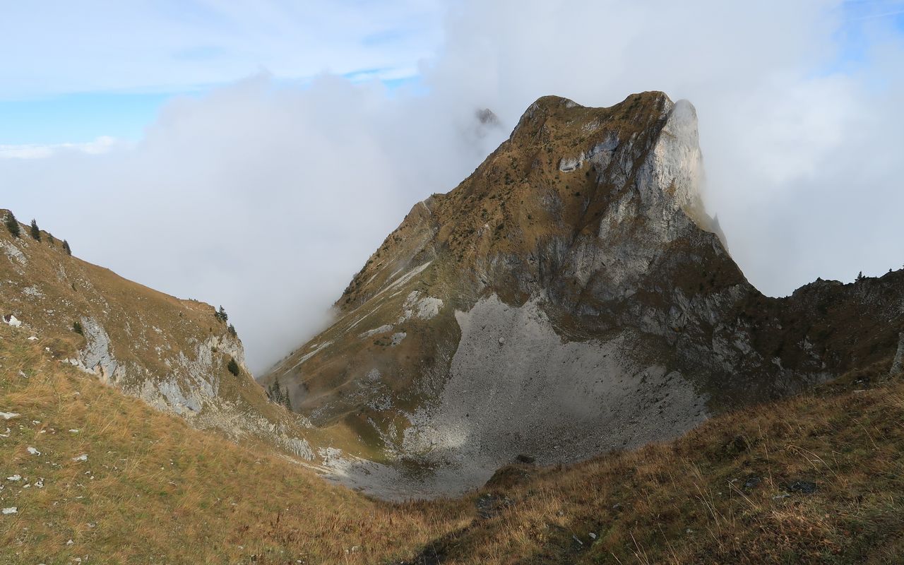
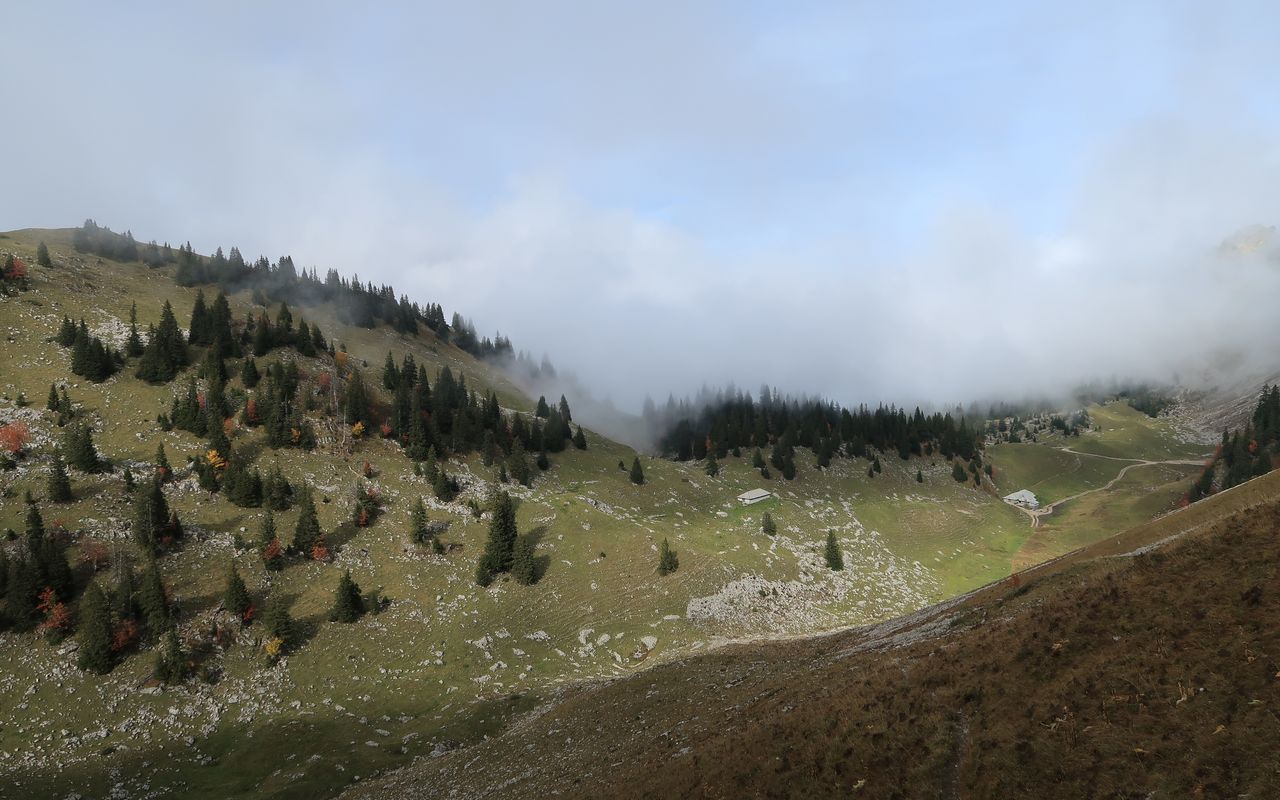
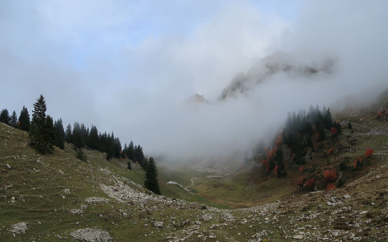
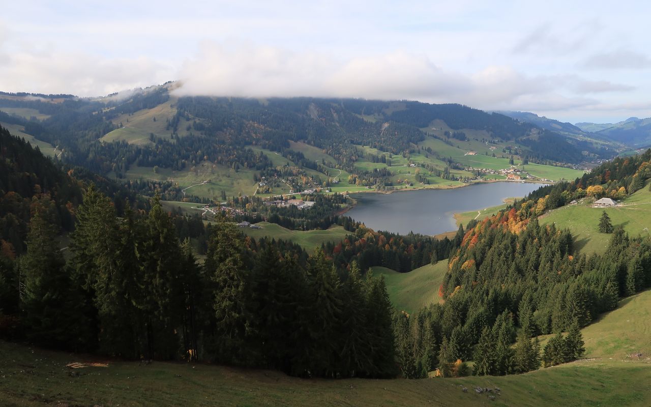
Schopfenspitz, called Gros Brun in French, is the highest summit of the Schopfenspitz range, though only by a metre: Chörblispitz is 2103 m, Schopfenspitz 2104 m. Being a cornerstone of three valleys, namely Breccaschlund, Jaunbachtal and Vallé du Javroz, Gros Brun offers a 360° degree panorama. Combining the two normal routes makes a pretty and popular traverse from Jaun to Schwarzsee, an alternative to Euschelspass.

Route description

Jaun – Schopfenspitz
From Jaun ascend on the hiking trail towards Euschelspass. At ca. 1100 m branch off to the left and follow the trail to the large farmhouse at Untere Jansegg (1365 m) via Striflera. Follow the road westward to P. 1475. Follow the zigzagging hiking trail up to the hut at Maischüpfen (1662 m). Ascend the valley between Maischüpfenspitz and Schopfenspitz. The trail ascends fairly steeply in a gully (equipped with a chain) to reach the Pertet y Tsamo col (1850 m, unnamed on the map). Then it traverses the west face to the north-west ridge and the Schopfenspitz-Sattel (2013 m, unnamed on the map). Ascend the last 90 metres of vertical height just below the north-west ridge to Schopfenspitz/Gros Brun (2104 m) with a bench and a summit cross.
Schopfenspitz – Schwarzsee Bad
Descend along the north-west ridge to Schopfenspitz-Sattel. The hiking trail now goes down eastward to Chambre aux Chamois (unnamed on the map), where the snow remains well into spring. It continues to the hut at Combi (1623 m), from where you have two possibilities. Follow a wide trail to Buvette Cerniets (1521 m) and then the road to Schwarzsee Bad, or, more interesting, hike up and down along Türmli to reach Rippetli (1483 m) and Stierenberg (1417 m). Now on an unmarked trail descend to Wälschi Rippa (1262 m and 1197 m). From P. 1213 on the last stretch is on the road.
Variant 1: direct ascent on the SE face
Instead of taking the hiking trail via Maischüpfen, you can begin to ascend the steep, grassy SE face before P. 1451. This variant is shorter, but definitely more tiresome than the hiking trail. There are a number of passages to overcome the small rocky escarpment at ca. 1800 m; T4+.
Variant 2: starting point La Valsainte monastery
If you want to begin the tour at La Valsainte (1015 m) despite the poor bus service, cross the Javro (965 m) and then follow the road to La Scie (ca. 1150 m). A steep hiking trail goes up to Pertet y Tsamo (1850 m); T3, 3½ h from La Valsainte to Schopfenspitz. It is also possible to start the tour at Vounetse (1610 m, summit station of the Charmey aerial cableway). However, a considerable descent to the Javro valley via Tissiniva (1472 m) und Tissiniva Derrey (1368 m) must be negotiated, before the ascent begins.

Additional information

Departure point

Jaun (1015 m)

An der tpf-Buslinie Bulle – Charmey – Jaun – Jaunpass – Boltigen.

End point

Schwarzsee Bad (FR) (1055 m)

An der tpf-Buslinie Fribourg – Tafers – Plaffeien – Schwarzsee.

Time

Total hiking time: 6 h

Jaun – Untere Jansegg – Maischüpfen – Schopfenspitz: 3½ h

Schopfenspitz – Combi – Breccaschlund – Schwarzsee Bad: 2½ h

Difficulty / Material

The tour is almost entirely on marked mountain hiking trails. The exception is the alternative descent from Combi via Wälschi Rippa. The descent from Combi in the Breccaschlund valley is more or less on concrete roads, depending on the variant.

Waypoints

La Valsainte, Couvent (1015 m)

Starting point of variant 2.

Pertet y Tsamo (1850 m)

Übergang zwischen Vallon du Riau de l'Essert und Vallée de la Jogne / Jauntal, zwischen Schopfenspitz und Vanil d'Arpille / Maischüpfenspitz gelegen.

Authors

Daniel Anker

Daniel Anker is a Bernese author and photographer. The historian has written around 40 ski tour, hiking, via ferrata and mountain bike guide books as well as detailed monographs on individual peaks in Switzerland.

Oliver Neumann

Oliver Neumann is an SAC tour guide and author for the SAC-Tourenportal. His area of work includes mountain and alpine hiking in the Freiburg Alps as well as snowshoe tours in the Jura, Bernese, Freiburg and Vaud Alps.

Our recommendations

SAC-Crocs

Equipment

SAC-Crocs

Price CHF 59.00
Member price CHF 49.00
Gipfelziele Freiburg

Berg- und Alpinwandern

Gipfelziele Freiburg

Price CHF 54.00
Member price CHF 45.00
Tourenportal/App-Abo Jahreszahlung

Subscription to the SAC Route Portal

Tourenportal/App-Abo Jahreszahlung

Price CHF 49.00
En famille vers les cabanes du CAS

Hütten

En famille vers les cabanes du CAS

Price CHF 54.00
Member price CHF 45.00
SAC-Hütten-Monopoly

At home

SAC-Hütten-Monopoly

Price CHF 69.90
Member price CHF 60.00
Les Alpes, un monde vivant

Ausbildung

Les Alpes, un monde vivant

Price CHF 64.00
Member price CHF 54.00
SAC-Taschenmesser

Equipment

SAC-Taschenmesser

Price CHF 54.00
Member price CHF 49.00
Hütten der Schweizer Alpen / Cabanes des Alpes suisses

Bildbände

Hütten der Schweizer Alpen / Cabanes des Alpes suisses

Price CHF 69.00
Member price CHF 59.00
feedback