South face | Mountain hiking | Swiss Alpine Club SAC
Unterstütze den SAC Jetzt spenden

South face (Normal route) Hahnen (OW) 2606 m

  • Difficulty
    T6-
  • Ascent
    4:15 h, 1480 m
  • Descent
    2–3 h, 1610 m

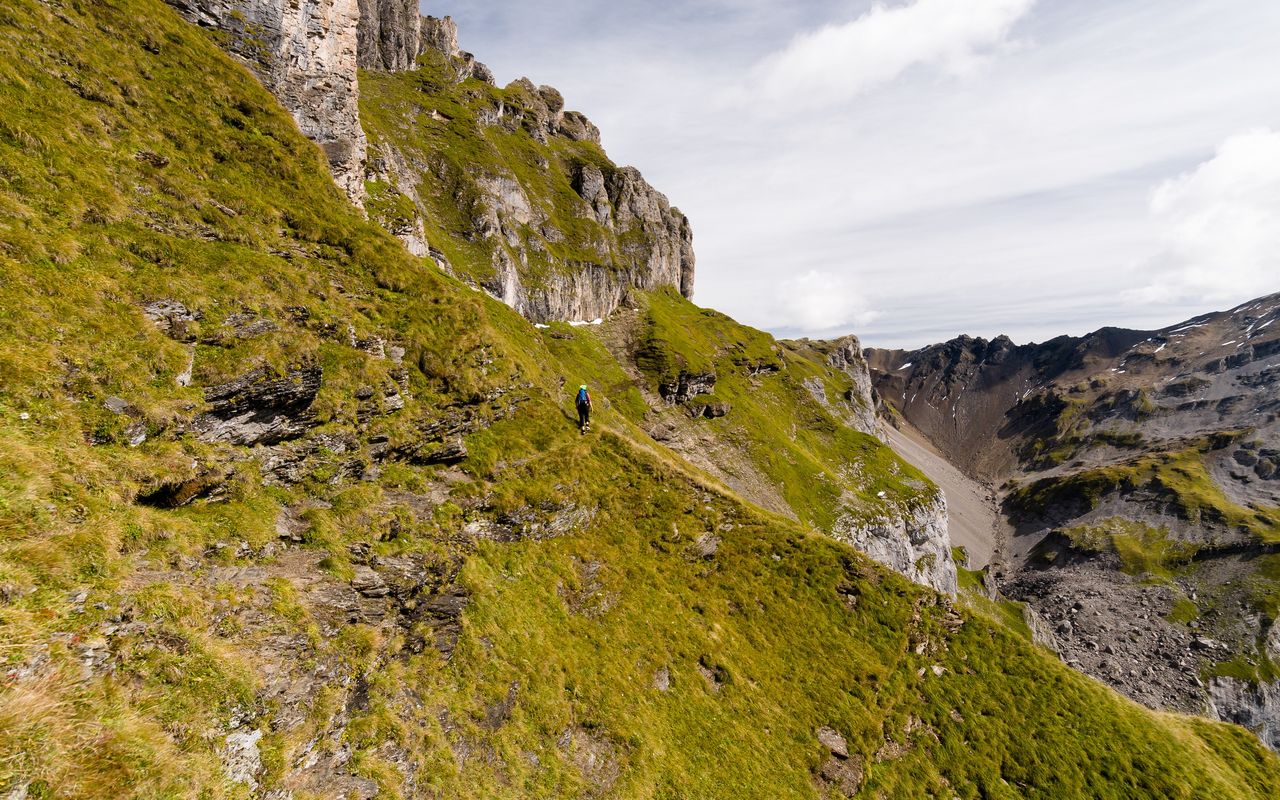
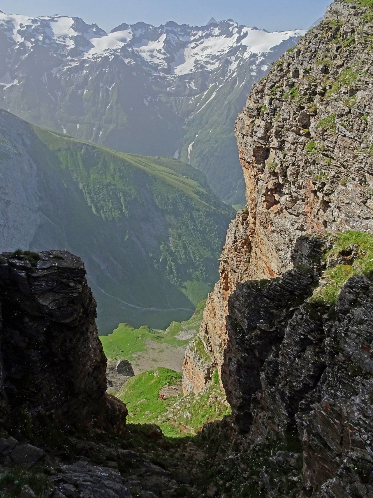
The rock castle of Engelberg

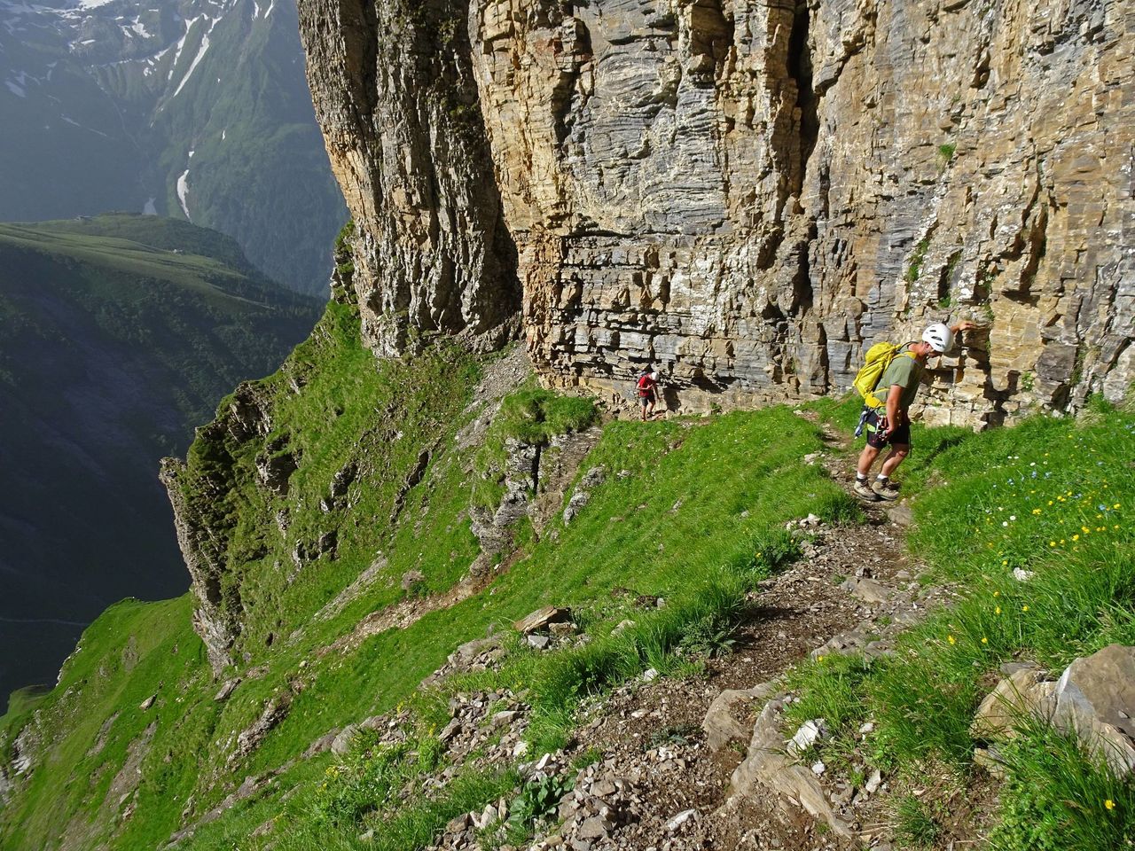
Hahnen is an elegant and bold looking mountain. From its isolated position it overlooks the Engelberg valley in an impressive way. The Engelberg people consider it their local mountain, not the much higher Titlis. But not only the view from the summit down to the valley is worth a visit, but also the 360° panorama. Looking at the mountain from the Engelberg station, one does not doubt for a second that the upper part offers some exposed mountain hiking terrain. The fixed ropes were removed from Hahnenband in 2019 after winter damage, the route has become more demanding. New there are solid iron poles and some intermediate bolts, professionally installed in the necessary places.

Route description

Horbis – Ober Zieblen
From the restaurant «Ende der Welt» (end of the world) at the very end of Horbis (1129 m) a marked trail leads southward into the forest, gaining height fast. In the sheep pastures of Pfaffen you reach Zieblenzopf. Continue through some clearings to Ober Zieblen (ca. 1630 m).
Ober Zieblen – Hahnen
At the chalets of Ober Zieblen leave the main trail and ascend briefly south-eastward to the forest edge. Now follow the good path on the edge of the slope up (to the right there is a chasm), aiming at the characteristic pinnacle of Chli Hahnen. From P. 1909 the ascending faint path leads to the right on the south face of Chli Hahnen. It runs through two grassy depressions to the distinct boulders below P. 2287. About 150 m before you reach the large boulders branch off to the left at a cairn at about 2180 m to gain height on a grassy slope and a scree gully. Slightly below the pinnacle at P. 2287 a fixed rope helps to overcome a steep step to the left. On schrofen and grass (some cairns) go northward, then north-westward up to Hahnenband. At about 2400 m a faint path runs, slightly exposed, to the right leading to the foot of the mighty east face of the secondary summit (P. 2593). From ca. 2420 m follow the foot of the wall. Some schrofen soon lead to the steepest segment: a schrofen gully running down southward from the breach between P. 2593 and the main summit. The final slope from the breach to the big summit cross of Hahnen on the other hand is unproblematic.
Hahnen – Ober Zieblen
For lack of an alternative, the descent from the Hahnen summit to Ober Zieblen is on the same route.
Ober Zieblen – Engelberg
From the chalets at Ober-Zieblen hike on a large trail, mostly through the forest, in wide (almost too wide) serpentines to Unter Zieblen and Berg and the wooden chapel. Now there are several possibilities to the Engelberg station, the fastest being the one on the tarred main road past Brunnibahn.

Additional information

Departure point

Horbis (1129 m)

Der Weiler Horbis, auch «End der Welt» genannt, befindet sich am Ende eines kurzen Stichtals, das von Engelberg nordostwärts abzweigt. Man erreicht Horbis zu Fuss auf markierten Wegen vom Bahnhof Engelberg (rund 50 Min.) bzw. von der Bushaltestelle Engelberg/Brunnibahn (rund 35 Min.), oder man nimmt ein Taxi vom Bahnhof direkt zum Horbis.

End point

Engelberg (999 m)

Difficulty / Material

The fixed ropes were removed from Hahnenband to the summit in 2019, the route has become more demanding. New solid iron poles and some intermediate bolts. Newly, solid iron poles every 15 - 20 m and numerous intermediate protection points have been professionally installed at the necessary points The rope can be used for belaying and, if necessary, for abseiling (rope 40m). At these points it is possible to belay and, if necessary, abseil (rope 40 m).

The key passages are some precipitous traverses on a steep grass slope as well as some stretches with schrofen. Grade T6 is due to the fact that the very steep summit slope must be undertaken also on the descent. Caution, risk of falling rocks, as the rock is fairly brittle, and on the ledges there is a lot of scree lying about (bring your helmet).

Author

Marco Volken

Marco Volken is a freelance photographer and alpine journalist. He has co-authored numerous books on the Alpine region, including illustrated books, non-fiction books, hut guides, hiking and club guides, ski touring and climbing guidebooks.

Our recommendations

Gipfelziele Zentralschweiz Vierwaldstättersee

Berg- und Alpinwandern

Gipfelziele Zentralschweiz Vierwaldstättersee

Price CHF 54.00
Member price CHF 45.00
SAC-Crocs

Equipment

SAC-Crocs

Price CHF 59.00
Member price CHF 49.00
Tourenportal/App-Abo Jahreszahlung

Subscription to the SAC Route Portal

Tourenportal/App-Abo Jahreszahlung

Price CHF 49.00
SAC-Hütten-Monopoly

At home

SAC-Hütten-Monopoly

Price CHF 69.90
Member price CHF 60.00
SAC-Taschenmesser

Equipment

SAC-Taschenmesser

Price CHF 54.00
Member price CHF 49.00
Schneeschuhtouren Zentralschweiz

Schneeschuhtouren

Schneeschuhtouren Zentralschweiz

Price CHF 59.00
Member price CHF 49.00
Ausbildung Bergwandern / Alpinwandern

Ausbildung

Ausbildung Bergwandern / Alpinwandern

Price CHF 59.00
Member price CHF 49.00
Hütten der Schweizer Alpen / Cabanes des Alpes suisses

Bildbände

Hütten der Schweizer Alpen / Cabanes des Alpes suisses

Price CHF 69.00
Member price CHF 59.00
feedback