North-west ridge and face | Mountain hiking | Swiss Alpine Club SAC
Unterstütze den SAC Jetzt spenden

North-west ridge and face (Normal route) Obers Tatelishore / Ober Tatelishorn 2961 m

  • Difficulty
    T4+
  • Ascent
    4 h, 1270 m
  • Descent
    3 h, 1270 m

Appearances are deceptive…

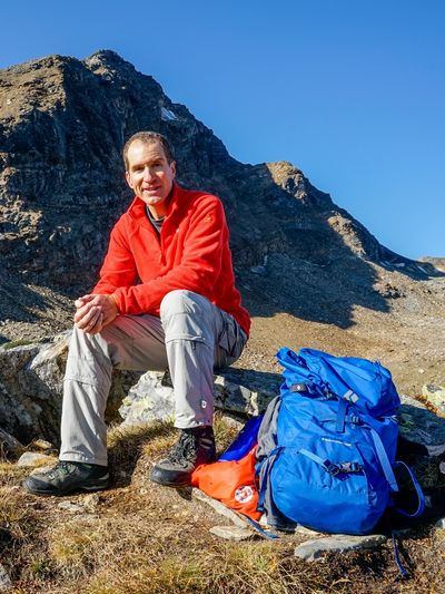
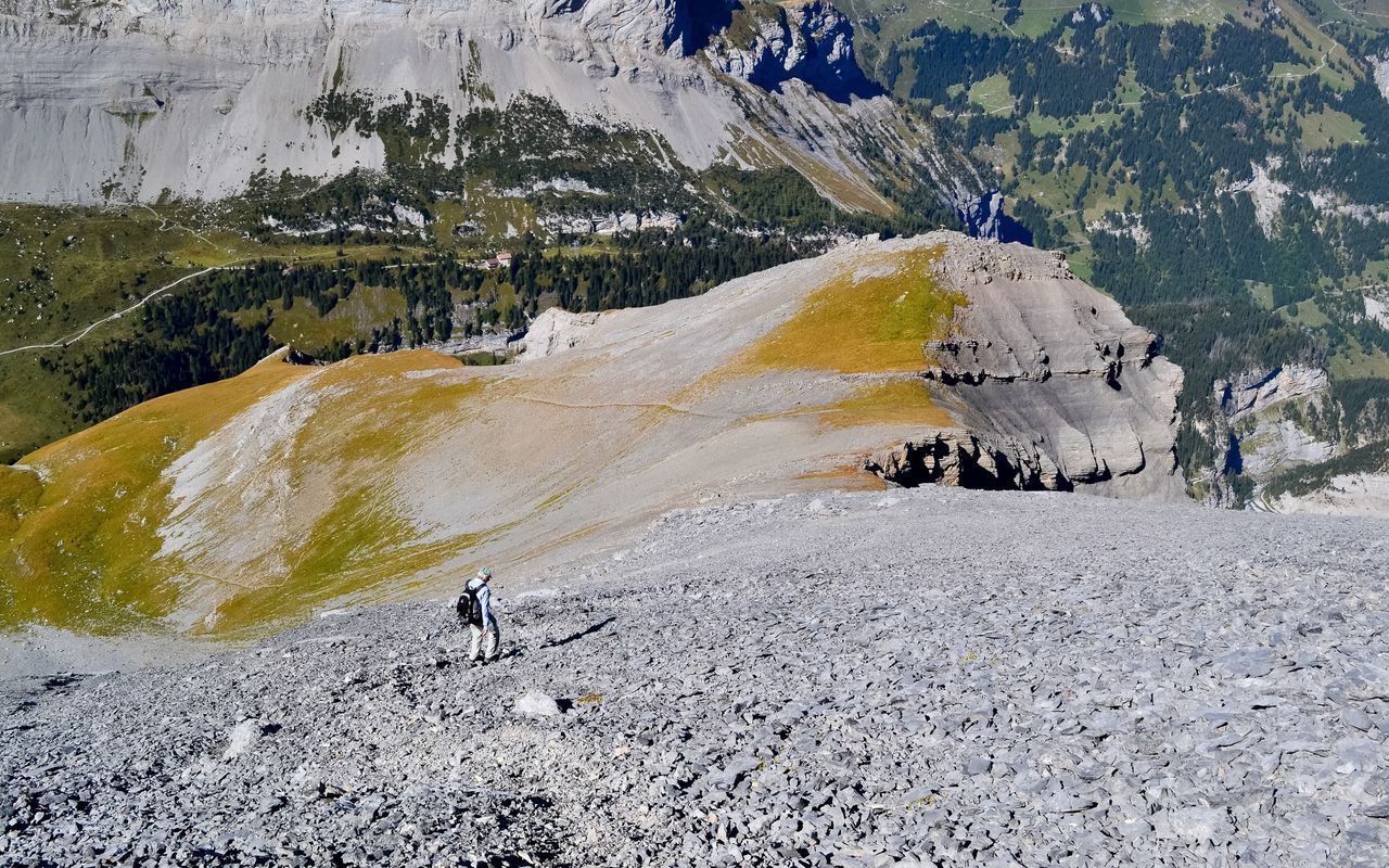
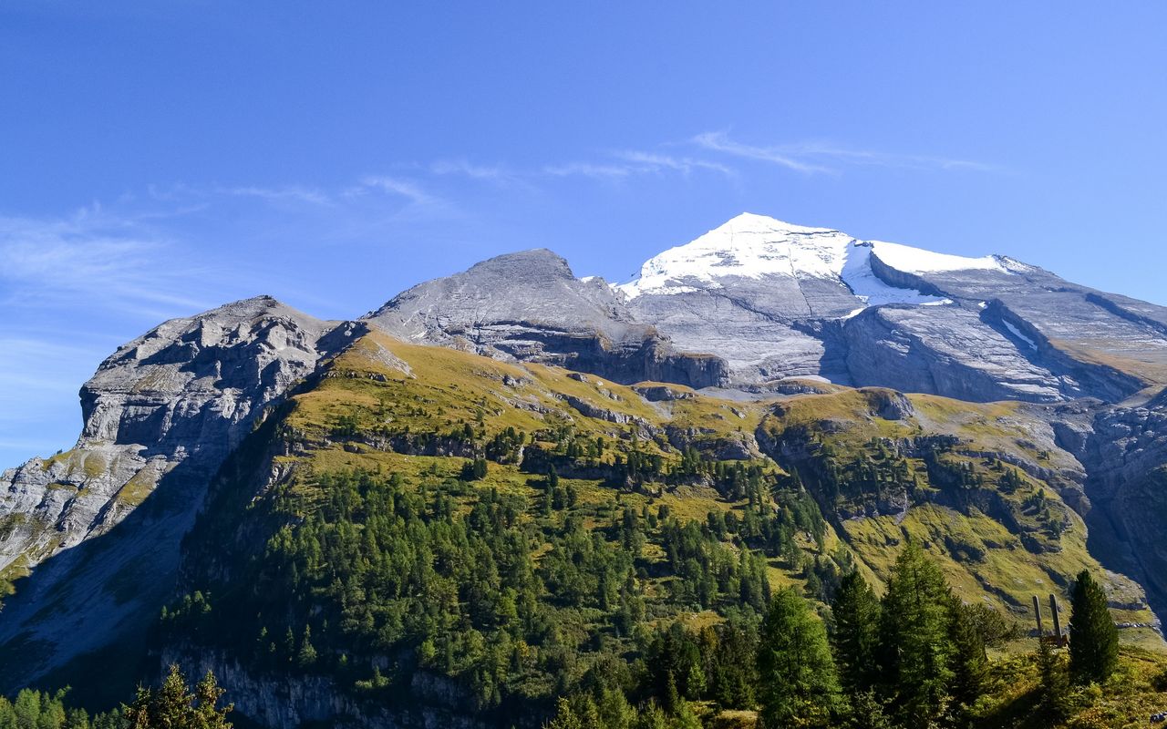
The north-west face of Obers Tatelishore does not look very promising viewed from afar. However, its scree and slab are much easier to walk on than it seems. The summit pays off with a marvellous panorama, a dizzying view down to Gasteretal and the view over to Altels, which seems to be at your fingertips. The glacier on Altels has all but disappeared; nevertheless, the vast, very regular steep incline is very impressive.

Route description

Sunnbüel – Unders Tatelishore
From Sunnbüel ascend on the mountain hiking trail to Schwarenbach as far as the bridge at P. 1871 on Spittelmatte. From here follow the signpost «Tatelis» to the left. This is a newly built path, which is not yet charted on the map. Cross the creek and ascend to a bifurcation (P. 2004). Now turn left (north) and continue to Sagiweid (ca. 2160 m) directly below the face of Altels. Now across the ditch of a nameless creek. This passage may turn out to be the crux of this tour, as it can be snow-filled (avalanche) the whole year long. In icy conditions the steep walls of the ditch present a high risk of slipping (ice-axe helpful). If the creek is covered with a thin layer of old snow, it can be dangerous to cross, as the snow bridge might collapse. After the ditch continue without difficulties on the faint path until Unders Tatelishore (2497 m). This summit alone is a tour in its own right. It is a beautiful peak offering splendid views. So far: T3.
Unders Tatelishore – Obers Tatelishore
From Unders Tatelishore hike south-eastward to Obers Tatelishore. Keep to the ridge or rather the northern rim of the north-west face. This face, which seems very brittle from afar, is easier to walk on than expected. The scree and rubble are more stable than anticipated. Some slabs as well as faint paths and cairns facilitate the ascent.
Descent Obers Tatelishore – Sunnbüel
For the descent from Obers Tatelishore to Sunnbüel take the same route.
Descent to Gasteretal and Eggeschwand
Descent to Eggeschwand: this is a very nice, partly exposed marked mountain hiking trail leading down from Spittelmatte to Gasteretal. From the aforementioned bridge (P. 1871) branch off to the right and continue shortly above Schwarzbach through a little gorge to the bifurcation at P. 1819. Turn right downwards, cross the creek, hike through the rocks named Gurnigel and zigzag down to Gasteretal and to Hotel Waldhaus, a romantic hotel and restaurant offering rooms without electricity, nor running water. From the hotel continue through Chluse down to Eggeschwand. P. 1871– Eggeschwand ca. 2 h, T3.

Additional information

Departure and arrival point

Sunnbüel, Bergstation (1934 m)

Summit station of the cable car Eggeschwand – Sunnbüel: www.sunnbuel.ch

Bus service from Kandersteg to Eggeschwand: afabus.ch

Difficulty / Material

There is a faint, but visible path up to Unders Tatelishore (T3); a newly prepared part on Spittelmatte, however, has not yet been charted on the map. It can be difficult to cross the creek after Sagiweid due to avalanche snow: risk of slipping and the snow bridge’s collapsing; an ice-axe can be helpful. The ascent to Obers Tatelishore is characterised by scree, rubble and slabs; faint paths and cairns show the way.

Waypoints

Unders Tatelishore / Unter Tatelishorn (2497 m)

Unders Tatelishore is traversed on the way to Obers Tatelishore. It is a destination in its own right.

Gasteretal, Waldhaus (1351 m)

Hotel Waldhaus lies on the alternative descent to Gasteretal. It is a romantic hotel and restaurant; rooms without electricity, nor running water.

Eggeschwand, Sunnbüelbahn Talstation (1193 m)

Endpoint of the alternative descent. Bottom station of Sunnbüelbahn with a restaurant; bus to Kandersteg railway station.

Neighbor summit

Gasterespitz (2822 m)

Beautiful vantage point on Wildelsigegrat in front of Balmhorn: minibus from Kandersteg to Neubrücke/Waldhaus (reservation required, phone 033 671 11 72). There is a marked mountain hiking trail to Balmhornhütte SAC, then a faint path to Gasterespitz. Exposed, T4. Balmhornhütte: www.sac-altels.ch, phone 033 675 13 40.

Authors

Fredy Joss

Sabine und Fredy Joss

Alpine hiking, climbing and other mountain sports Sabine and Fredy Joss's passion. They have been writing and photographing for the SAC publishing house and the club magazine Die Alpen for many years. Sabine is also a biologist and tour guide; Fredy a proofreader and editor for various magazines.

Sabine Joss

Our recommendations

Skitouren Berner Alpen Ost

Skitouren

Skitouren Berner Alpen Ost

Price CHF 44.00
Member price CHF 34.00
SAC-Crocs

Equipment

SAC-Crocs

Price CHF 59.00
Member price CHF 49.00
Klettern Kombipaket Berner Oberland

Klettern

Klettern Kombipaket Berner Oberland

Price CHF 98.00
Member price CHF 79.00
Tourenportal/App-Abo Jahreszahlung

Subscription to the SAC Route Portal

Tourenportal/App-Abo Jahreszahlung

Price CHF 49.00
Gipfelziele Berner Oberland Grossformat

Berg- und Alpinwandern

Gipfelziele Berner Oberland Grossformat

Price CHF 54.00
Member price CHF 45.00
SAC-Hütten-Monopoly

At home

SAC-Hütten-Monopoly

Price CHF 69.90
Member price CHF 60.00
SAC-Taschenmesser

Equipment

SAC-Taschenmesser

Price CHF 54.00
Member price CHF 49.00
feedback