Western ridge-south-western ridge traverse | Mountain hiking | Swiss Alpine Club SAC
Unterstütze den SAC Jetzt spenden

Western ridge-south-western ridge traverse Schnidehore / Schnidehorn 2937 m

  • Difficulty
    T5-
  • Ascent
    4:30 h, 1370 m
  • Descent
    3 h, 1370 m

Treading on neolithical paths

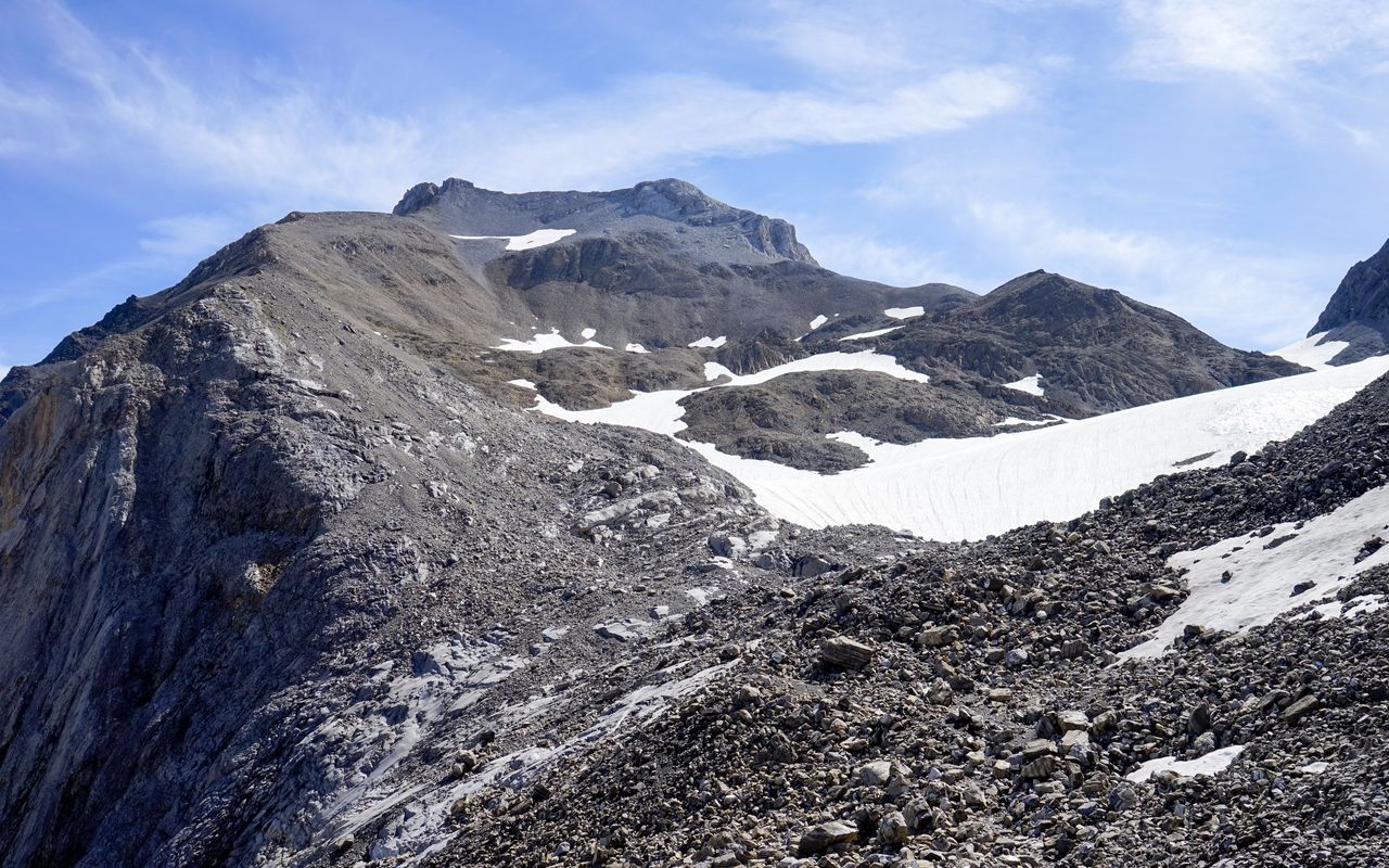
Since numerous artefacts such as bows, quivers, shoes and other garments, tools and weapons from the 3rd millennium B.C. were found in the hot summer of 2003, Schnidejoch has become a well-known col. 5000 years later one hikes up to the col and on to Schnidehore for pleasure. Ascending from the west and descending to the south-west makes a wonderful traverse. A short climbing passage under the summit can be avoided.

Route description

Iffigenalp – Wildhornhütte
From Iffigenalp ascend on the marked mountain hiking trail via Groppi and Egge to the lovely Iffigsee. Follow the north shore around the lake and continue on Sandbode, a vast alluvial plain, to Wildhornhütte (2302 m).
Wildhornhütte – Chilchligletscher
From Wildhornhütte continue on the mountain hiking trail towards Schnidejoch: on the plain just behind the cabin the path is hardly visible, then, on the moraine ridge, it is more distinct. At an altitude of ca. 2600 m hike below Chilchligletscher on to its eastern rim.
Chilchligletscher – Schnidehore
On the eastern rim of Chilchligletscher leave the path to gain the western ridge of Schnidehorn across rubble and gravel slopes. The gravel is easily walkable. Always on the ridge ascend as far as the summit rocks. Below those rocks traverse to the right (south) in loose rubble to gain the south-west ridge. Now climb the summit rocks (a few short passages II, moderately exposed) and ascend again on gravel the last metres to the summit. The rocks can be avoided by going south-eastward, either rather steeply just below the rocks or on a longer detour and with a loss of altitude, but easier on a faint path.
Schnidehore – Schnidejoch
From the summit walk back on the same route to the point below the summit rocks, then continue, slightly exposed, on the south-western ridge to the shoulder P. 2921. From here south-eastward on a faint, hardly visible path, but marked with cairns, descend around the shoulder and continue on the Berne/Valais border to Schnidejoch (2755 m).
Schnidejoch – Iffigenalp
From Schnidejoch follow the marked mountain hiking trail back to Wildhornhütte and Iffigenalp.
Ascent or descent from/to Lac de Tseuzier
From Barrage du Rawil / Lac de Tseuzier (postal car from Sion): it is an equally attractive ascent. You walk on marked mountain hiking trails as far as Schnidejoch. Saves roughly 30 min. as compared to the way from Iffigenalp. It is well suited for the descent, too. Unfortunately, there are few bus connections from/to Barrage du Rawil.

Additional information

Departure and arrival point

Iffigenalp (1584 m)

Access by car alternating traffic from Hubelmatte uphill: x.30 to x.45 hrs, downhill: x.00 to x.15 hrs.

Regular bus in the summer season or Alpentaxi from Lenk: 4x4 taxi (Tel. +41 33 733 33 33)

Difficulty / Material

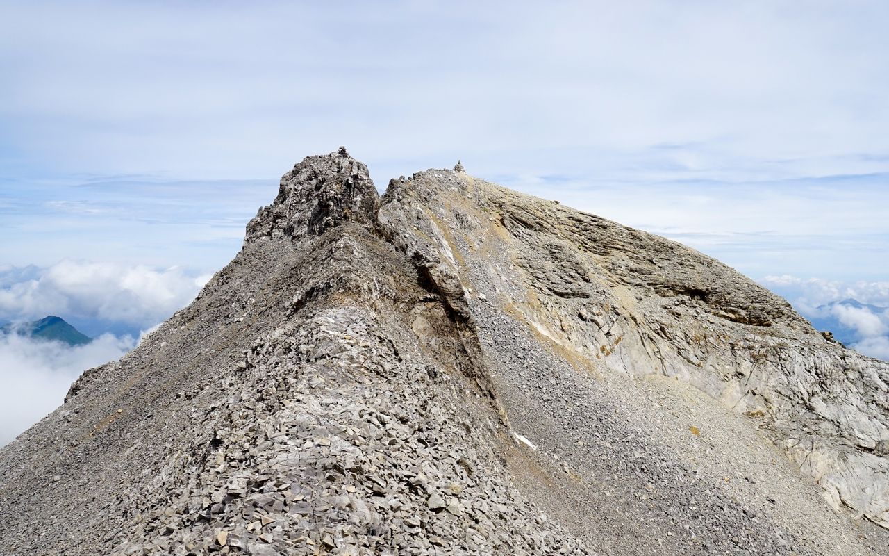
From the west ascend pathless in partly stable, partly loose gravel. Under the summit climb over some rocks (a few metres II, T5–), which can be avoided on a faint path through rubble (T4+). On the south-west ridge there are cairns and a faint trail.

Waypoints

Wildhornhütte SAC (2303 m)

The cabin is located on an attractive site and offers an ideal possibility to spread the tour over two days.

Schnidejoch (2755 m)

One crosses this col on the border between the cantons of Berne and Valais on the main itinerary as well as on the alternative route.

Barrage du Rawil (Lac de Tseuzier) (1779 m)

Starting or final point of the alternative route.

Neighbor summit

Niesehore / Niesehorn (2776 m)

Over the south ridge. In the beginning it is rather steep and rocky, some faint trails, T4.

North-east ridge: you reach the ridge around P. 2469 from the south-west through steep grassy slopes or from the north (from the saddle P. 2381) through rubble. After that there are faint trails, cairns and short scrambling passages, T4.

Author

Fredy Joss

Sabine und Fredy Joss

Alpine hiking, climbing and other mountain sports Sabine and Fredy Joss's passion. They have been writing and photographing for the SAC publishing house and the club magazine Die Alpen for many years. Sabine is also a biologist and tour guide; Fredy a proofreader and editor for various magazines.

Our recommendations

Walliser Alpen

Alpine Touren

Selection guide

Walliser Alpen

Price CHF 49.00
Member price CHF 39.00
Skitouren Berner Alpen Ost

Skitouren

Skitouren Berner Alpen Ost

Price CHF 44.00
Member price CHF 34.00
SAC-Crocs

Equipment

SAC-Crocs

Price CHF 59.00
Member price CHF 49.00
Klettern Kombipaket Berner Oberland

Klettern

Klettern Kombipaket Berner Oberland

Price CHF 98.00
Member price CHF 79.00
Tourenportal/App-Abo Jahreszahlung

Subscription to the SAC Route Portal

Tourenportal/App-Abo Jahreszahlung

Price CHF 49.00
Gipfelziele Berner Oberland Grossformat

Berg- und Alpinwandern

Gipfelziele Berner Oberland Grossformat

Price CHF 54.00
Member price CHF 45.00
SAC-Hütten-Monopoly

At home

SAC-Hütten-Monopoly

Price CHF 69.90
Member price CHF 60.00
SAC-Taschenmesser

Equipment

SAC-Taschenmesser

Price CHF 54.00
Member price CHF 49.00
Bergsport Sommer

Ausbildung

Bergsport Sommer

Price CHF 59.00
Member price CHF 49.00
Ausbildung Bergwandern / Alpinwandern

Ausbildung

Ausbildung Bergwandern / Alpinwandern

Price CHF 59.00
Member price CHF 49.00
feedback