From south via the South East Ridge | Alpinism | Swiss Alpine Club SAC
Unterstütze den SAC Jetzt spenden

From south via the South East Ridge (Normal route) Wilerhorn (VS) 3307 m

  • Difficulty
    F, 2a
  • Ascent
    7–7 h, 2240 m

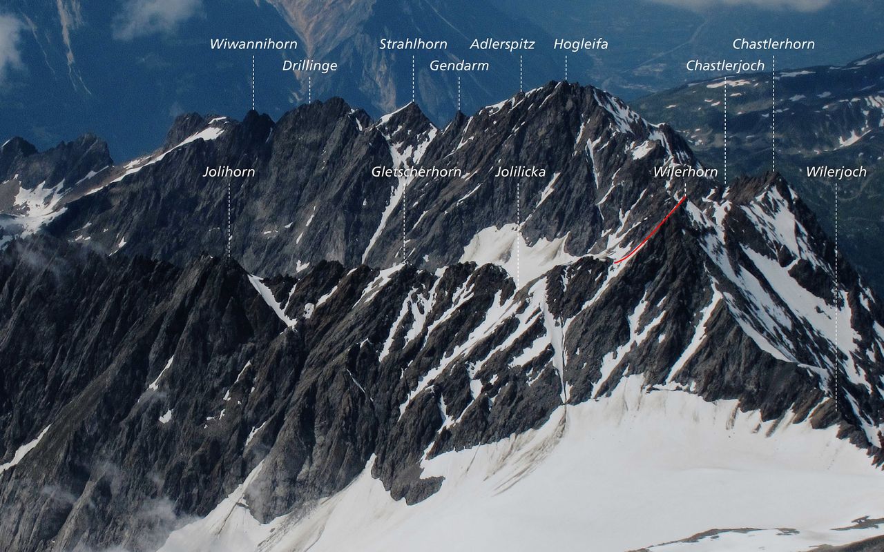
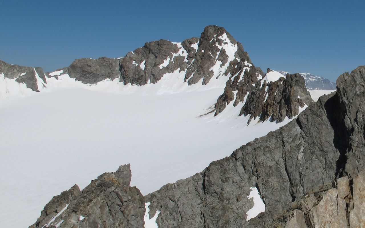
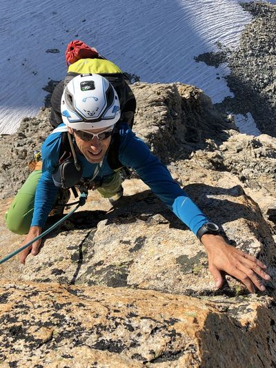
Normal route from Hohtenn via Patzalp and Jolialp. Since there are no huts to stay in in along the Jolital, the ascent is very long. At the Chiemattbode, however, is a good spot to bivvy/ pitch a tent, thus you can split the ascent over two days. It is also possible to take the bike up the Alpstrasse to Jolialp, later shortening the descent. From Hohtenn to the summit of the Wilerhorn, you pass all types of vegetation, that is, from the near Mediterranean climate of the Lötschberg's southern step to the glaciated high mountains around the Bietschhorn. The Wilerhorn offers a wonderful panoramic view of the Bernese and Valais Alps and is the immediate neighbor of the Bietschhorn.

Route description

Hohtenn - Chiemattbode
From the station Hohtenn (1077 m) you first follow the Südrampenweg (path) direction Ausserberg. After the railway underpass, choose the path leading to Alp Tatz. From Alp Tatz, take the path, or the road that crosses several times over the path, to the hairpin bend at P.1640. From here on, continue straight along the wide path with branches off to Alp Joli. At the Alp Joli you stay on the western (!!!DIFFERENT TO THE MAP!!!) side of the stream and follow trails up to the Chiemattbode (possible camp site).
Chiemattbode - Wilerhorn
After crossing over the Chiemattbode, follow tracks up along the moraine in the middle of the valley, then bear east to pass P. 2627 on the right. From here, climb on up to P. 2928 (some moderate scrambling) and enter the glacier at about 2980 m. Now head for the Jolilicka (col) at 3200 m, southeast of the main summit via the gently sloping glacier. The climb up to the Jolilicka over a snow or rubble slope is straightforward. Finally climb the steep snow/ screes to join ridges leading to the summit. These are climbed direct, or on their eastern side.

Additional information

Departure point

Hohtenn, Bahnhof (1077 m)

Time

3–4 Std. vom Chiemattbode (Biwakmöglichkeit)

Waypoints
History

E. von Fellenberg wiht P. Siegen and B. Henzen, 29. April 1879.

Author

Bernhard Senn

Bernhard Senn is a physiotherapist specializing in workplace ergonomics and workplace health promotion. Bernhard has been an SAC author since 2013 and will often be found 'out and about' in the mountains; whether with rock gear, skis, mountain bike or paraglider.

Our recommendations

Walliser Alpen

Alpine Touren

Selection guide

Walliser Alpen

Price CHF 49.00
Member price CHF 39.00
Skitouren Berner Alpen Ost

Skitouren

Skitouren Berner Alpen Ost

Price CHF 44.00
Member price CHF 34.00
Klettern Kombipaket Berner Oberland

Klettern

Klettern Kombipaket Berner Oberland

Price CHF 98.00
Member price CHF 79.00
Tourenportal/App-Abo Jahreszahlung

Subscription to the SAC Route Portal

Tourenportal/App-Abo Jahreszahlung

Price CHF 49.00
Gipfelziele Berner Oberland Grossformat

Berg- und Alpinwandern

Gipfelziele Berner Oberland Grossformat

Price CHF 54.00
Member price CHF 45.00
SAC-Hydro Flask

Equipment

SAC-Hydro Flask

Price CHF 39.00
Member price CHF 35.00
SAC-Taschenmesser

Equipment

SAC-Taschenmesser

Price CHF 54.00
Member price CHF 49.00
SAC-Brändi Dog XS

Equipment

SAC-Brändi Dog XS

Price CHF 66.00
Member price CHF 60.00
Bergsport Sommer

Ausbildung

Bergsport Sommer

Price CHF 59.00
Member price CHF 49.00
Ausbildung Bergwandern / Alpinwandern

Ausbildung

Ausbildung Bergwandern / Alpinwandern

Price CHF 59.00
Member price CHF 49.00
feedback