From Sellamatt | Mountain hiking | Swiss Alpine Club SAC
Unterstütze den SAC Jetzt spenden

From Sellamatt (Normal route) Zuestoll 2234 m

  • Difficulty
    T4-
  • Ascent
    2:30 h, 850 m
  • Descent
    1:30 h, 850 m

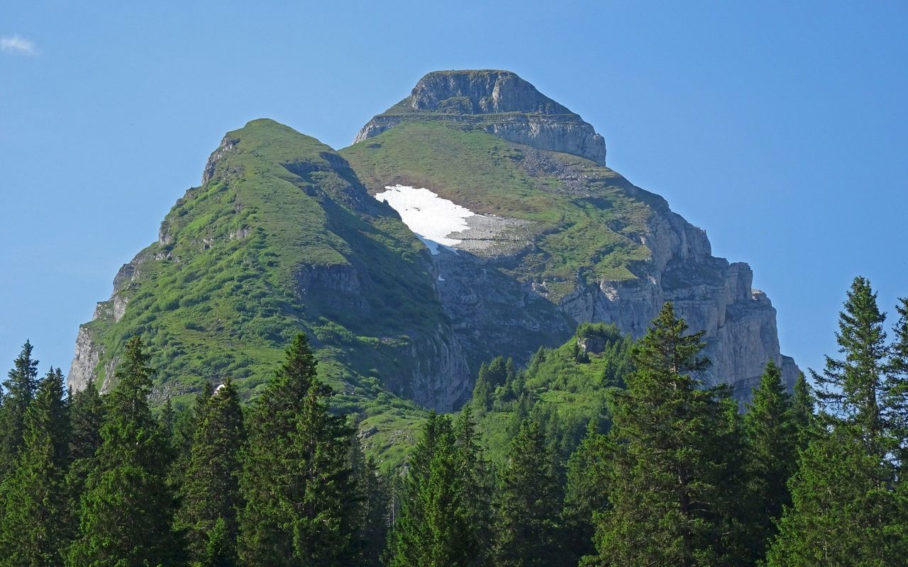
The most elegant of the seven...

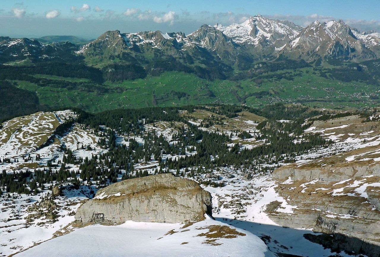
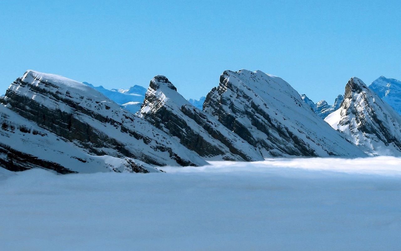
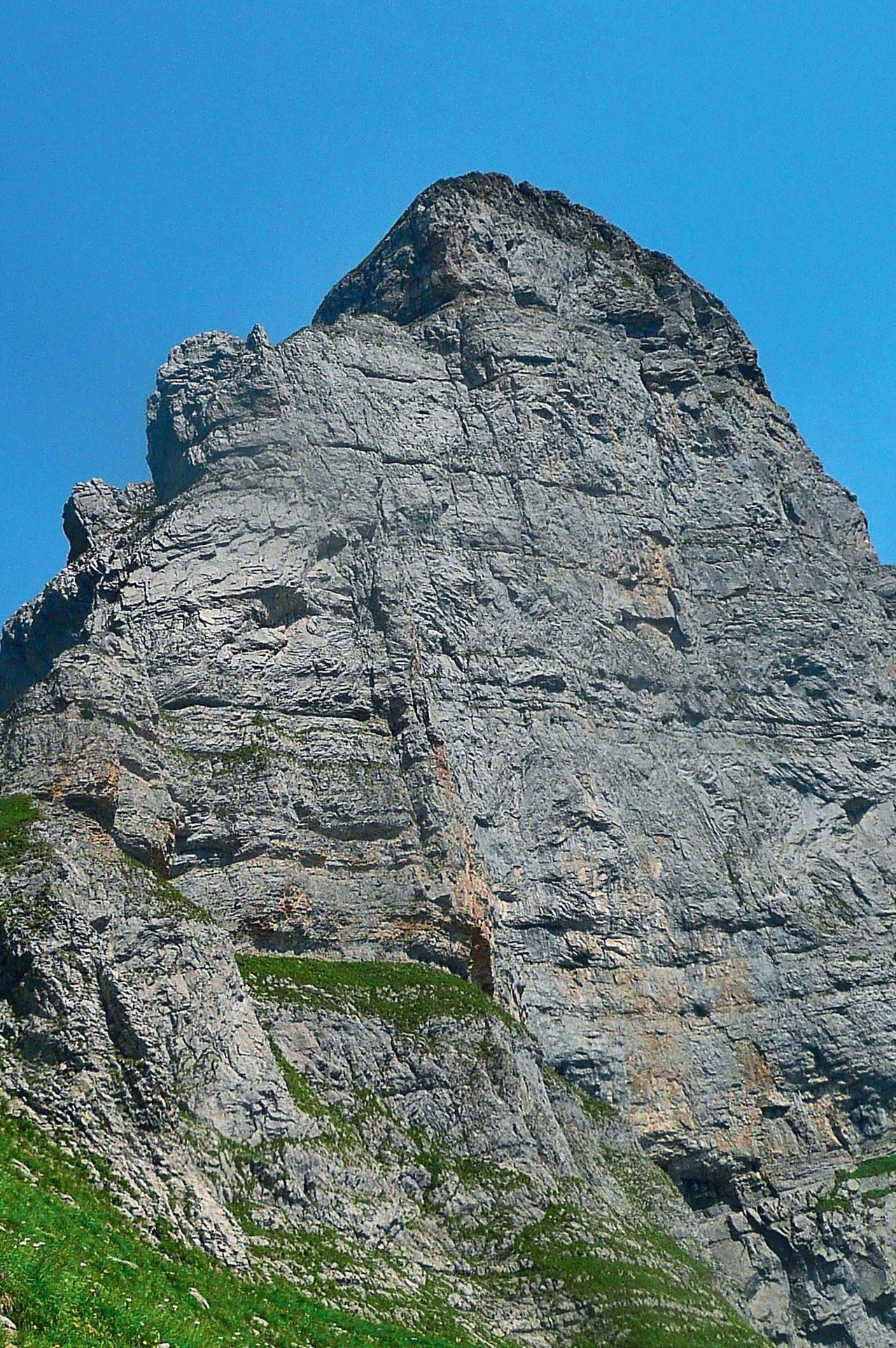
The Churfirsten range of seven mountains between Walensee and Toggenburg, is unique. On the north side they form a precisely arranged row of monopitch slopes and on the south they are sheer cliffs offering a splendid view down to Walensee almost 2000 metres down. Hiking to one of them is a must for every alpine hiker. The question is: which one? We have chosen Zuestoll for its elegant form. The ascent is short and multifaceted. It offers a number of exposed, but well-equipped passages and the aforementioned view.

Route description

Selamatt - Rüggli (P. 1736)
From the Selamatt summit station go horizontally to Zinggen, where you take the white-red marked mountain trail south-westward. Shortly before Langlitten turn left to hike on hilly terrain until the bifurcation to Schibenstoll at P. 1736 below Rüggli.
Rüggli (P. 1736) - Zuestoll
At P. 1736 scramble the first escarpment (now marked white-blue) to reach Rüggli. From there follow a good path on the Zuestoll ridge until an exposed small ridge which slightly descends to the summit ridge. Zigzag up to the summit structure, which is overcome with the help of steel cables (exposed passage).
Descent
On the ascent
Variant below the small ridge
You can ascend or descend below the rock walls to the west of the summit ridge. From Rüggli a faint path on scree goes south-westward along impressive rock walls to reach the large karst slope of the Zuestoll north face. It is equally long and difficult as the normal route, but unmarked.

Additional information

Departure and arrival point

Selamatt, Bergstation (1389 m)

Gondelbahn ab Alt St. Johann, www.toggenburg.ch

Time

Selamatt - Langlitten - Rüggli - Zuestoll: 2½ h

Descent Zuestoll - Selamatt: 1½ h

Difficulty / Material

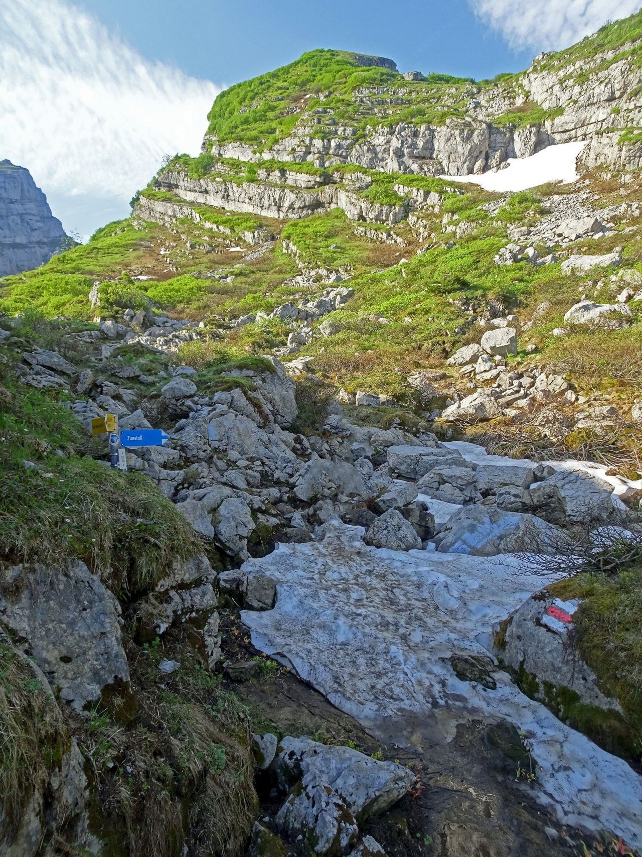
There are three cruxes: the ascent to Rüggli, the exposed small ridge leading to the summit ridge, and the summit structure itself (equipped with steel cables). Do not underestimate the tour in snow or rain.

The summit ascent is now marked white-blue; it had been white-red until recently.

Neighbor summit

Schibenstoll (2234 m)

The same altitude as Zuestoll, Schibestoll is a different experience. The higher you hike, the flatter the terrain becomes. At P. 1736 follow the white-red trail on the left on overgrown karst until you reach the ridge. Ascend on this ridge to reach a steep couloir which gives access to the undemanding summit slope. From P. 1736 a good hour, T3+, continuously marked white-red.

Our recommendations

Skitouren Glarus - St. Gallen - Appenzell

Skitouren

Skitouren Glarus - St. Gallen - Appenzell

Price CHF 44.00
Member price CHF 34.00
SAC-Crocs

Equipment

SAC-Crocs

Price CHF 59.00
Member price CHF 49.00
Tourenportal/App-Abo Jahreszahlung

Subscription to the SAC Route Portal

Tourenportal/App-Abo Jahreszahlung

Price CHF 49.00
SAC-Hütten-Monopoly

At home

SAC-Hütten-Monopoly

Price CHF 69.90
Member price CHF 60.00
Klettern Alpstein

Klettern

Klettern Alpstein

Price CHF 64.00
Member price CHF 54.00
SAC-Taschenmesser

Equipment

SAC-Taschenmesser

Price CHF 54.00
Member price CHF 49.00
Bergsport Sommer

Ausbildung

Bergsport Sommer

Price CHF 59.00
Member price CHF 49.00
Klettern St. Galler Oberland

Klettern

Klettern St. Galler Oberland

Price CHF 69.00
Member price CHF 59.00
feedback