From Capanna Saléi via Pilone to the Bagni di Craveggia | Mountain hiking | Swiss Alpine Club SAC
Unterstütze den SAC Jetzt spenden

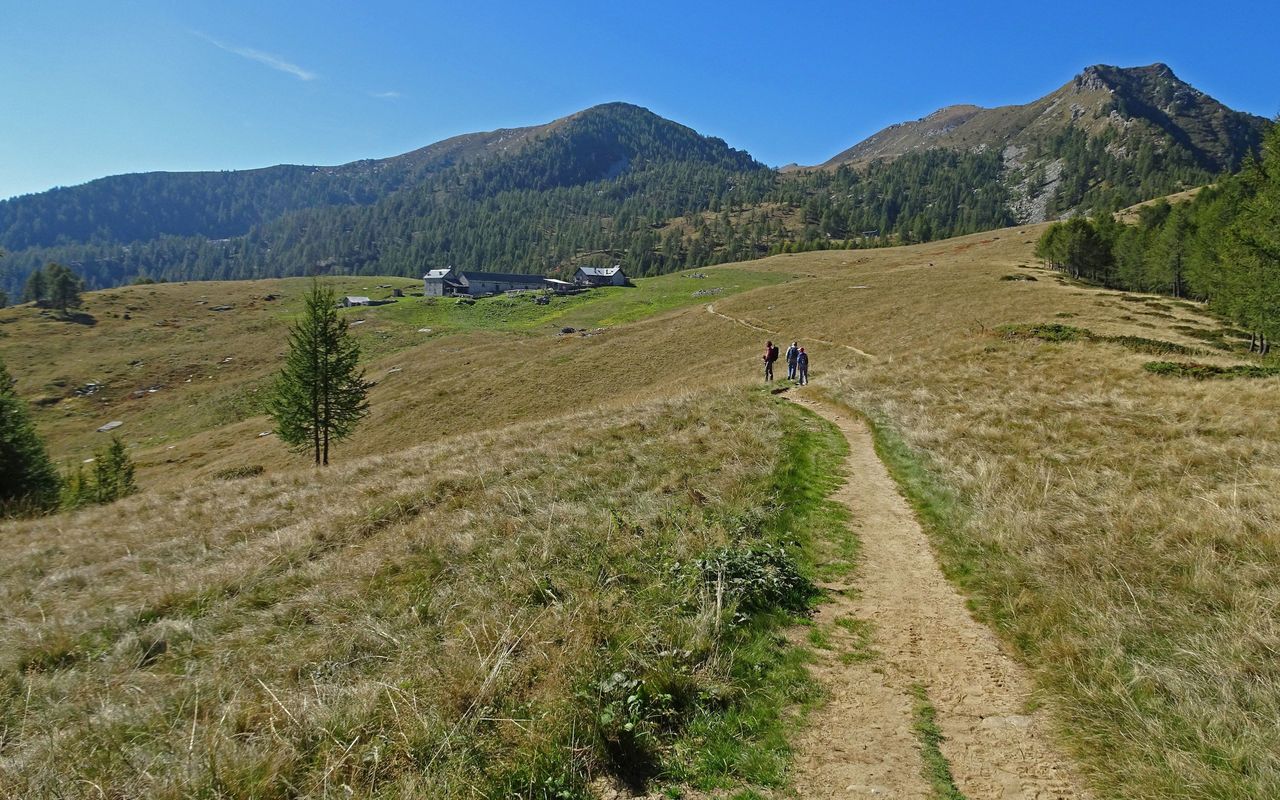
From Capanna Saléi via Pilone to the Bagni di Craveggia Cima Pian del Bozzo / Pilone 2192 m

  • Difficulty
    T3+
  • Ascent
    1:15 h, 550 m
  • Descent
    3:30 h, 1340 m

The vantage point and the old spa

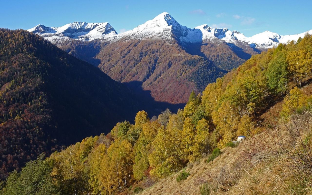
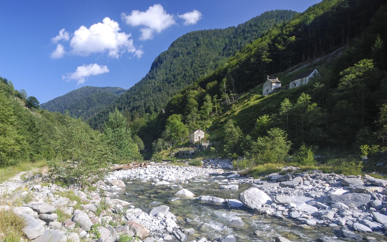
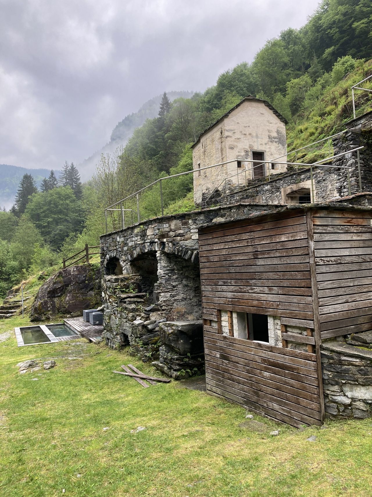
If you descend more or less along the border from Pilone to Valle Onsernone, on the valley floor you come across the ruins of a building with an interesting past. It is part of the remains of the formerly grand spa of Bagni di Craveggia. Built in 1823 and completely destroyed in 1881 by a fire, it was rebuilt shortly afterwards. In the winter of 1950/51 huge masses of snow thundered down from Pilone through Valle della Camana, annihilating the hotel on the other side of the river. In its heyday the hotel accommodated guests who were carried across the mountains in litters from Craveggia in Valle Vigezzo. In the healing water they found relief from their illnesses. The spa profited from the 28 °C warm water wells bubbling out of the mountain. It was collected in big tubs. In the ruins of the former main building you will still find one of those big granite tubs, and the water is still doing what it used to do: bringing relief to visitors. This time it is hikers who can treat their tired limbs with the dark cellar bathed in candlelight.

Route description

Capanna Saléi – Pilone
From Capanna Saléi the trail leading to Laghetto dei Saléi (in summer often warm enough to take a swim) and to Passo del Bùsan (2006 m) is marked well. Now continue on a disappearing path through the sunny side of Motto dei Ciapitt and more or less on the ridge to the highest point of Pilone. The prominent cairn and the huge boulder mark the border between Italy and Switzerland. It bears the inscription «R.I.C.S. 14» (Repubblica Italiana, Confederazione Svizzera; the small «C» below probably stands for the Italian commune Craveggia, while «O» is for Onsernone in Switzerland).
Pilone – Mondada – Piattone
The descent follows the wide east ridge of Pilone via P. 2079 back to Passo del Bùsan (2006 m), from where you go exactly southward past Munzelüm to the beautifully located Alpe Pesced (1778 m). Continue to go down the valley towards Spruga, until the signpost at Pian Secco shows the way to the Ristorante Mondada. From here it would take you about half an hour to reach Spruga on the direct trail, but much more interesting and adventurous is the detour via the Bagni di Craveggia. From the hamlet Mondada traverse westward horizontally on a faint path and at the next bifurcation at Piattone take the lower trail which leads directly into Valle della Camana (red colour marking).
Piattone – Bagni di Craveggia
After Piattone go horizontally through a fairly steep forest (red colour marking) then traverse a rocky escarpment ("I Scalaa", safety chains). Now you reach the creek at the bridge P. 1393 on stones and rock slabs. Continue on an occasionally faint path to reach the two houses at Camana (1375 m) in the overgrown clearing. Now the path is very faint, but with your instinct and open eyes you will find your way down the steep forest interspersed with small rocky ledges to P. 977. There it is best to take off your boots in order to wade through the Isorno, the water level permitting, to reach the ruins of the former spa (or use the bridge 250 m to the west). A large granite tub full of warm water and more tubs outside the cellar invite you to take a break.
Bagni di Craveggia – Spruga
From the buildings above the spa the last stretch of the trail leads you to the barracks of the border control and shortly afterwards across the river on a bridge to the small road, which winds its way up along imposing rock walls to the bus station at Spruga (1113 m).

Additional information

Departure point
End point

Spruga (1113 m)

Time

Capanna Saléi – Pilone 1 h 15 min.

Pilone – Bagni di Craveggia 2 h 45 min.

Bagni di Craveggia – Spruga 45 min.

Difficulty / Material

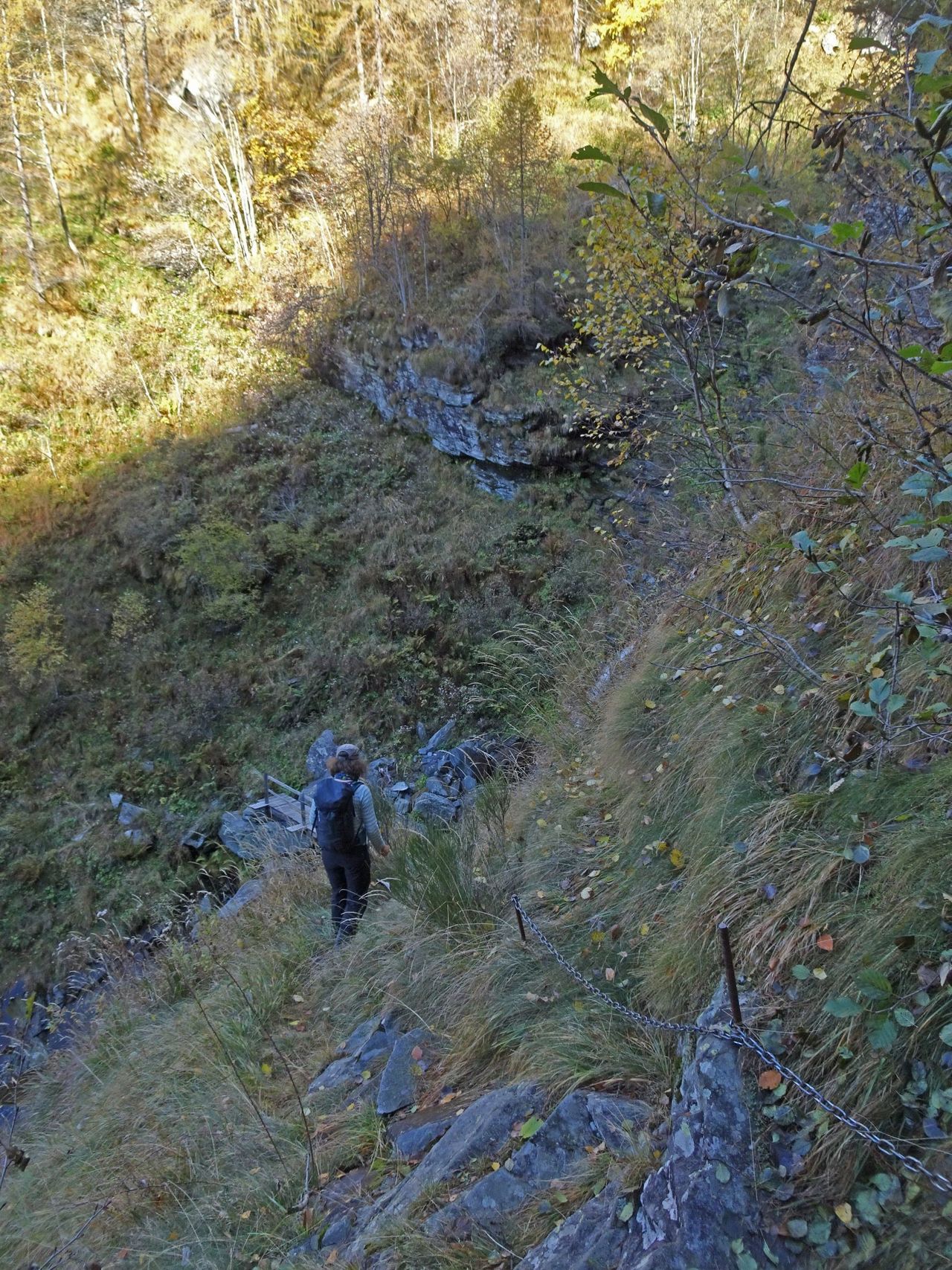
Finding the right trail to Mondada is quite difficult, as a number of trails merge there. If you have found the correct path at Tecc (red colour marking), you come across some passages where the trail has collapsed. The increasingly faint path goes past some rocks to the ditch of the creek. If you have discovered the path to Camana, you will find the clearing, which is being overgrown more and more, and the descent to the Bagni without any difficulties.

Waypoints

Passo del Bùsan (2006 m)

Easy and much used passage from Valle Onsernone into Valle di Vergeletto

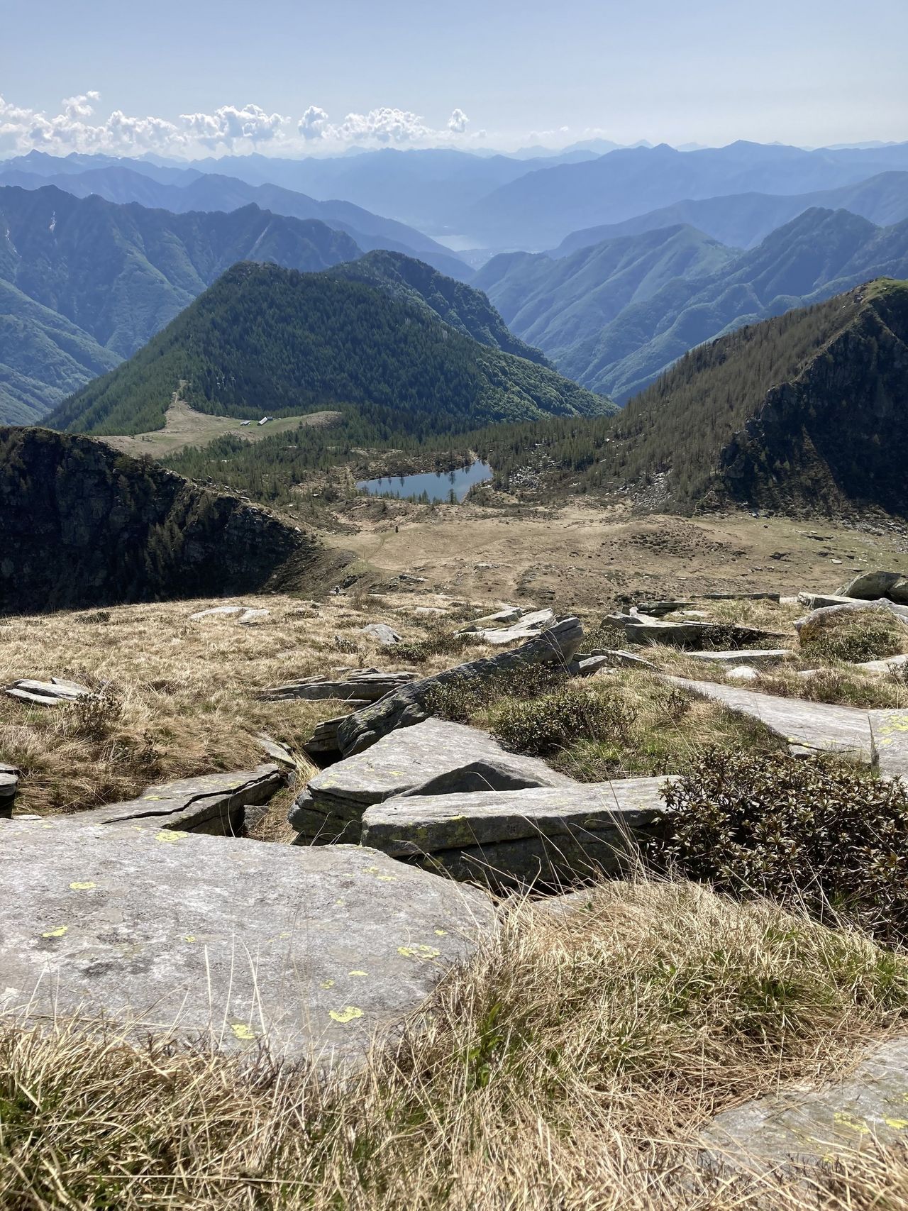
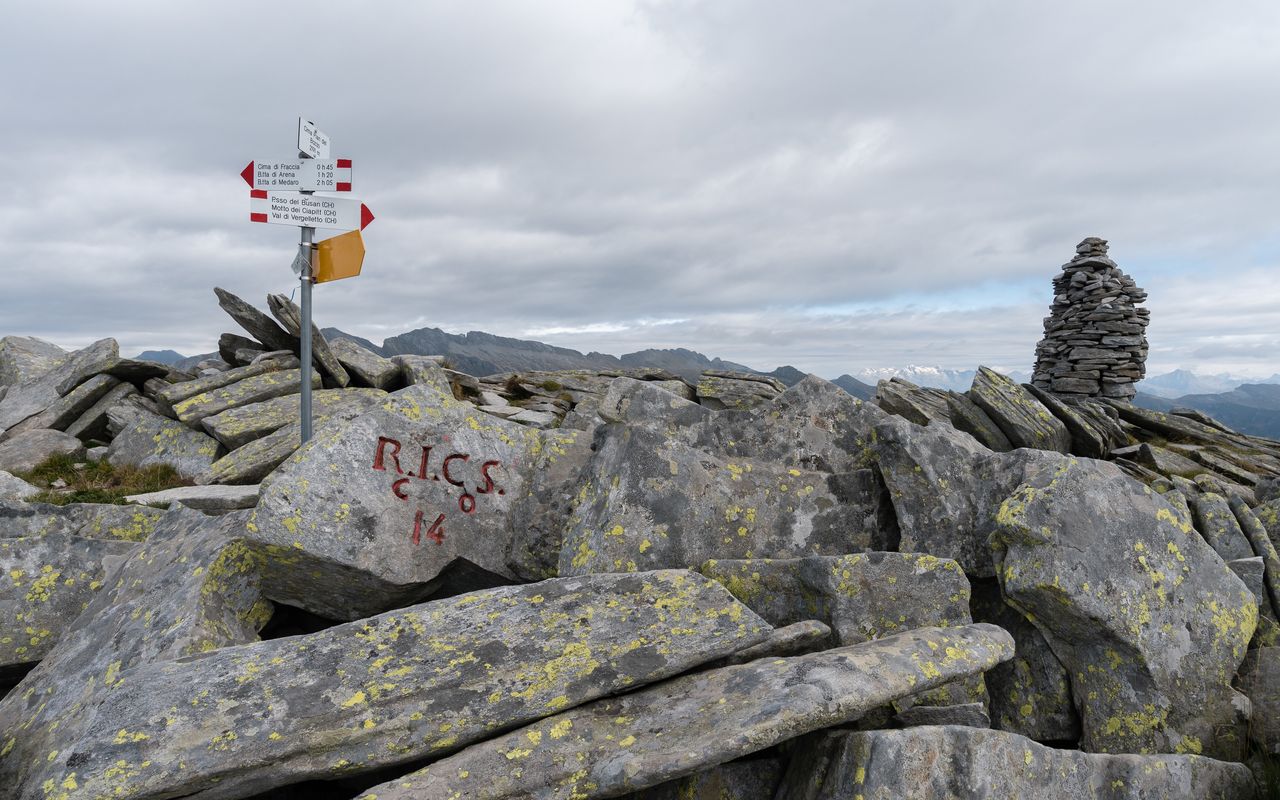
Bocchetta dei Ciapitt (2079 m)

Beginning of the wide ridge, occasionally interspersed with rocks, which runs via Pilone until Pizzo di Madei

Author

Remo Kundert

Remo Kundert is a hiking guide and owner of the hiking tour operator Per Pedes Bergferien. He also works as a freelance photographer and alpine journalist, and has co-authored numerous hut guidebooks, alpine- and family hiking books.

Our recommendations

Primo soccorso

Ausbildung

Primo soccorso

Price CHF 39.00
Member price CHF 33.00
SAC-Crocs

Equipment

SAC-Crocs

Price CHF 59.00
Member price CHF 49.00
Tourenportal/App-Abo Jahreszahlung

Subscription to the SAC Route Portal

Tourenportal/App-Abo Jahreszahlung

Price CHF 49.00
SAC-Hütten-Monopoly

At home

SAC-Hütten-Monopoly

Price CHF 69.90
Member price CHF 60.00
Klettern Tessin / Ticino

Klettern

Klettern Tessin / Ticino

Price CHF 64.00
Member price CHF 54.00
SAC-Taschenmesser

Equipment

SAC-Taschenmesser

Price CHF 54.00
Member price CHF 49.00
Hütten der Schweizer Alpen / Cabanes des Alpes suisses

Bildbände

Hütten der Schweizer Alpen / Cabanes des Alpes suisses

Price CHF 69.00
Member price CHF 59.00
feedback