![[Translate to English:]](/fileadmin/Der_SAC/Unserer_Partner/CSS_cyan_rgb.svg)
From the Domhütte via the Nord-Flank (Normal route) Dom 4545 m
-
- Difficulty
- PD+, 3a
-
- Ascent
- 6–7 h, 1640 m
-
- Descent
- 40 m
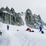
The normal route is not so difficult, but very long. The summit day alone involves 1600 m of ascent, after which you're looking at a 3137 m descent to the village of Randa. From the Domhütte you climb over the Festigletscher to the Festijoch, then over the north flank to reach the top. The route to Festijoch is delicate, with quite some risk of rockfall. After the Festijoch, you must also keep a respectful distance from the serac zone on the north flank; at the same time paying attention to the large crevasses that run in the direction of travel.
Route description
Domhütte - Festigletscher
From the Domhütte (2937 m) follow the path eastwards over the northern lateral moraine of the Festigletscher up to 3300 m, 1 hour.
Festigletscher - Festijoch
Enter onto the heavily crevassed glacier and follow it close to the rocks below P. 3529. The glacier becomes flatter then. Continue on up to the foot of the rocks below the Festijoch (3722 m). The following passage is relatively new, as the Festigletscher has massively lost height: a cliff now obstructs the path to the Festijoch. Climb a little further on, then cross rocks into the fall line of the 'joch'. Here, a steep firn field leads straight up; follow this until you get onto rock again, down and right of the Festijoch. Now climb through somewhat brittle rocks diagonally from right to left (2 rope lengths) to reach the Festijoch (3722 m), 1 1/2 hours. Since this passage is usually dealt with at night, there are now cat's eyes fixed to the rock, which can be seen in the light of a headlamp (WS +, 3a).
This steep section beneath the Festijoch is also tricky in descent.
Festijoch - Dom
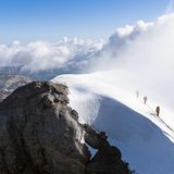
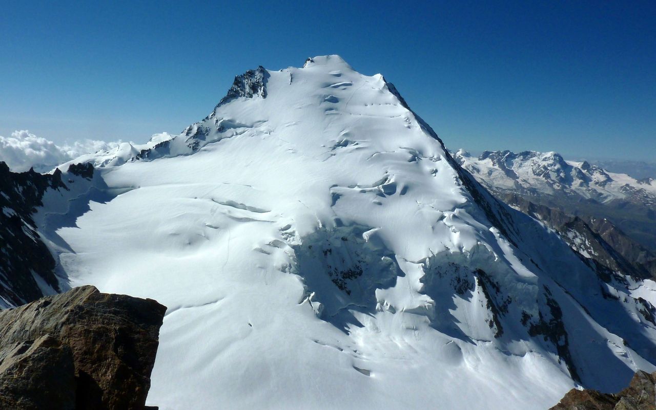
A short descent leads onto the Hobärg glacier. Now go in a wide arc left (N) below the dangerous serac zones. Since you climb parallel to the crevasses, it is also important to pay attention to these. Beyond the seracs, at about 3950 m, keep right (S) and ascend in a great curve southwest onto the firn and snow hump above the serac zone, in the centre of the N flank of Dom. Higher up you can see the saddle between the summit and P. 4479, known as the 'Gabel'. Climb steadily towards this. From there, a short firn ridge leads to the summit of Dom (4545 m), crowned by an iron cross, which is the highest point completely within Switzerland. 3 1/2 hrs.
Just to the left (NE) below the summit is a large cornice, hardly recognizable from the summit and which must be completely avoided! Accidents happen here again and again, as the cornice breaks off into the east wall.
Descent
Follow the route of ascent.