Stoss – Ättenberg – Spitzhubel – Hohmattli | Mountain hiking | Swiss Alpine Club SAC
Unterstütze den SAC Jetzt spenden

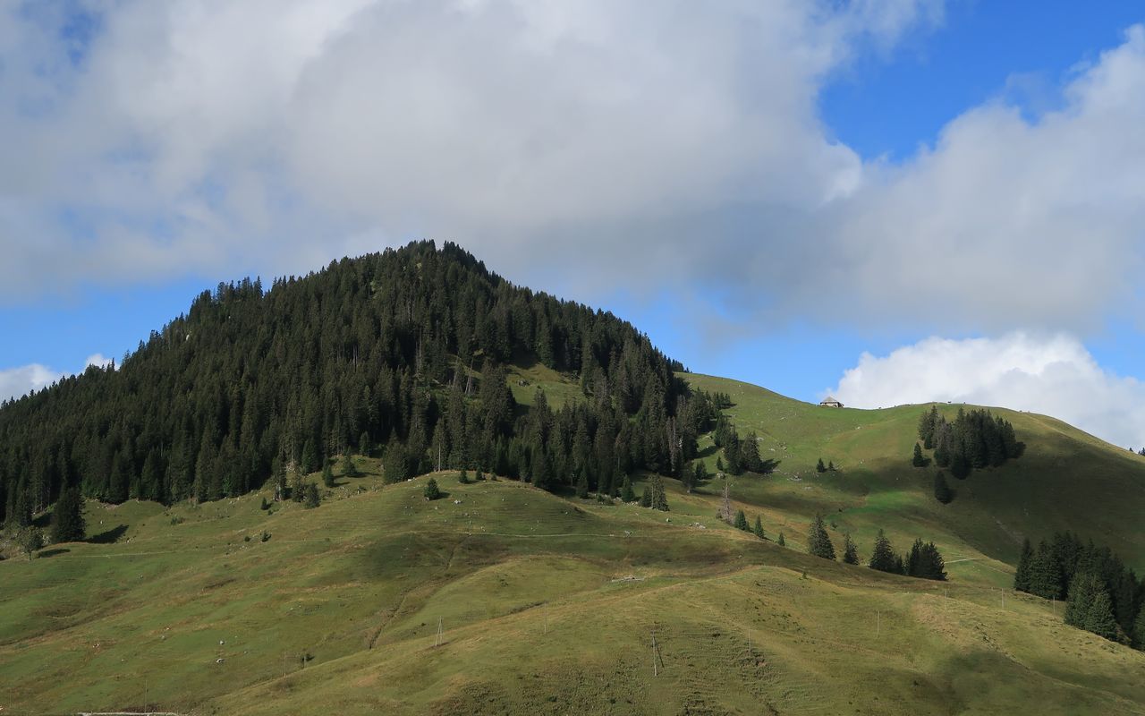
Stoss – Ättenberg – Spitzhubel – Hohmattli Hohmattli 1794 m

  • Difficulty
    T2
  • Ascent
    3:30 h, 1260 m
  • Descent
    2:30 h, 1080 m

South- or northward, depending on the season.

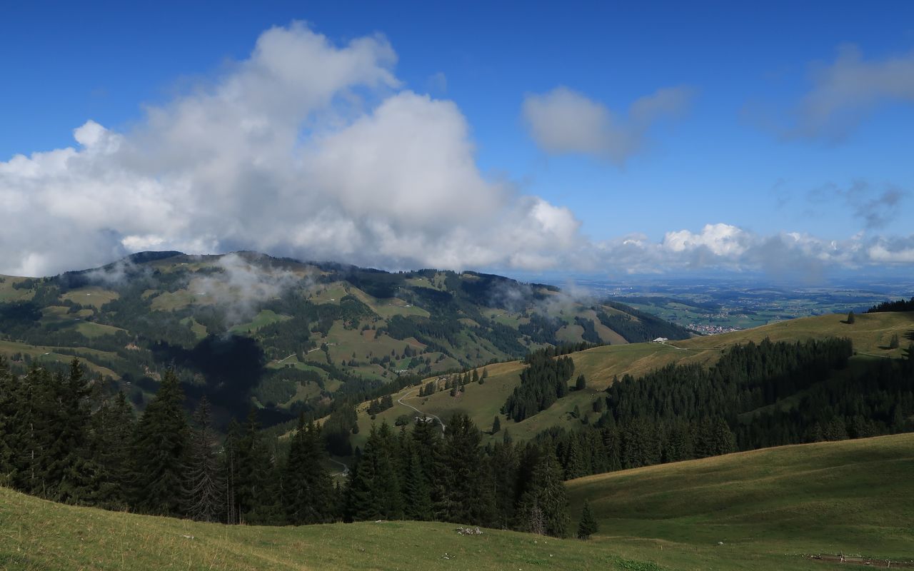
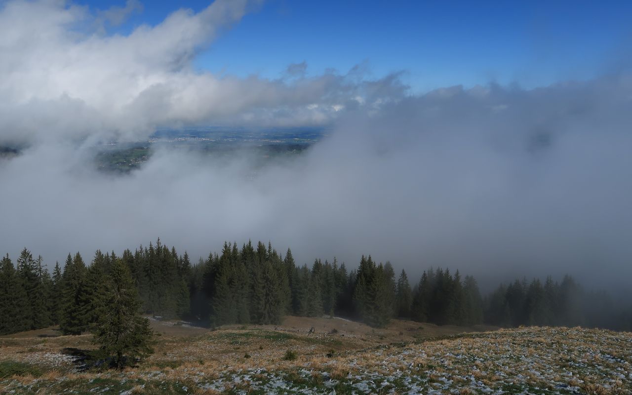
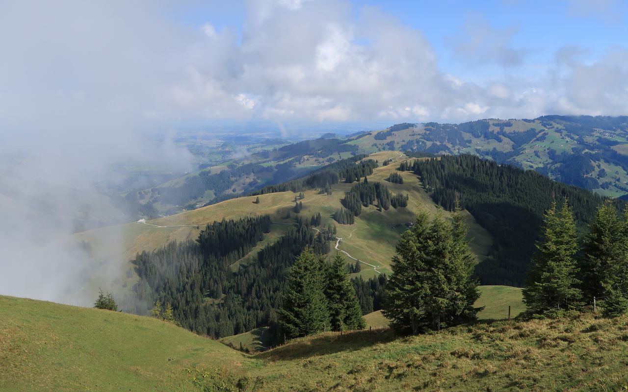
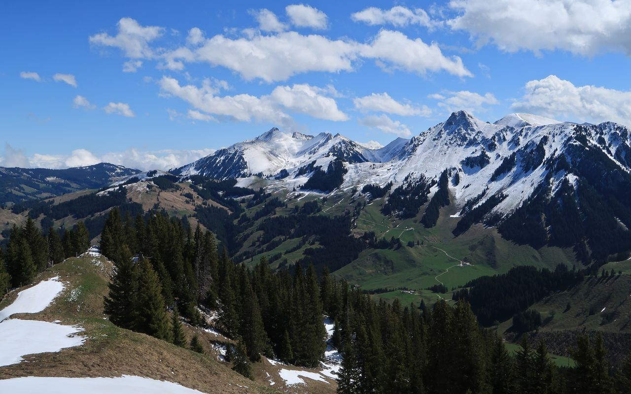
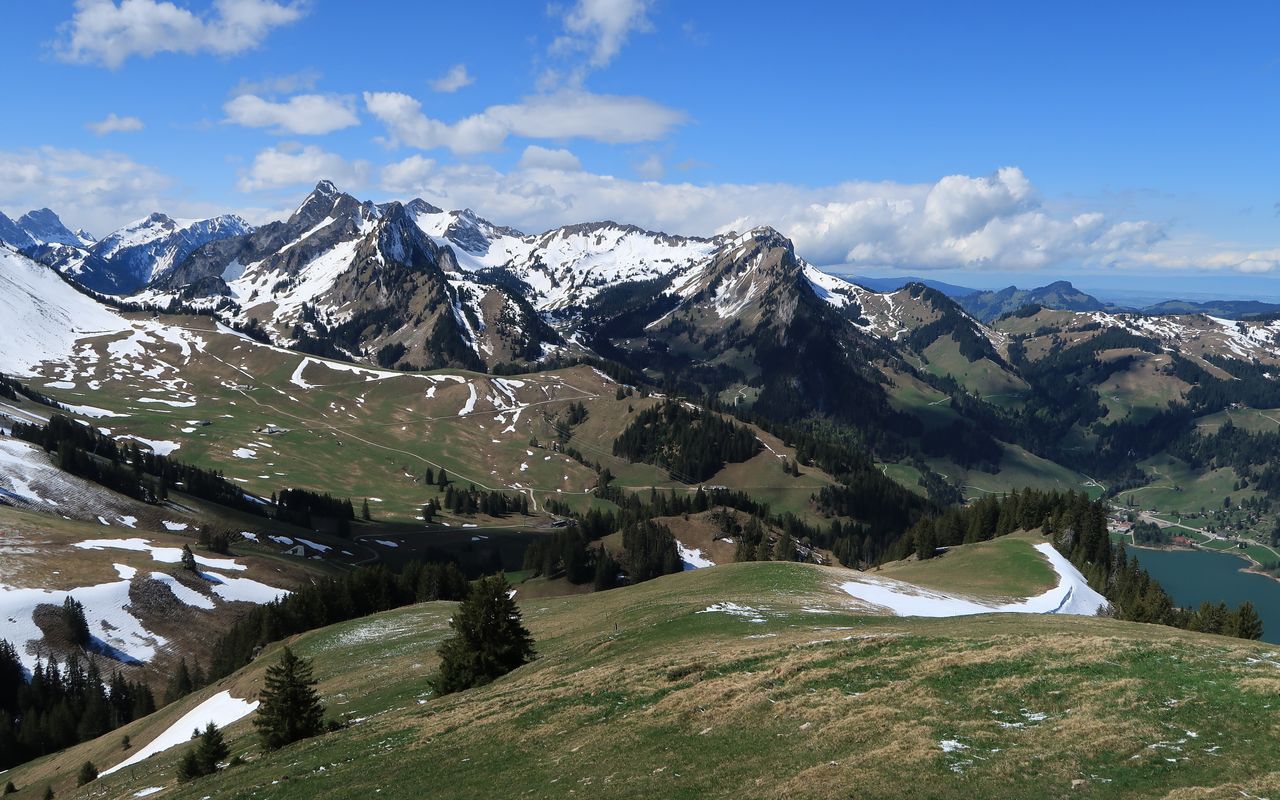
In summer, it is preferable to traverse the grassy and partially forested ridge between Seeschlund and Muscherenschlund from north to south. This way you have a good view to the mighty mountains of the German speaking part of Fribourg. Moreover, you pass the rustic Chalet du Hohberg before you take on the highest summit of the area.

Route description

Zollhaus – Stoss – Ättenberg – Chalet du Hohberg CAS
From the Zollhaus bus station follow the Gurnigel road until Guetemashus on the left-hand side. Pathless ascend in the pastures to enter the forest further up, where you find an old path. Follow the path through the forest. Again in pastures ascend to Wissenbachera (1146 m). Depending on the conditions of the pasture (high or low grass), ascend directly pathless on the north-west ridge via Eggersloch to a street bend (ca. 1265 m) or follow the road to the same point. From Grundbergera a trail branches off to the Stoss alp (cheese dairy). Follow the small road southward and turn right to reach the Stoss summit (P. 1537) pathless. Descend to a saddle (1513 m) and follow the road to Gross Ättenberg. Shortly afterwards leave the hiking trail to ascend the north ridge and to reach the highest point of Ättenberg (1614 m). Southward descend to reach the hiking trail again. Follow the trail to a saddle (1468 m). Either hike directly on faint paths to Ober Hohberg or follow the marked trails up and down and up again to Chalet du Hohberg CAS (1478 m)
Chalet du Hohberg CAS – Spitzhubel and back
From the Chalet you can make a detour to reach Spitzhubel (1556 m) following the south-west ridge (faint paths and clearings). Descend back to Chalet du Hohberg.
Chalet du Hohberg CAS – Hohmattli – Hürlinenfluh – Schwarzsee Gypsera
From the chalet hike west back to P. 1504. From P. 1504 follow a hiking trail to Hohmattli (1794 m) via Ober Hohberg. Continue on the trail to reach two mountain restaurants: the first, Salzmatt, is southward, and the second, Hürlisboden (1507 m) is to the west of Salzmatt. Now hike northward to reach a saddle (ca. 1490 m), and in a short detour you can hike up to Hürlinenfluh (P. 1529, unnamed on the map). From the saddle follow the hiking trail to Schwarzsee for a short while, then take the trail branching off to the right and pass a hut. Descend to the Riggisalpbach and hike through its gorge on a wonderful trail. At the end hike past the church to reach the bus station at Schwarzsee Gypsera.
Variant: Hohmattli – Horners Hürli – Schwarzsee Gypsera
You can also descend on a skiing route off the Kaiseregg hiking area. From Hohmattli follow the ridge southward. At a saddle before P. 1627 descend northward pathless and steeply (35-40°). Traverse to the pastures of Horners Hürli, at first above an escarpment, then below a rock face. Pass the chalet to find a trail through the forest. Again in pastures descend to Hürleni. Continue on the road to Schwarzsee Gypsera; T3+, Hohmattli – Schwarzsee Gypsera 1¼ h.

Additional information

Departure point

Zollhaus FR (876 m)

An der tpf-Buslinie Fribourg – Tafers – Plaffeien – Schwarzsee und der Postauto-Linie Thurnen – Gurnigel – Plaffeien – Schwarzenburg (Gurnigel-Linie).

End point

Schwarzsee, Gypsera (FR) (1046 m)

An der tpf-Buslinie Fribourg – Tafers – Plaffeien – Schwarzsee.

Time

Total hiking time: 6 h

Zollhaus – Stoss: 2 h

Stoss – Chalet du Hohberg CAS: 1 h. Detour to Spitzhubel: 30 mins

Chalet du Hohberg CAS – Hohmattli: 1 h

Hohmattli – Hürlinenfluh – Schwarzsee Gypsera: 1½ h

The difficulty is T2 for traversing Hohmattli. The rest is easier. There are marked and unmarked trails and pathless passages.

Difficulty / Material

T2 für die Überschreitung des Hohmattli, sonst einfacher; markierte und unmarkierte Wege, teilweise auch weglos.

Waypoints
Catering and overnight stay

Chalet du Hohberg (1468 m)

The cabin is situated south of Spitzhubel (1557 m) and sleeps 25 persons. It has a warden on the weekends from Ascension Day through the beginning of July, then daily through mid-September. SAC Section Moléson, www.cas-moleson.ch , Reservations at Dominique Delaquis, phone 026 466 60 63 , email: hohberg@cas-moleson.ch.

Authors

Daniel Anker

Daniel Anker is a Bernese author and photographer. The historian has written around 40 ski tour, hiking, via ferrata and mountain bike guide books as well as detailed monographs on individual peaks in Switzerland.

Oliver Neumann

Oliver Neumann is an SAC tour guide and author for the SAC-Tourenportal. His area of work includes mountain and alpine hiking in the Freiburg Alps as well as snowshoe tours in the Jura, Bernese, Freiburg and Vaud Alps.

Our recommendations

SAC-Crocs

Equipment

SAC-Crocs

Price CHF 59.00
Member price CHF 49.00
Gipfelziele Freiburg

Berg- und Alpinwandern

Gipfelziele Freiburg

Price CHF 54.00
Member price CHF 45.00
Tourenportal/App-Abo Jahreszahlung

Subscription to the SAC Route Portal

Tourenportal/App-Abo Jahreszahlung

Price CHF 49.00
En famille vers les cabanes du CAS

Hütten

En famille vers les cabanes du CAS

Price CHF 54.00
Member price CHF 45.00
SAC-Hütten-Monopoly

At home

SAC-Hütten-Monopoly

Price CHF 69.90
Member price CHF 60.00
Les Alpes, un monde vivant

Ausbildung

Les Alpes, un monde vivant

Price CHF 64.00
Member price CHF 54.00
SAC-Taschenmesser

Equipment

SAC-Taschenmesser

Price CHF 54.00
Member price CHF 49.00
Hütten der Schweizer Alpen / Cabanes des Alpes suisses

Bildbände

Hütten der Schweizer Alpen / Cabanes des Alpes suisses

Price CHF 69.00
Member price CHF 59.00
feedback