Traverse from Quinten to Arvenbühl via Gocht | Mountain hiking | Swiss Alpine Club SAC
Unterstütze den SAC Jetzt spenden

Traverse from Quinten to Arvenbühl via Gocht Nägeliberg / Nägeler 2161 m

  • Difficulty
    T5-
  • Ascent
    5–6 h, 1900 m
  • Descent
    2–3 h, 1050 m

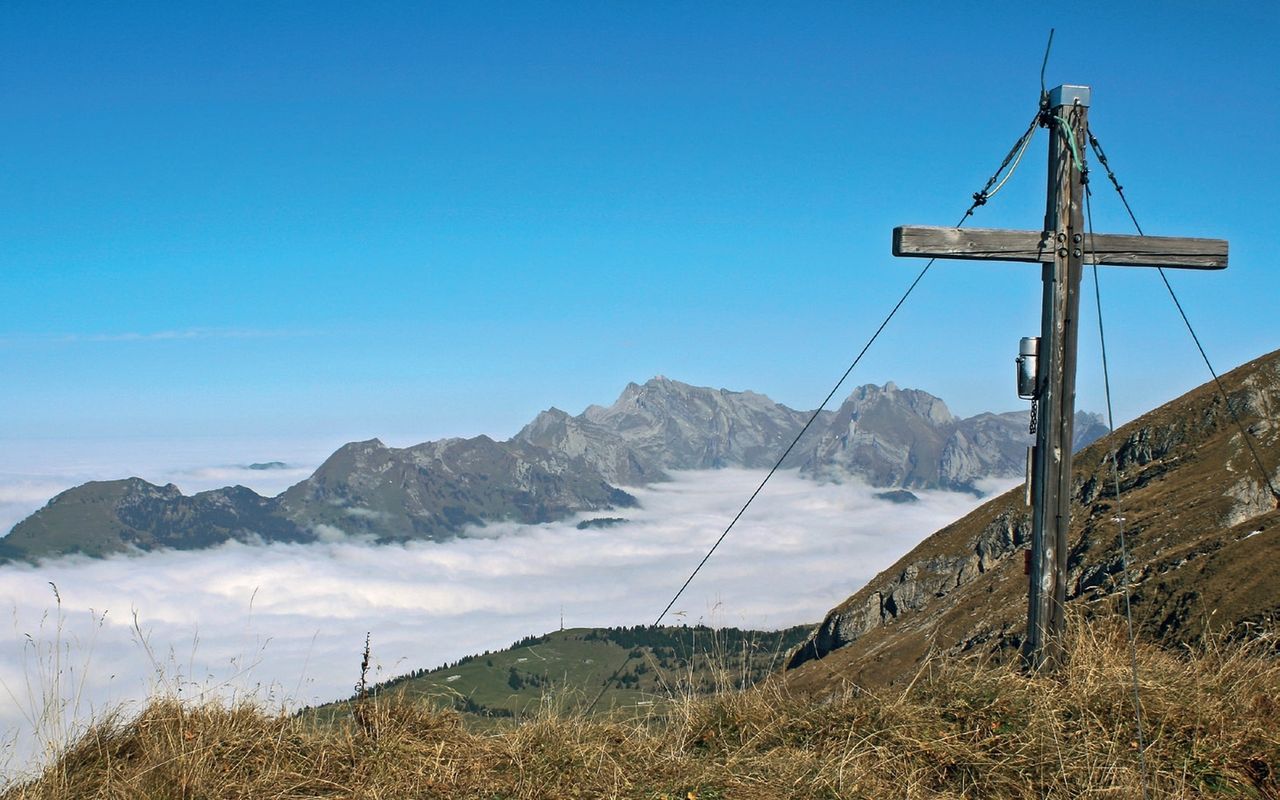
Uncompromising verticals to the Walensee

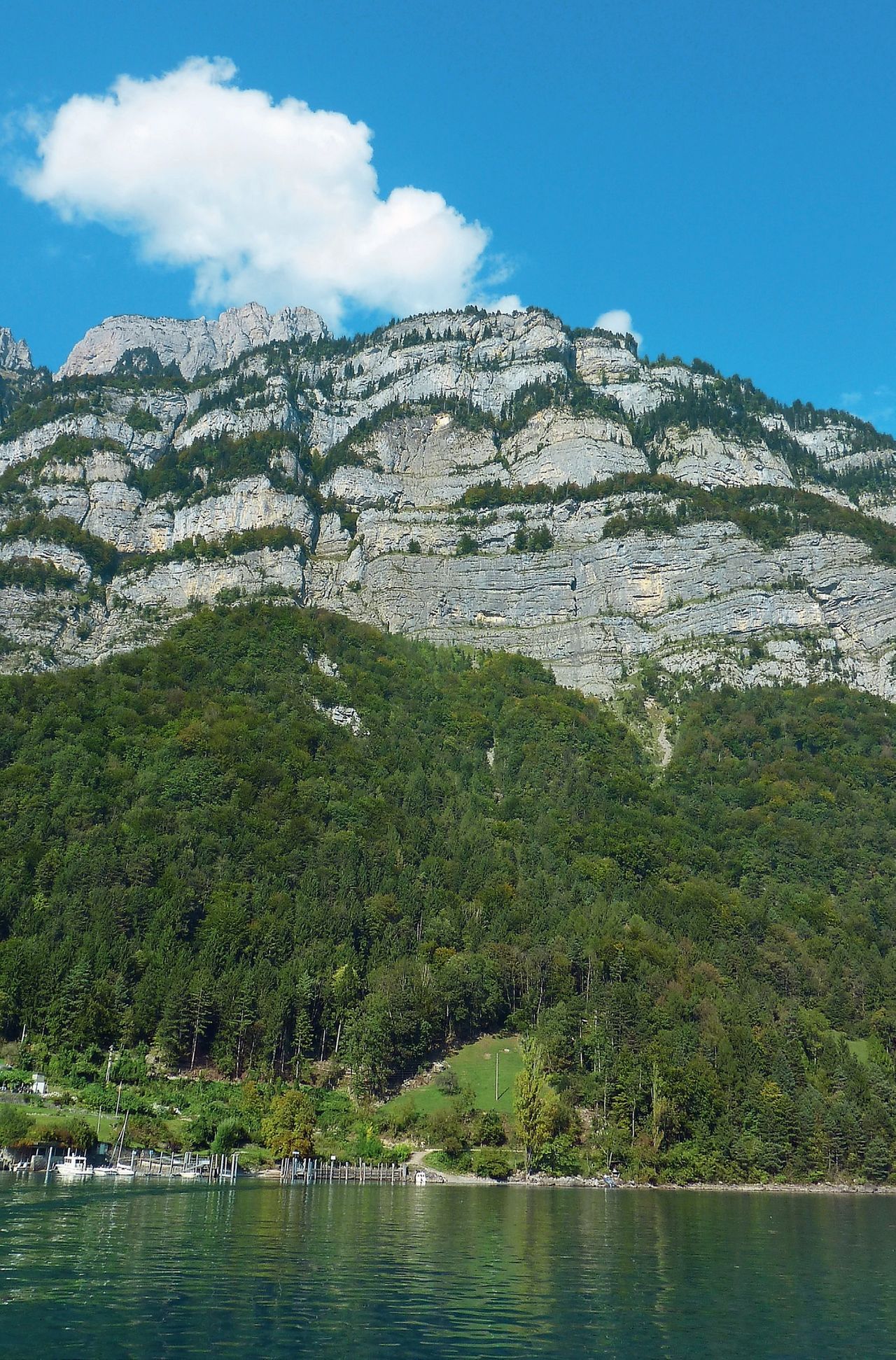
The Churfirsten mountains are much better known, but none of them is as close to Walensee as Nägeliberg. The vertical distance is 1700 metres, more than a mile. So, the view down to the lake and the vineyards of Quinten is breath-taking. The itinerary is as follows: from the quaint wine and fishing village of Quinten, which is only accessible by boat or on foot, the trail ascends through forest to the hay meadows of Laubegg. Then one traverses to the foot of the vertical south face of Nägeliberg. Now follows a spectacular ascent through the wild Gocht populated by ibex and chamois, and finally the itinerary leads up a steep slope and traverses the uppermost part of the south face to reach the summit. With almost 2000 metres of vertical height climbed, be proud of your achievement as a mountaineer and enjoy the view.

Route description

Quinten - bifurcation Gocht (P. 1520)
From Quinten follow the marked mountain hiking trails towards Gocht. At P. 1520 before the Säls alp the white-blue marked alpine hiking trail branches off (signpost).
Bifurcation Gocht (P. 1520) - Gocht - Nägeliberg - Alp Hinderselun
Follow the alpine hiking trail winding its way up Gocht. From the highest point (P. 1951) initially follow the ridge, then go eastward between boulders. The rocky ledge that blocks the direct way along the ridge, is bypassed north (left) on scree and grass. Then go southward (right) scrambling over a rocky escarpment (crux) and the uppermost ledge to reach the ridge. On the south side of the ridge a sort of grassy funnel opens. The traverse is exposed, but it is on a good grassy path. In a few minutes you reach the Nägeliberg summit on the other side of the funnel. The descent follows the north-east ridge to P. 2085, then it turns north-westward on grassy slopes. Continue pathless in hilly, arduous terrain (dolines!). T3+. Close to P. 1830 at Hinderselun you meet the white-red-white marked mountain trail (Toggenburger Höhenweg).
Hinderselun - Arvenbühl
Follow the Toggenburger Höhenweg (short re-ascent at Tritt) to Amden, Arvenbühl.
Variant: descent to Toggenburg
The descent to Toggenburg makes a pretty traverse. Below Nägeliberg go north-eastward in pastures (pathless) until you meet the Toggenburger Höhenweg. Now hike (or during the summer season ride the aerial cableway) from Strichboden to Starkenbach. From Nägeliberg to Starkenbach 2–3 h, T3+.

Additional information

Departure point

Quinten (433 m)

Quinten ist nur per Schiff erreichbar, Fahrplan beachten!

End point

Arvenbüel, Arven (1272 m)

Time

Quinten - Laubegg - P. 1521 - Gocht - Nägeliberg: 5–6 h

Nägeliberg - Tritt - First - Amden Arvenbühl: 2–3 h

Difficulty / Material

The path through Gocht is marked white-blue-white, but the last 100 metres of vertical height are exposed and there is a risk of rock fall. Alpine experience and dry, snow-free conditions are required. The ascent to the summit is even more demanding: it is pathless on steep scree and grassy slopes. The mentally challenging crux is an exposed traverse on grass on the south face.

Waypoints

Strichboden, Bergstation (1578 m)

It is the end point of the variant (and the fastest descent). Information and schedule for the aerial cableway: wildmannli.jimdo.com/alpwirtschaft-wildmannli/fahrplan-selunbahn/ call 071 999 34 87

Starkenbach (893 m)

End point of the variant when descending on foot

Neighbor summit

Schären (2193 m)

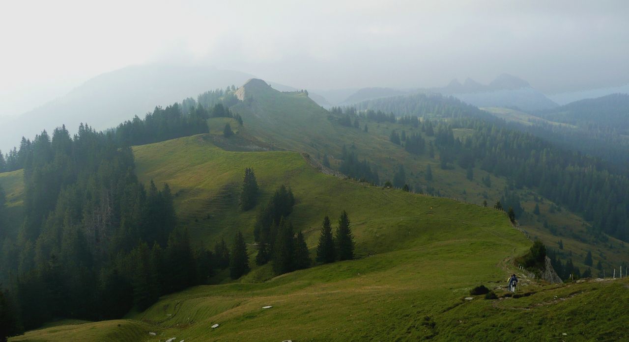
Schären is a rewarding neighbour summit. It can easily be added to the tour. From Nägeliberg follow the ridge (one exposed passage), T4, ½ h. The descent from Schären north-eastward is slightly steeper than from Nägeliberg. The variant to Starkenbach in Toggenburg is the shortest descent from this summit; from Nägeliberg 2–3 h.

Our recommendations

Skitouren Glarus - St. Gallen - Appenzell

Skitouren

Skitouren Glarus - St. Gallen - Appenzell

Price CHF 44.00
Member price CHF 34.00
SAC-Crocs

Equipment

SAC-Crocs

Price CHF 59.00
Member price CHF 49.00
Tourenportal/App-Abo Jahreszahlung

Subscription to the SAC Route Portal

Tourenportal/App-Abo Jahreszahlung

Price CHF 49.00
SAC-Hütten-Monopoly

At home

SAC-Hütten-Monopoly

Price CHF 69.90
Member price CHF 60.00
Klettern Alpstein

Klettern

Klettern Alpstein

Price CHF 64.00
Member price CHF 54.00
SAC-Taschenmesser

Equipment

SAC-Taschenmesser

Price CHF 54.00
Member price CHF 49.00
Bergsport Sommer

Ausbildung

Bergsport Sommer

Price CHF 59.00
Member price CHF 49.00
Klettern St. Galler Oberland

Klettern

Klettern St. Galler Oberland

Price CHF 69.00
Member price CHF 59.00
feedback